First Alert: Rain today with slight threat for flooding and Yellow Alert for accumulating snows Friday
[anvplayer video=”5091382″ station=”998131″]
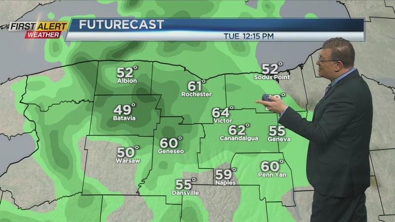
ROCHESTER, N.Y. (WHEC) — Mild weather continues today with rain on the increase this morning into the afternoon.
A Flood Watch is up for the Genesee Valley and points west. Thankfully the rain doesn’t appear to be heavy with amounts in the quarter to half inch range. That combined with additional snowmelt may cause some creeks and streams to rise later today into tonight. Any flooding will be very localized with most of us not dealing with any issues.
Rain will exit the region this evening and colder air with a gusty wind will arrive tomorrow. A few snow showers in the forecast Wednesday but any accumulations will be light. Cold and dry weather on Thursday will give way to a storm system that arrives late at night into Friday.
Computer models have shown great consistency from model run to run over several days so the confidence in seeing accumulating snow to end the week is pretty high. Yellow Alert is in place to give a heads up for that winter weather on the way. Right now much of the region may be looking at 6” or more of snow. Not a blizzard by any stretch but a decent snowstorm is likely.
One thing to watch will be for the possibility a little mix may develop, especially south of Rochester. Any mix will lower the snow totals in some areas so stay tuned for updates on that and the latest timing of the snow from News10NBC on TV and at whec.com online.
—————————————
Download the WHEC First Alert Weather app to stay up to date while on the go.
Watch the latest full forecast at whec.com/weather.