First Alert Weather: Great travel weather Wednesday, some snow returns Friday
[News10NBC]
ROCHESTER, N.Y. (WHEC) — Most of our northern tier counties picked up at least some snow, with a coating to an inch or two common north of the Thruway. A few towns in Wayne County recorded 3-4" from the lake effect snow Monday night into Tuesday morning.
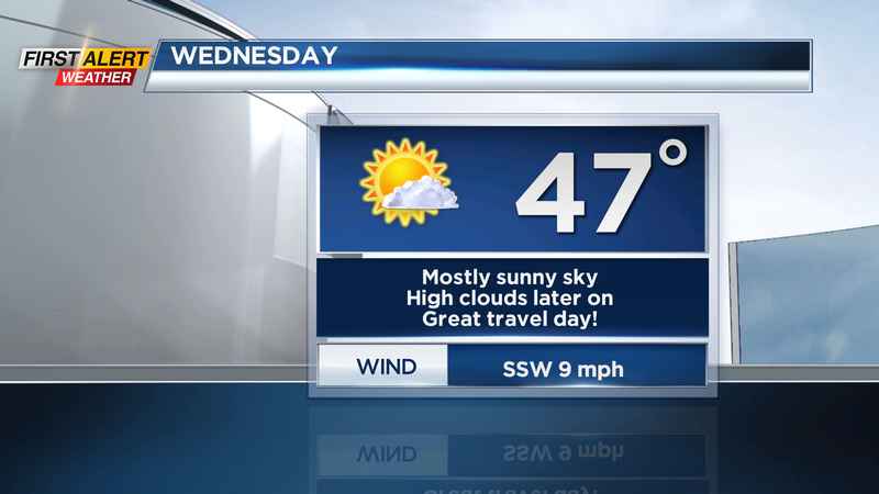
High pressure building in means a clear sky at times tonight, which in turn, means a chilly night. Many spots away from Lake Ontario will drop into the mid-20s by morning. Wednesday is one of the biggest travel days of the year, and the weather couldn’t be better! The biggest weather issue will be the need for sunglasses as you’re hitting the roads. We’re dry on Wednesday.
Weather will go downhill a bit by the end of the week, with clouds and some light rain showers on Thanksgiving Day, and some wind and lake effect snow on Friday into Saturday.
A Yellow Alert is up for Friday afternoon into Saturday morning, for another round of lake effect snow. Amounts are fuzzy this far out but expect another round of minor snow that may slicken up the roads for any Black Friday shopping, or those traveling home on Saturday. We’ll keep you updated on snowfall amounts as we get a little closer.
Lake snow ends Saturday afternoon, with mainly dry weather on Sunday and Monday. Another fast-moving clipper may deliver another shot of chillier air, plus some lake effect by Tuesday or Wednesday of next week. But again, with this being a week away, specifics are very limited. We do know, that we are entering a period of active weather, with several chances for snow, but no "big" storms in the foreseeable future.
———————————
Download the WHEC First Alert Weather app to stay up to date while on the go.
Watch the latest full forecast at whec.com/weather.