Yellow Alert: Tracking strong thunderstorms with the potential of arriving in Western New York
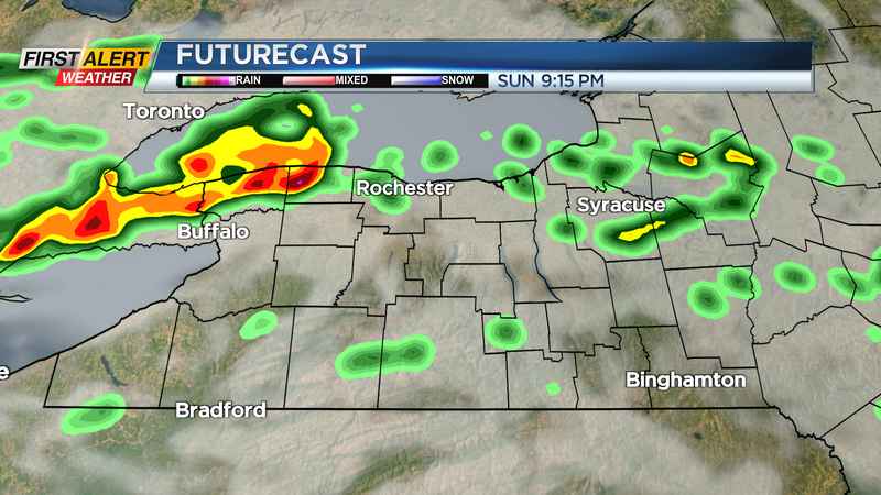
ROCHESTER, N.Y. (WHEC) — Strong thunderstorms now moving across central Michigan will be approaching Rochester this evening.
These storms are following along a front which has become nearly stationary over Western New York.
The primary threat from these storms will be small hail and localized flooding, but the greatest potential is for strong, damaging straight-line winds.
If these storms arrive with the intensity as expected, there will be the possibility of tree and powerline damage. The likely arrival time would be between 7:00 PM and 11:00 PM tonight as several squall lines are possible.
As a result, the News10NBCFirst Alert weather team continues with a Yellow Alert for all of Western New York for tonight.
After midnight the chance of severe storms will end with just scattered showers possible for the remainder of the night. Temperatures this evening will fall through the 60s.
For Monday, drier air will return to the area with dewpoints lowering into the 50s and temperatures moderating into the low 70s. We expect just a small chance of a few sprinkles for the early morning with partial sunshine for the afternoon.
In addition, it looks like summer weather is not finished just yet. You can expect more heat and humidity for Tuesday and Wednesday with the chance of a few showers and thunderstorms each day.
The News10NBCFirst Alert weather team will continue to keep you updated throughout the night.
———————————————
Download the WHEC First Alert Weather app to stay up to date while on the go.
Watch the latest full forecast at whec.com/weather.