First Alert Weather: First nice end to the week, sunny start to the weekend
ROCHESTER, N.Y. – We are still green on the Threat Tracker for the next handful of days as no severe weather is expected for the near future. A large area of high pressure is building in the Midwest bringing drier conditions moving into Thursday evening as dewpoints stay in the 50s. These low dewpoints along with clear skies will provide the ideal setup for low temperatures Thursday night in the 50s. Higher elevations in southern Livingston County may even dip into the 40s making for a chilly evening. A northerly flow of air will keep us just below average on Friday with highs in the upper 70s and plenty of sunshine to end the week.
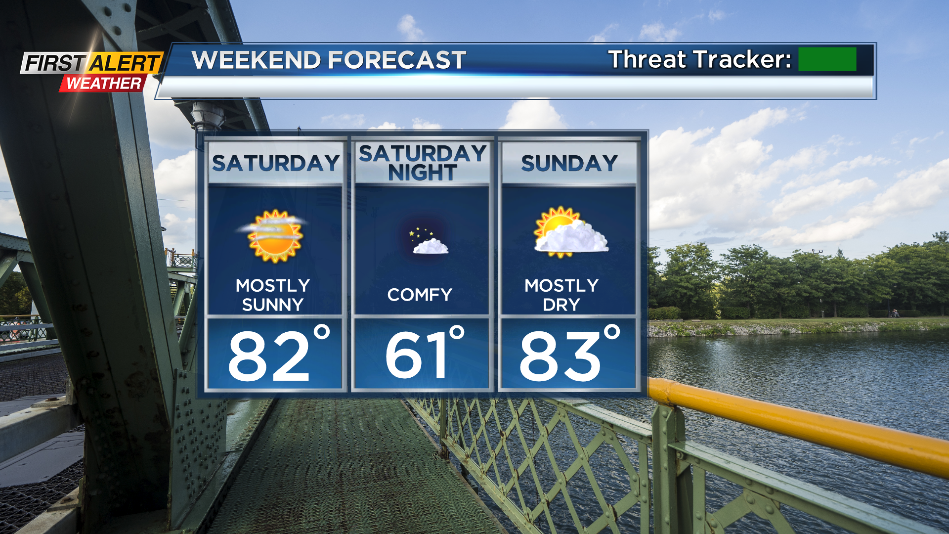
Looking at your weekend, temperatures start to return to average with highs in the low 80s. Fair weather dominates Saturday and Sunday despite a low-pressure system to our northeast attempting to bring us precipitation Sunday evening. However, this system is too far to our northeast to compete with the high pressure and dry air to our south, decreasing rainfall potential for Sunday evening.
Going into next week, temperatures return to seasonable with highs in the lower to mid-80s and sunshine is expected to start off the workweek. Due to warm afternoon temperatures and moisture moving in from the southeast, a spotty shower may be possible. However, the greatest chance of precipitation comes midweek as our next system brings showers and thunderstorms Wednesday through Friday.