First Alert Weather: Warmer air and sunshine return Tuesday
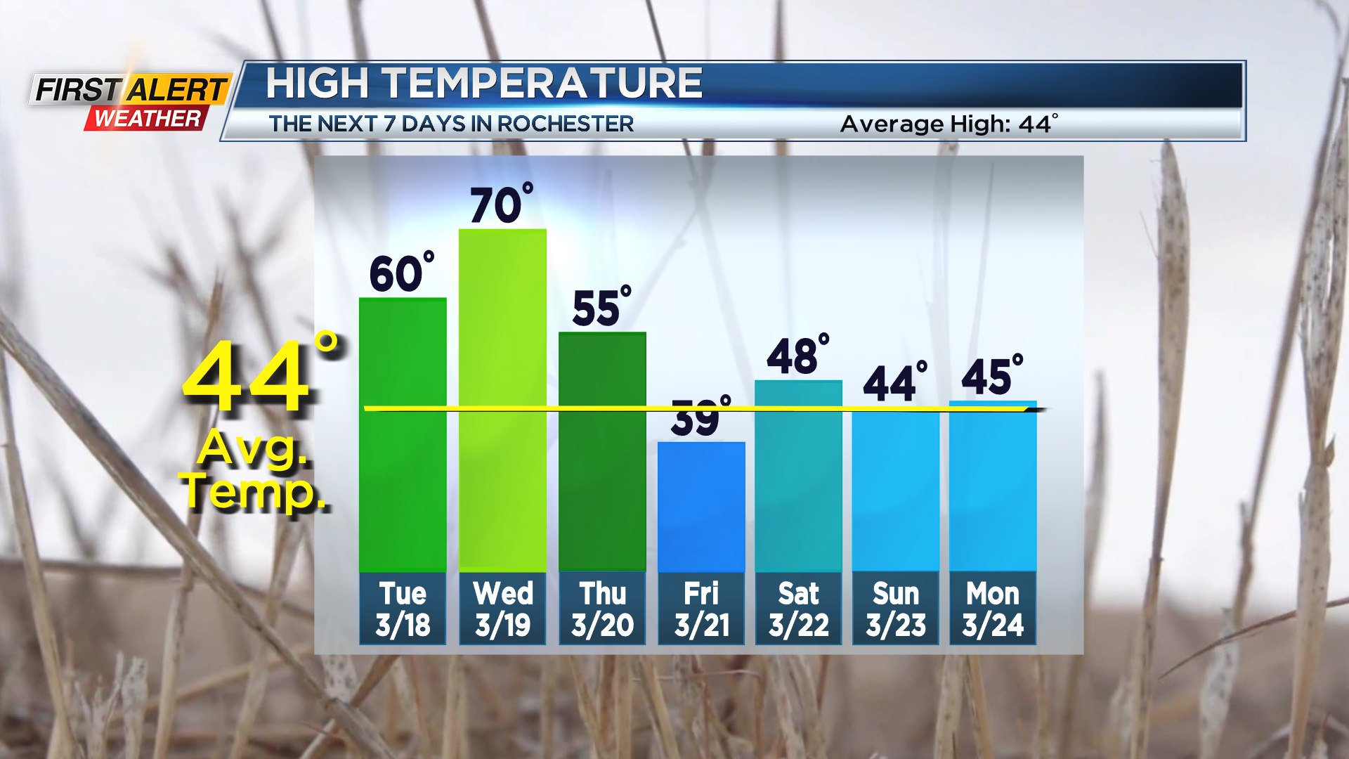
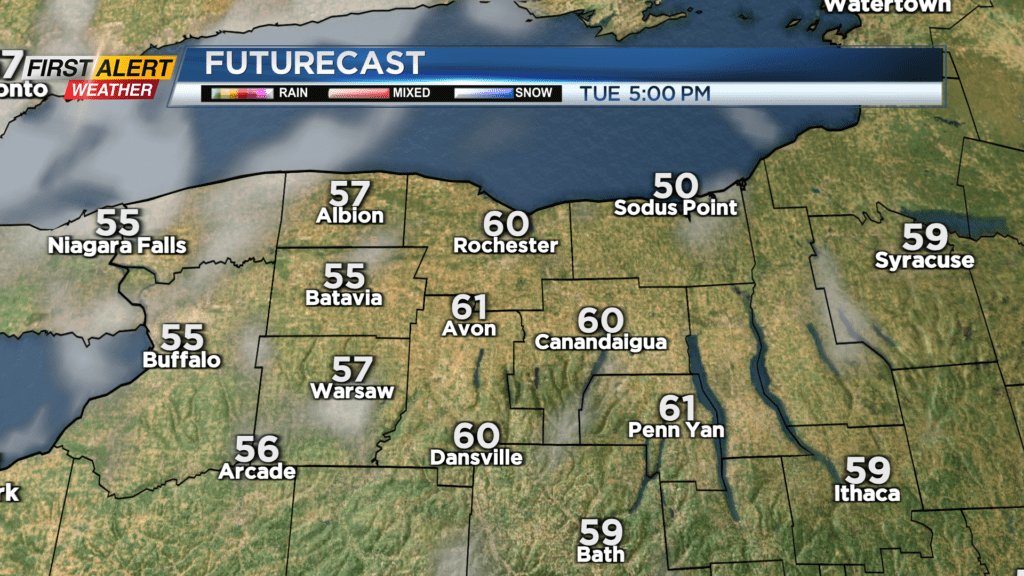
ROCHESTER, N.Y. – We went from near record warmth on Sunday, back to winter on Monday with temperatures hovering near freezing. But, we’ll warm up again just as quickly! We’ll see a clearing sky Monday night, leading to a very nice spring-like day on Tuesday. It’ll start chilly, with lows in the upper 20s, but warm quickly back to near 60 degrees by the afternoon under a mostly sunny sky. Wednesday will be our warmest day of the week, and possibly for the rest of the month, with highs near 70.
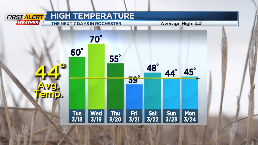
Thursday will start off on the mild side, but another strong cold front will bring a round of rain, along with falling temperatures by afternoon and evening. Friday will start with clouds and perhaps a few snowflakes, but we’ll see some sunshine by the end of the day. That being said, we won’t warm up very much, holding in the upper 30s and lower 40s.
Beyond that, our weather turns much more unsettled, and trending chillier than average. The weekend will hold in the 40s. An upper level low will move in next week, likely keeping us a bit unsettled and cooler than average, with a mix of rain and some snow showers, and temperatures in the lower 40s.