First Alert Weather: Warm for Tuesday with severe storm threat for Thursday
[anvplayer video=”5115217″ station=”998131″]
ROCHESTER, N.Y. (WHEC) — High clouds will give way to sunshine on Tuesday with beautiful weather ahead in the afternoon into tonight.
The heat arrives Wednesday with sun and clouds and an isolated thunder threat as the humidity increases.
The latest Threat Tracker has Yellow Alert on Thursday highlighted for potential severe storms. Heat and humidity will increase with air temperatures around 90 and the heat index will be in the mid-90s on Thursday.
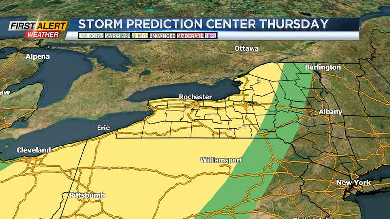
As a cold front approaches on Thursday afternoon thunderstorms are likely to develop. The Storm Prediction Center has western New York and the Finger Lakes in the slight risk zone for severe weather. The main concern will be heavy rain and flash flooding. Lightning, damaging wind gusts and hail are also possible with the storms.
The Yellow Alert is a heads up to pay attention to the forecast as the weather may impact your plans Thursday. Following that front, cooler and drier weather arrives in time for a nice weekend. Stay tuned to News10NBC for the latest on the heat and thunder threat later in the week.
______________
Download the WHEC First Alert Weather app to stay up to date while on the go.
Watch the latest full forecast online.