In depth: Beyond the 10 Day
[anvplayer video=”5091027″ station=”998131″]
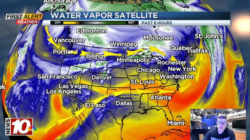
ROCHESTER, N.Y. (WHEC) —Currently across the United States, we have a west to east flow of the jet stream with a developing ridge over the East and a developing trough over the West. The Polar and Subtropical jet remain separate, which means no big storms are occurring or strengthening over the Lower 48. The ridge that was over the Western US continues to retrograde towards the Eastern Pacific which will allow warmer weather to move in across the Eastern US before a change back to cooler weather. Overall the next two weeks will feature this back and forth of warm and cold as we continue to approach the Spring season.
Ridging over the Eastern US this week will keep us on the milder side of things and bring another taste of Spring before a return to Winter at the end of the week. Ridging late this week will give way to troughing across the east because ridging over the Pacific will again shift back east and over the Western US. This will be due to active storminess swinging in across the Aleutian Islands. The storminess will kick the ridge over the Pacific back over the Western US and force cold air to move back across the Eastern half of the nation. Then after that, it seems we may swing back towards a milder setup after the middle of next week. This will be due to the lack of storminess over the Aleutian Islands, allowing the Western US ridge to move back over the Pacific. Over the next two weeks, it seems that we have entered the "Battle of the Seasons" as Winter and Spring duke it out. With this battle going on we will have a few storm chances, and a couple of them may even bring snow.
Early this week we will be on the milder side of things. An area of low pressure will strengthen over the Central US and move northeast along a cold front. There isn’t enough cold air ahead of this storm to force it south and bring us snow which means we will see rain showers and temperatures above average as it swings north. There is no flood threat locally as the snow pack has significantly been depleted, and not as much rain is expected. Even though there isn’t enough cold air ahead of this storm, there will be on the backside of this storm for our next opportunity. This next snow chance will come on Friday of this week. High pressure late this week will return the cold air locally and setup the "banana high" look. This will help force a developing low pressure system moving north towards the East Coast. Uncertainty remain on exact track of this area of low pressure, but odds are increasing on snow for our region locally and I’d be prepared for some decent snow accumulations at least. Then another storm chance is on the heels for early next week.
As of now, this one looks to be well off the East Coast but dynamics are closer for something locally than might appear. I personally think this one will miss off the East Coast, but this will be something to watch with the cold air in place. It will come down to the quickness of the northern stream of energy. If the northern stream swings in quicker, than we will have an area of low pressure pulled up the East Coast while a late interaction will keep it offshore. As we continue to move back an forth between warm and cold over the next two weeks, the last storm chance within the next two weeks will come at the tail end (Mar 5-Mar 7). Models are signaling an active jet stream over the Tennessee River valley with another area of low pressure developing over the Central US and then moving east. Obvious questions come with this one like track, intensity, and cold air supply. These questions will be answered with time, but it does look like unsettled weather is on the way within that timeframe. Our next update will come on Wednesday, February 23rd.
Temperatures: The ebb and flow of cold and warm. Mild early this week before a cool down late this week and into early next week, then back to seasonable weather.

Precipitation: Above Average the next two weeks.
Storm Chances:
Feb 22-Feb 23: We are on the mild side with rain showers. No flooding expected. Backside snow showers, little to no accumulation.
Feb 25-Feb 26: High pressure will block the northern track, sending low pressure to the East Coast. Increasing odds for snow accumulations, will we see any mixing?
Feb 27-Feb 28: A miss off the East Coast as of now, but changes to bring this up the East Coast are possible. Not much blocking over the Atlantic so it will be tough.
Mar 5-Mar 7: Active jet over the Tennessee River Valley depends on track, intensity, and cold air supply. Rain, snow, sleet, and freezing rain possible.