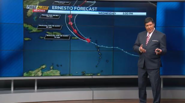
First Alert Weather In Depth: Trouble in the tropics, again

(WHEC photo)
Western New York is fortunate that this portion of the country usually does not see a direct impact from tropical storms and hurricanes. However, we do often get the indirect effects, primarily in form of heavy rain. This happened earlier in the season with the remnants of Beryl and Debby.
The satellite pictures and the Hurricane Hunters tell us that once again there is trouble in the tropics. The latest named storm is Ernesto, and there is no doubt that the folks living in Puerto Rico have seen some heavy rain and strong winds. The question is, where is Ernesto going? In the coming days the prevailing winds or steering winds appear to be pushing Ernesto further north over the Atlantic Ocean. That is really a good sign for the communities along the East Coast of the United States. But with that projected path, Ernesto will be heading for the island of Bermuda as a Category 1 or Category 2 storm. Arrival time appears to be this weekend.
If you are keep track of this season, this is the fifth named storm and we still have a long way to go for the season to come to an end. If past history is any example, the average tropical storm frequency will increase in the coming weeks. Data and historical records show that over the last hundred years the highest probability of tropical development is for the month of September. Then the months of October and November should bring a decrease in frequency of tropical weather with the end of the hurricane season coming by the end of November.