First Alert Forecast: Another round of snow and rain to end the work week
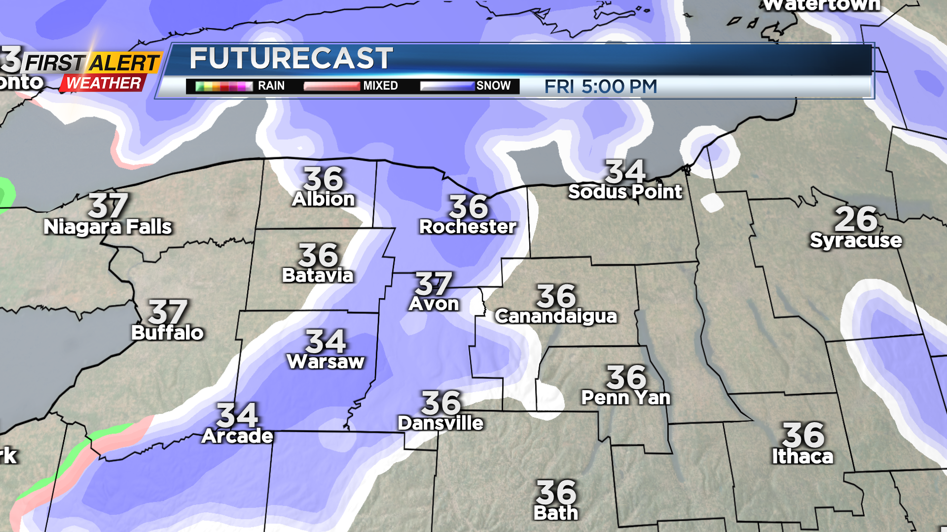
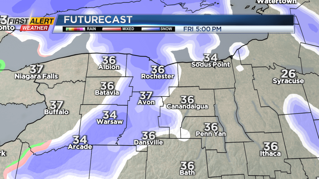
Colder air building in behind a departing fasting moving area of low pressure will produce a few lake snow showers Thursday night and Friday morning. No accumulation is expected into Friday morning, but we’ll see another batch of light snow developing by late afternoon and evening with our next (and last) clipper of the week. While the snow will likely be falling for the evening commute, air temperatures will be climbing through the 30s, so any impact on the roads and commute should be very minor. We may get a fresh coating to an inch of snow on top of what is left of our old snowpack.
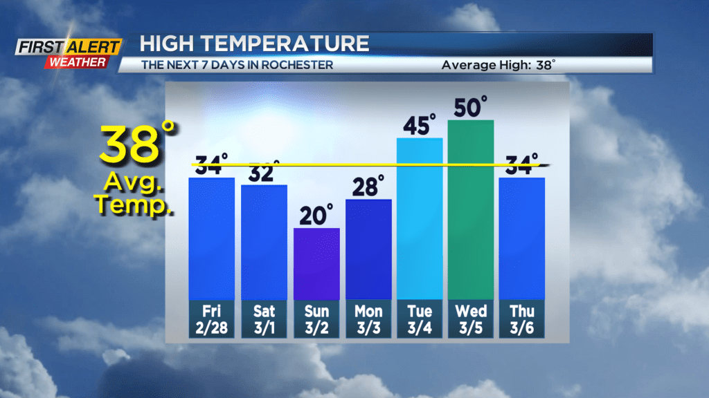
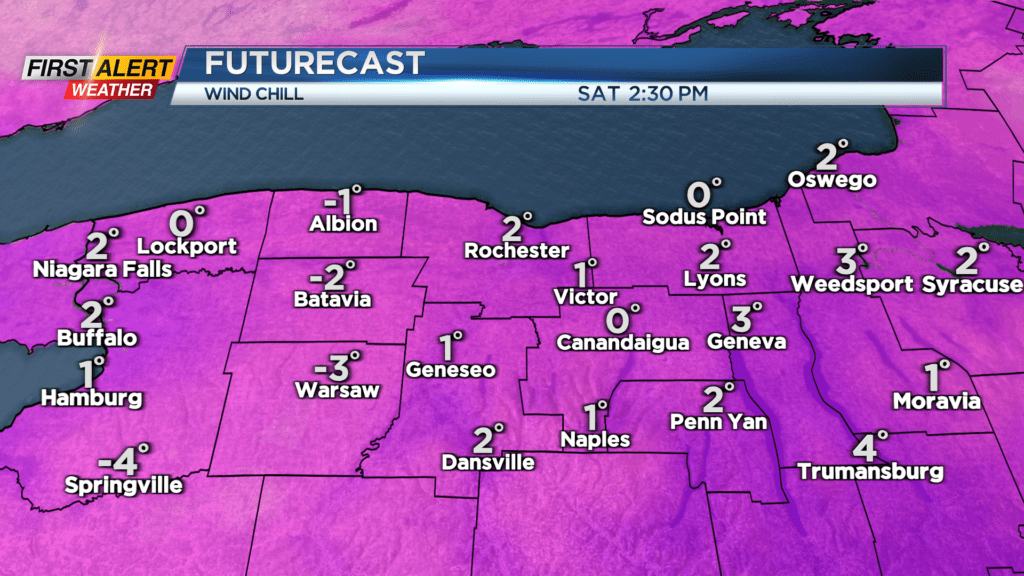
It’ll be turning much colder for the weekend, as that last area of low pressure pulls away. We’ll get a punch of Arctic air on Saturday, dropping our temperatures from above freezing, quickly into the 20s and teens by late in the day. Sunday’s highs will hover in the upper teens to near 20 degrees. The wind will pick up on Saturday, with wind chills dropping to, or below zero this weekend. On top of that, we’ll see some lake effect snow showers developing. The flakes will be fairly persistent, but accumulations should be fairly minor, with an inch or two for most of the area throughout the weekend.
Some lake flakes may linger into early Monday morning before high pressure and sunshine take over. Then we warm into 40s on Tuesday and 50s on Wednesday with our next stronger storm. This will also arrive with a period of rain on Wednesday, followed by another punch of colder air, and a bit of wind and some snow showers on Thursday.