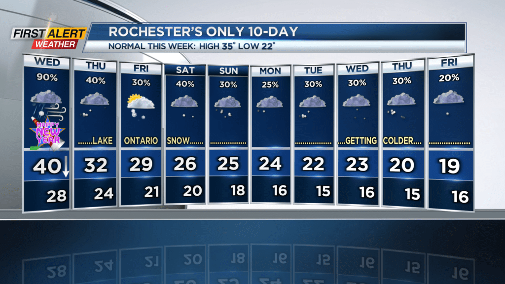
First Alert Weather: 2025 greets us with fog, rain, and snow
New Year's Day will feature rain turning to snow, but no significant accumulations are expected.
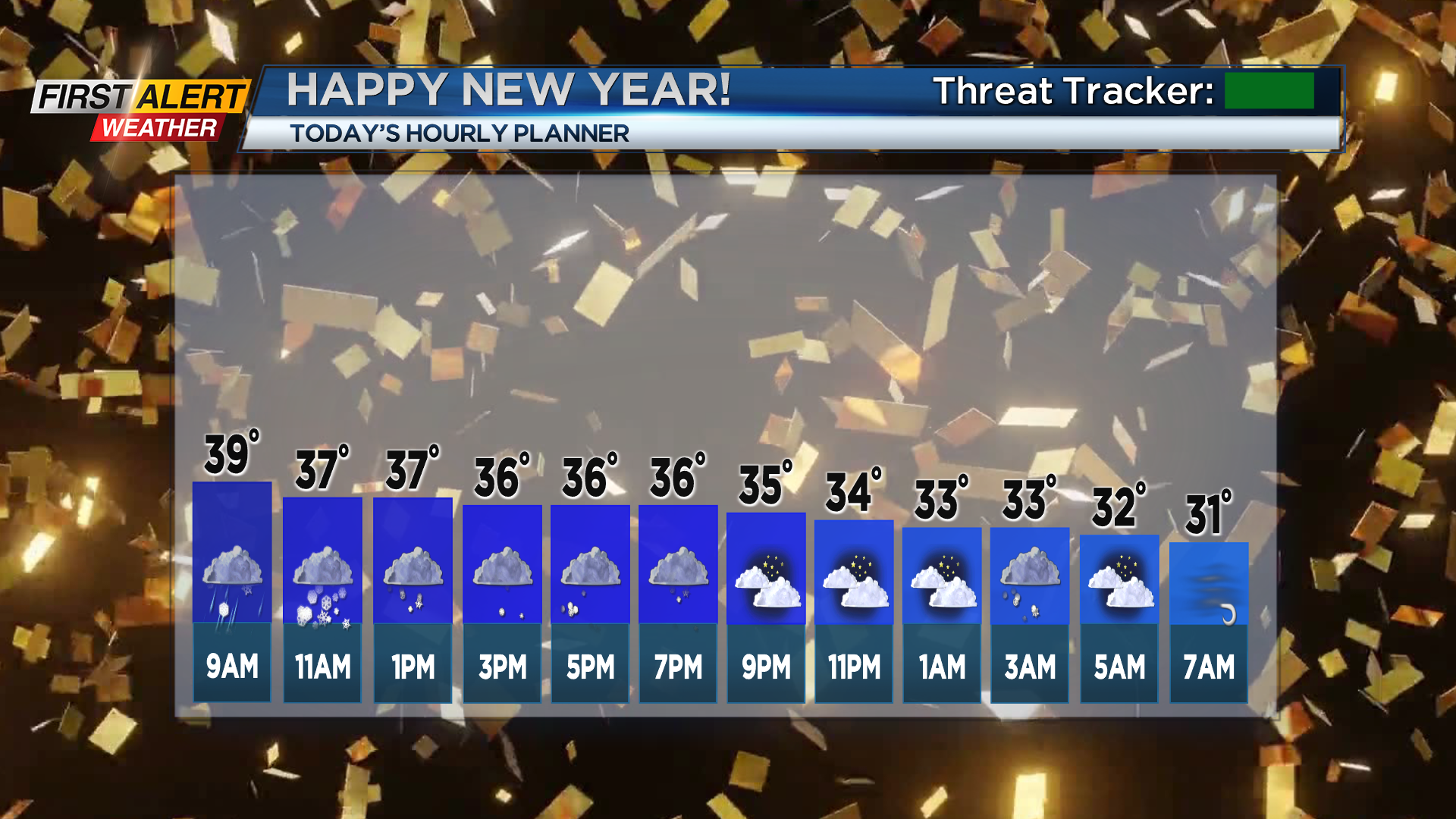
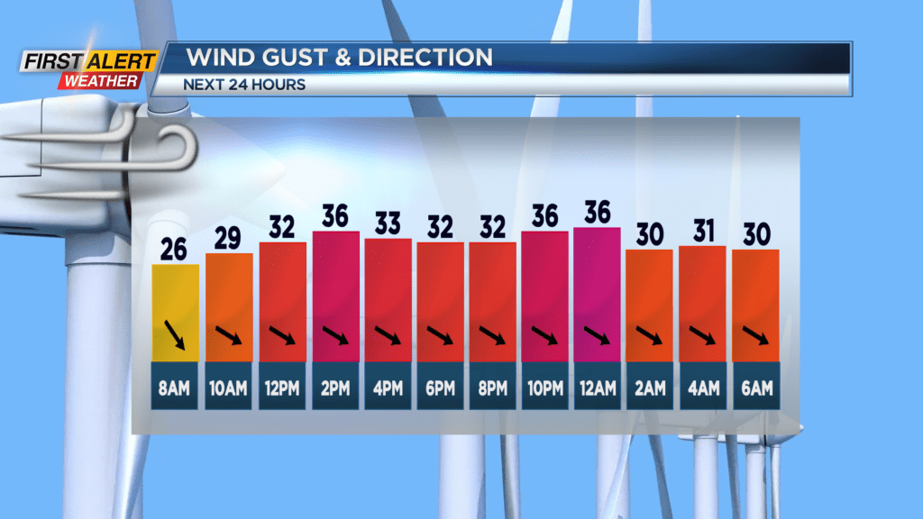
ROCHESTER. N.Y. We woke up to some dense fog in and around Rochester this morning, with visibility dropping to a mile and a half at one point. That fog should lift by around 9am, and then for the rest of the first day of the year we’ll see light rain turn to light wet snow, alongside some gusty winds.

As a low pressure system passes to the northeast, cold air will move in from the west and transition the rain to snow in the mid-morning hours. The ground will be above freezing all day which means accumulations will remain under an inch and will not impact travel. However, those widespread snow showers will transition to a lake effect snow band overnight that will impact areas east and southeast of Lake Ontario; this includes portions of Wayne County. This snow band will remain near the same position into Thursday night, then shift north towards Tug Hill before coming back down by noon on Friday. At that time Rochester could also see a few lake flakes from the snow band.
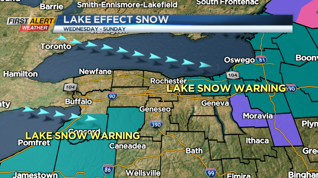
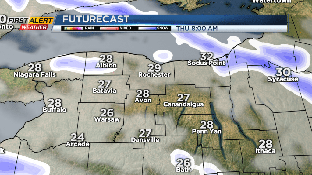
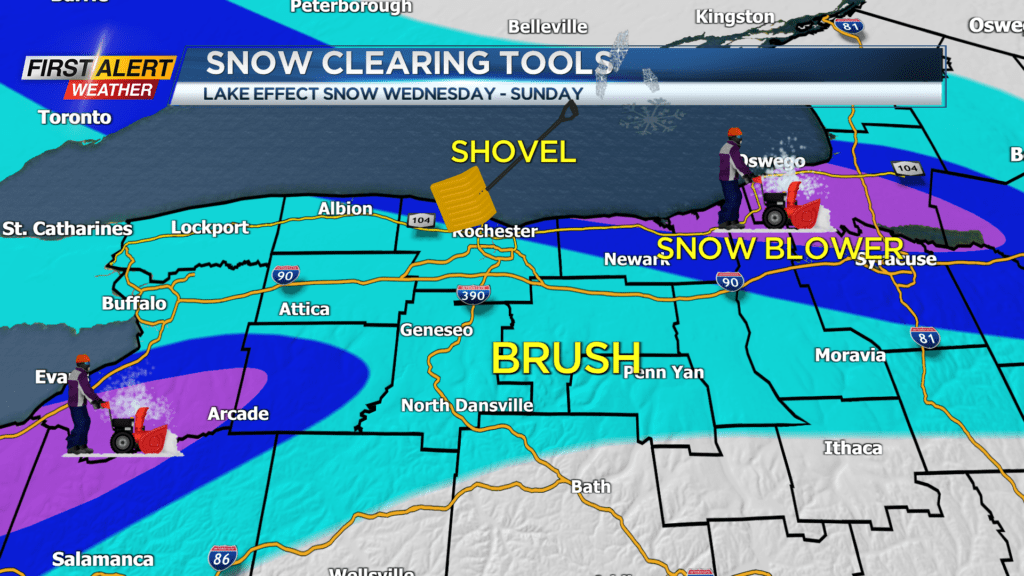
As is usually the case with lake effect snow, this will be a highly localized event, meaning it’s hard to make exact snowfall amount forecasts town by town. Overall however, most areas in the Rochester region will only see a dusting to a few inches at most by the end of the weekend, whereas areas southeast of the lakes including Wayne County will need to bring out the shovel and snowblower as they may see up to six inches of snow.
We encourage you to stay tuned to News10 NBC to see how this forecast develops.
