First Alert Weather: A brisk wind and snow showers into Wednesday
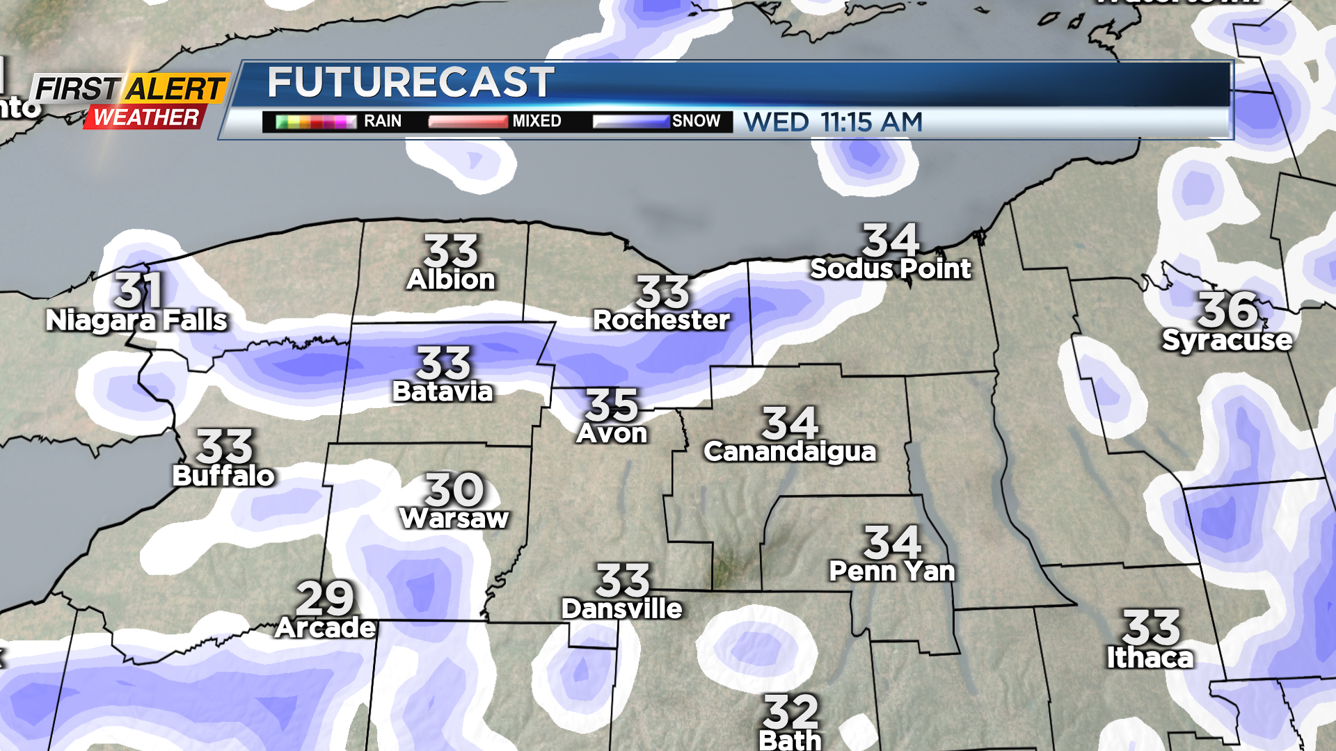
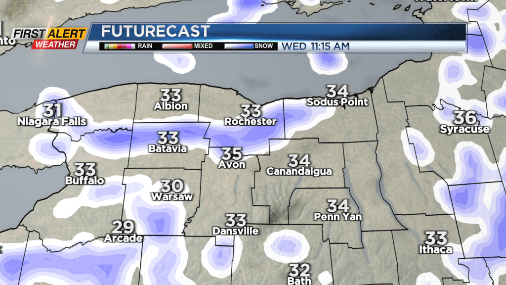
ROCHESTER, N.Y. – Our wintry start to Spring continues, with more chilly air and frozen precipitation on Wednesday. Outside of a few passing flurries or snow showers, Tuesday night will be mostly cloudy and chilly, but quiet. Winds will also ease a bit. Another punch of chillier air will arrive on Wednesday. This will bring a burst of snow showers mixed with graupel at times, especially late morning into the early afternoon. Meanwhile, winds will pick up once again, and another reinforcing shot of cold air arrives, keeping us in the 30s. While it’ll look rather wintry at times, we don’t expect any snow to accumulate on roads, as it’ll melt quickly after reaching the ground.
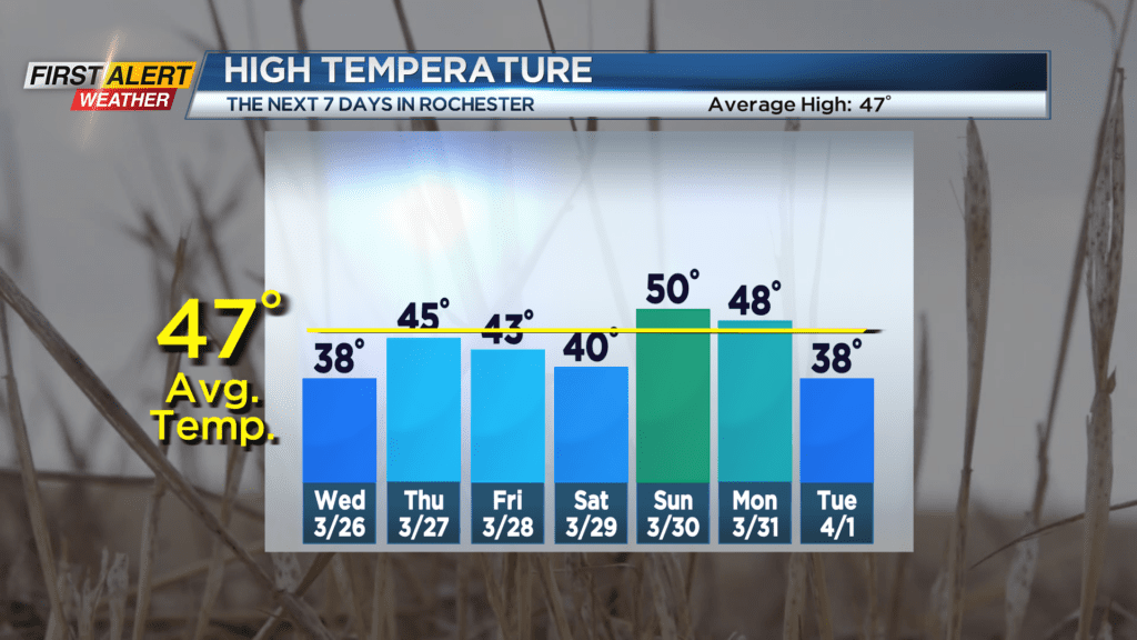
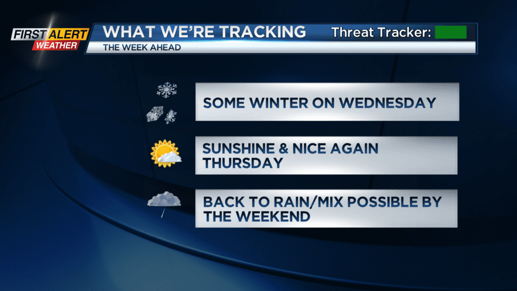
High pressure builds back in on Thursday, bringing a return to more sunshine, and more seasonable temperatures in the mid and upper 40s. Our next system will arrive on Friday, with an increase in clouds, followed by some rain showers developing during the evening. This same system will meander over us this weekend. There’s the chance we could see some rain, changing over to an icy/wintry mix on Saturday, though the trend for any ice has been shifting a little further north, which would put it out over Lake Ontario or into southern Ontario, Canada. Still, the forecast is worth monitoring for any brief icing.
We’ll warm back into the 50s, and warm enough for plain old rain showers on Sunday and early Monday, but temperatures will be falling back later on Monday. This will likely set us up for a chilly but dry home opener for the Rochester Red Wings on Tuesday. That forecast is still about a week away, and some changes are likely. So, stay tuned!