First Alert Weather: A windy and wintry end to the week, and a very cold weekend ahead
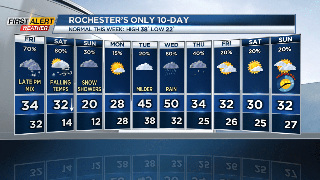
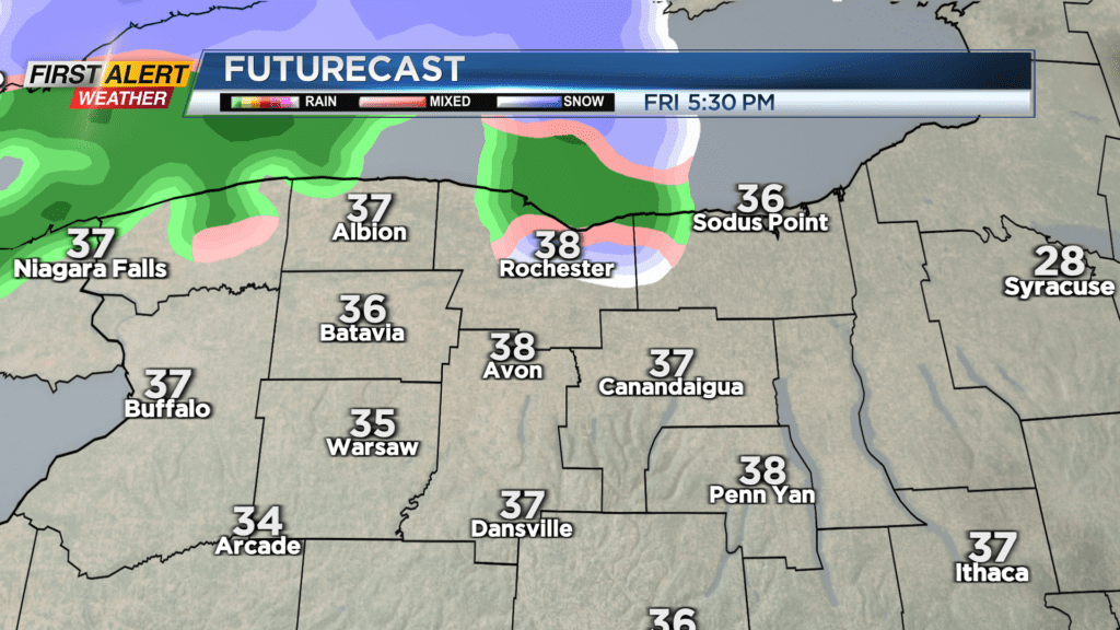
ROCHESTER, N.Y. – We’ve entered the flip-flop phase of the winter season, where we get a little taste of “Fool’s Spring” before dipping back into that frigid arctic air. That second part happens this weekend. Yet another clipper system will be entering the area within the next few hours, and once it passes you can expect bone-chilling temperatures and pesky lake effect snow through the weekend.
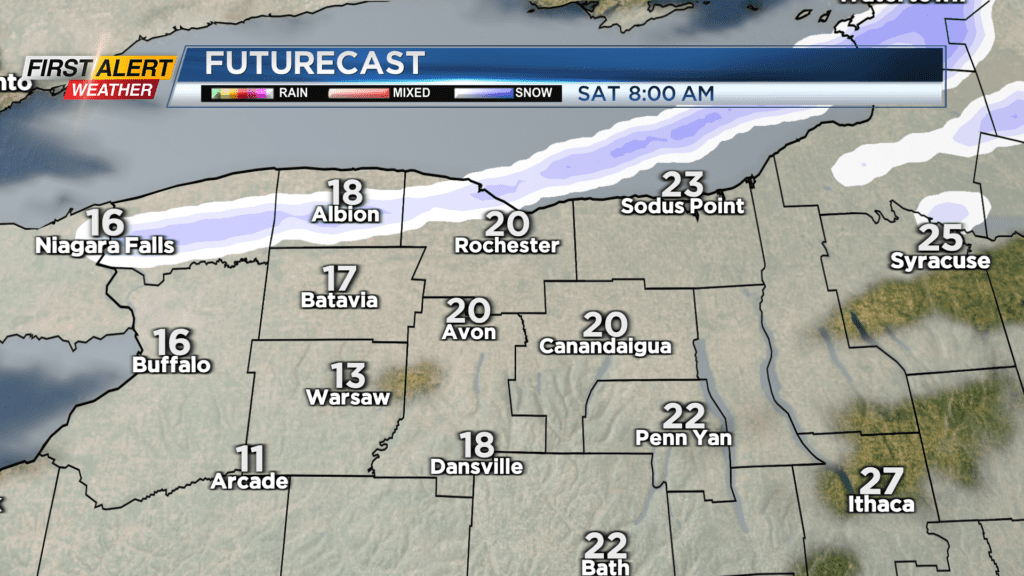
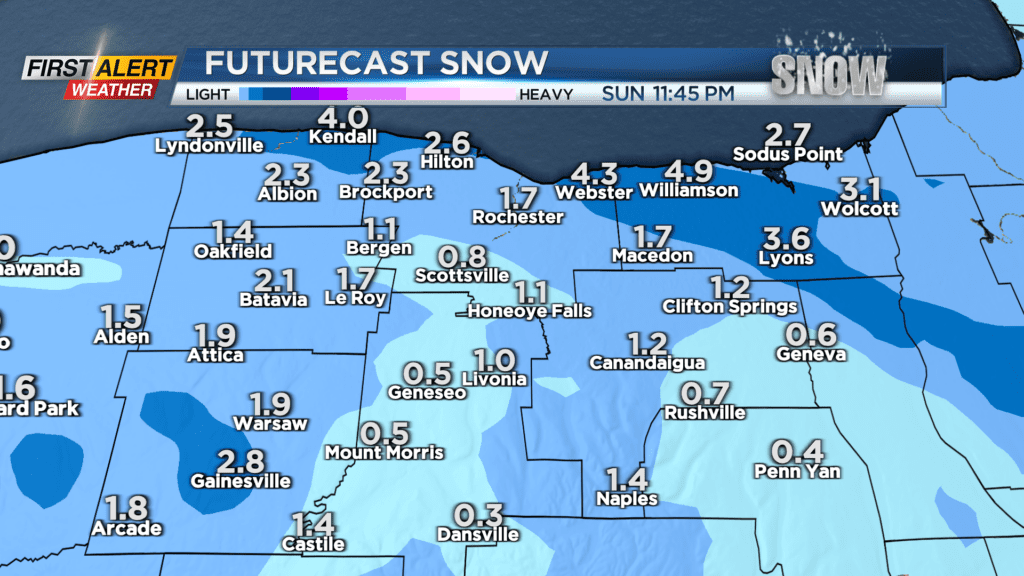
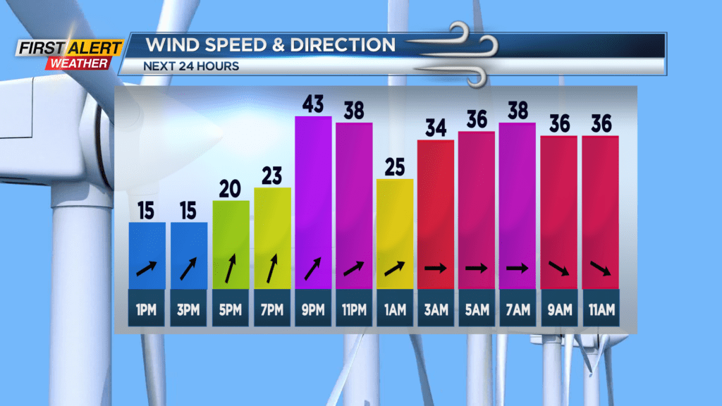
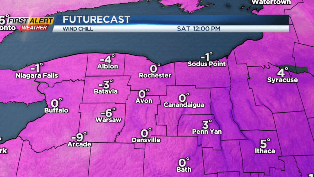
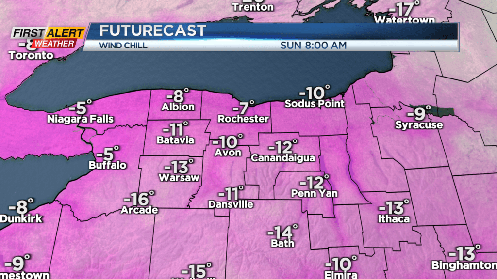
Lake effect snow will be localized but not major; most areas will only see a few inches with some spots getting up to 5″ of the light fluffy variety. Lake snow showers are possible throughout the day Saturday and Sunday; on Saturday they will primarily be coming from the northwest, and on Sunday from the west. Both days will be painfully cold. Saturday could see gusts of up to 40 MPH, but Sunday morning will be dealing with the worse wind chill; with the air feeling like nearly -10 degrees in the morning.
Not all is bleak, however; as mentioned above, we are flip-flopping with the temperatures over the next ten days. Monday will still be chilly, but we’ll see a good amount of sun… If you haven’t had the chance to see that Planetary Parade yet, Monday night is a great chance, as most of the clouds will be to the north, and the “parade” starts at the southern horizon. On Wednesday we could be getting back up to 50 degrees! Unfortunately, it will come with some ugly rain. Thursday could see some more lake effect snow, and then the rest of the week will be quiet… Don’t forget to Spring Forward on the clocks next Sunday!