First Alert Weather: A cold front brings wind, cold and lake snow Tuesday
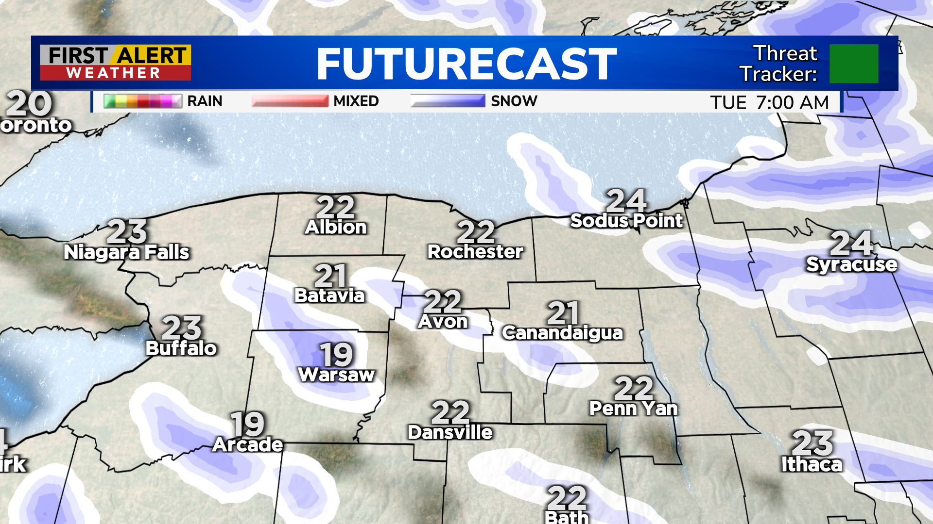
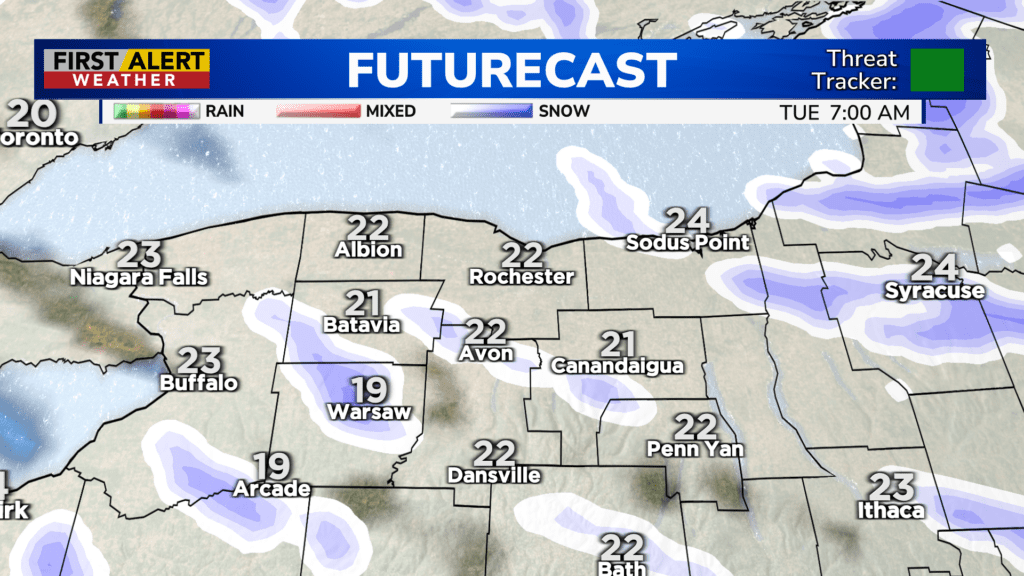
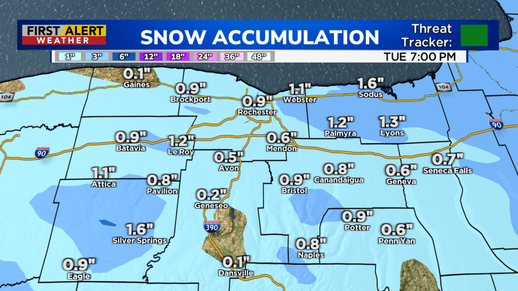
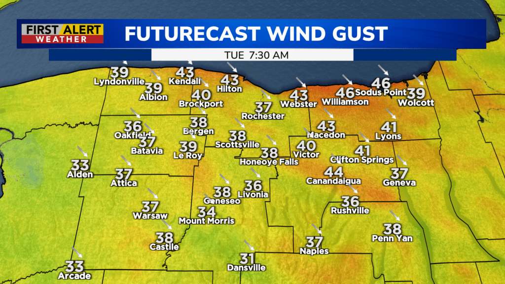
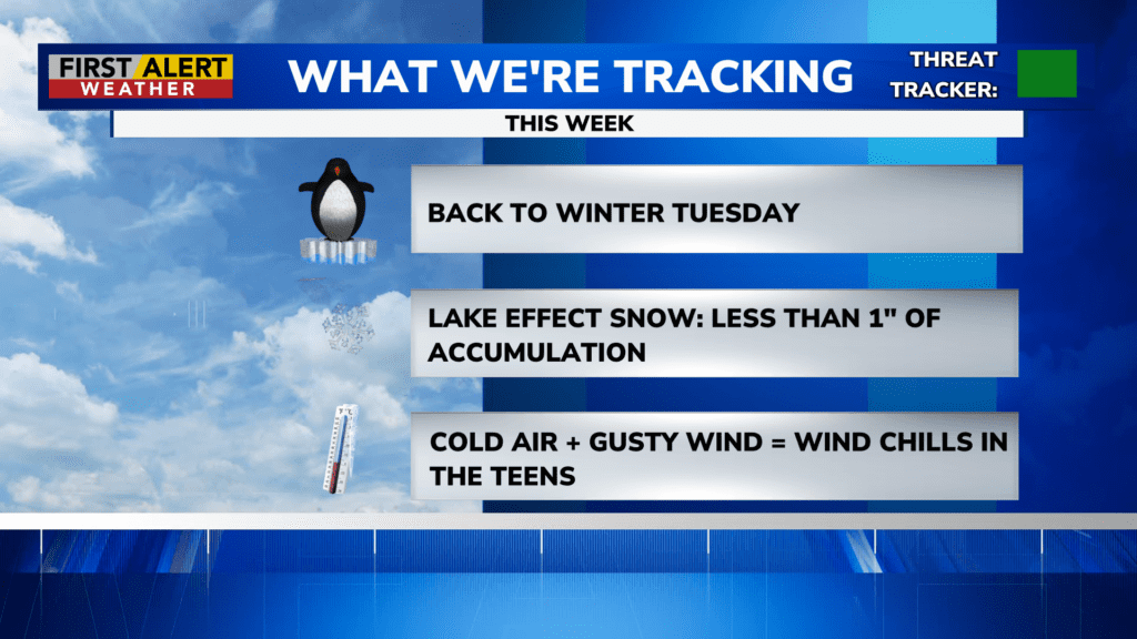
ROCHESTER, N.Y. – We started the week off quiet, but that is changing quickly with a cold front Monday night. This will bring in a burst of rain and wet snow, followed by gusty winds and falling temperatures by early Tuesday morning. We’ll see some lake effect snow developing, especially through the first half of Tuesday. If you see any accumulation, it’ll likely be a coating on grassy surfaces, with nothing sticking on roads or sidewalks. Even with air temperatures hovering around freezing, the April sun has enough strength to help melt any snow fairly quickly. Still, it’ll feel very much like winter, with a gusty wind dropping wind chills into the teens. Speaking of the wind, it’ll gust 35-45 mph out of the Northwest for a period Tuesday morning into the early afternoon. Wind Advisories are posted for most of our area.
Wednesday will still be chilly, but it won’t be as harsh as Tuesday, with temperatures in the upper 30s, less wind and a little more sun. Still, a few flurries are possible early Wednesday. Our next system moving in on Thursday will bring mostly rain showers, but a few flakes may mix in, especially in the higher terrain south of Rochester.
Temperatures will moderate somewhat by the end of the week, but it’ll be rather unsettled with several rounds of showers into Friday and Saturday, before hopefully drying out a bit for Sunday.

