First Alert Weather: Cold morning with no major warmup on Friday, but plenty of sun
ROCHESTER, N.Y. – Over the past week or so, we have seen numerous days that started near freezing and topped out around 70 degrees. But on Friday, there won’t be a warmup later into the day.
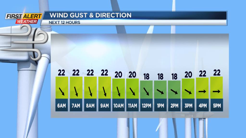
High temperatures across Western New York on Friday will be in the low to mid 40s but high pressure nudging in will promote clear skies. Winds will shift from northwest to west, gusting up to around 20 miles per hour.
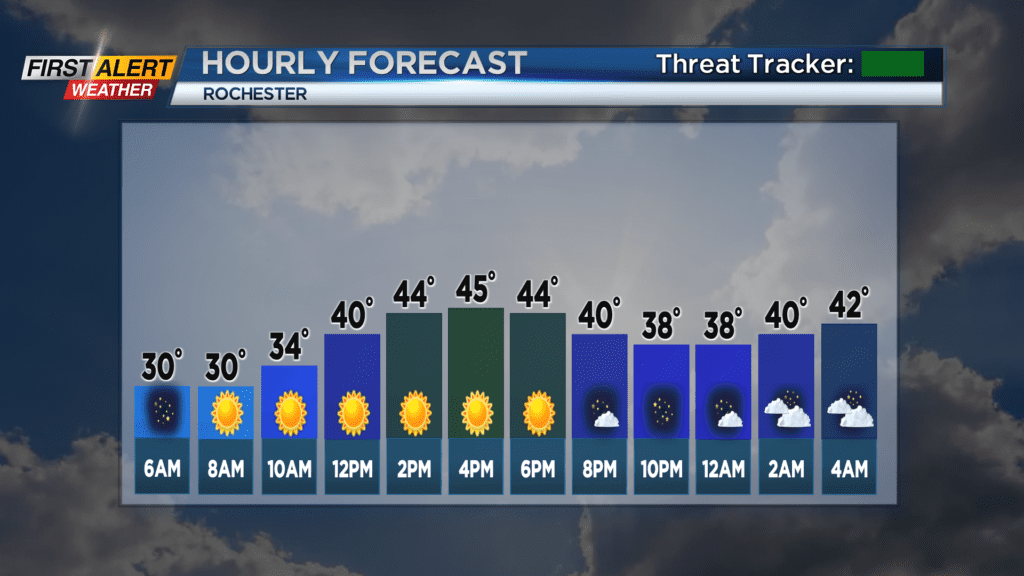
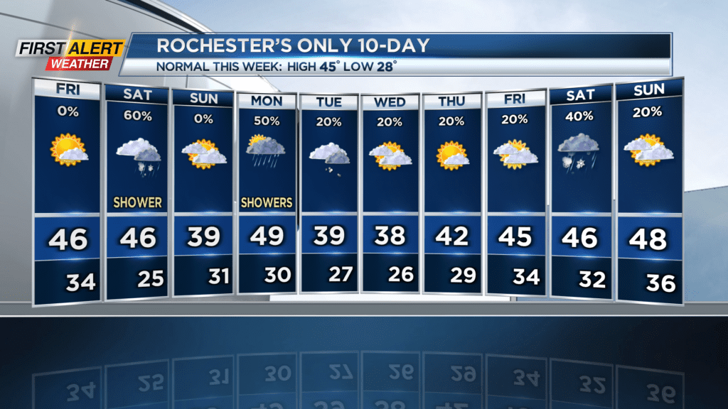
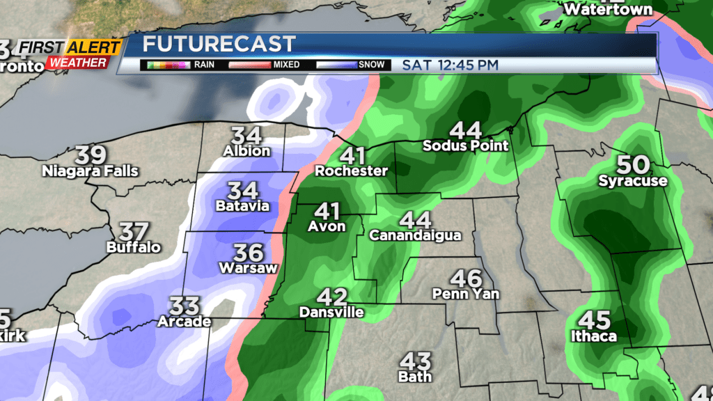
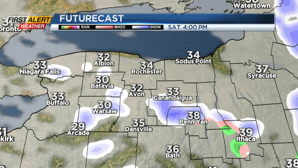
Skies stay clear and cold on Friday night, so if you’re going out, keep that jacket handy. On Saturday, we’re tracking a cold front that will bring in some light rain in the morning into the afternoon, and cold air behind that front may turn some of the last drops into flakes, but only a coating of snow is expected at worst.
Winds will make things feel colder, coming out of the northwest with gusts up to 30 MPH. Some lake snow is also possible afterward due to northwest wind and dropping temps, but incoming high pressure will quickly dampen any lake response Saturday night.
We don’t get much warmer for Sunday, topping out in the low 40s, but we’ll have mostly sunny skies and light winds up until Sunday night when a warm front brings clouds and a mix of rain and snow. Only minor accumulations are expected, and only in the higher elevations near and south of the Finger Lakes.
Stay tuned for News10 NBC for all your First Alert Weather updates.