First Alert Weather: A dry and cooler Sunday, then looking ahead to… Snow??
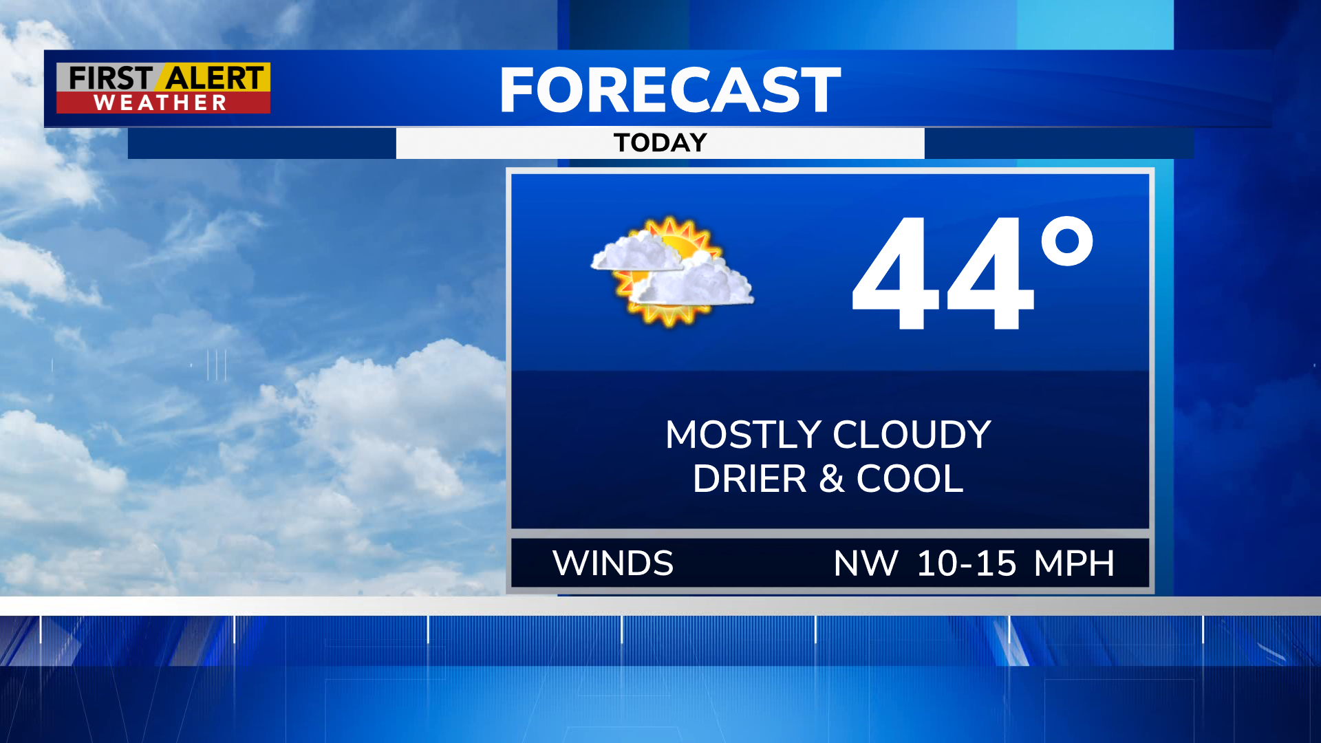
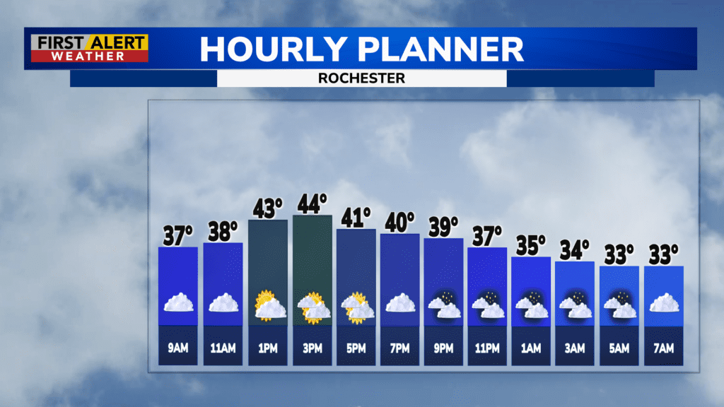
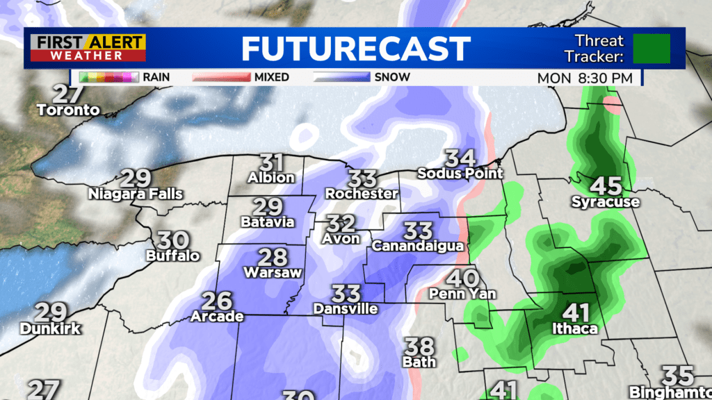
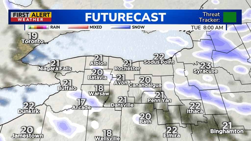
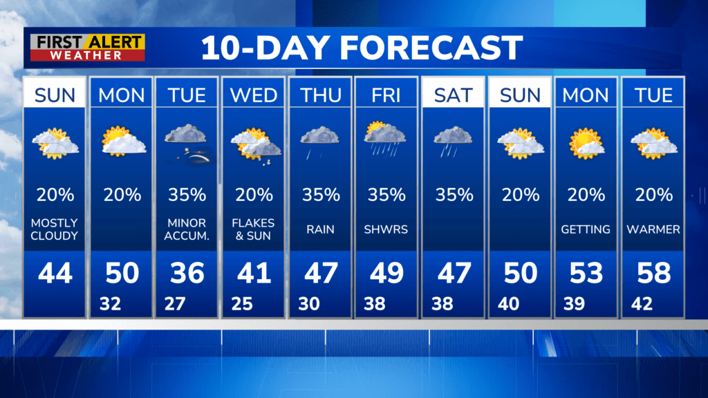
ROCHESTER, N.Y. – We’re in for a much drier and colder day then we had yesterday, with Sunday highs reaching the low to mid 40s. Winds won’t be so bad, with our strongest gusts coming out of the northwest at 20-25 MPH. Those northwest winds will keep us cool and continue tomorrow, with a cold front eventually bringing in even COLDER air alongside some moisture which means… SNOW! Yup, winter isn’t done with us yet, apparently. Now don’t worry, this is an Alberta Clipper, which means it’s quick and won’t leave much. Some lake effect snow follows as the frigid northwest winds move over the lakes, but again, it won’t amount to much. By Tuesday night, we’re really just looking at a coating for most. Some local spots COULD see an inch and change.
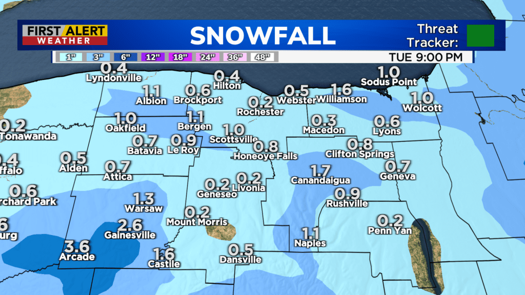
Cold winds continue those lake flakes a bit Wednesday, but since the winds will start to come out of the west instead of the NORTHwest, that means the snow will be concentrated to our EAST. So, Wayne County may see additional minor accumulation… But overall Wednesday will just be chilly and mostly cloudy.
Expect rain showers Thursday and Friday, with temperatures beginning to rise to seasonable levels and then FINALLY becoming above average going into next week.
Stay tuned to News10 NBC for all your First Alert Weather updates.

