First Alert Weather: A frosty start to Friday for some of us
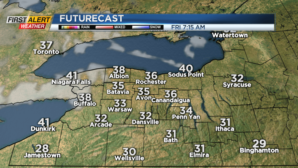
ROCHESTER, N.Y. — High pressure building back in behind our cold front will provide a clear sky overnight into the start of Friday. This will lead to some areas of frost once again away from Lake Ontario, especially south of Rochester.
Sunshine to start the day will be overtaken by clouds ahead of our next system, which may also bring in a few light showers by Friday late afternoon and early evening. While most of these will clear by Saturday morning, cooler air aloft will begin to settle in this weekend, which may be enough to spark a few lake-enhanced rain showers on Saturday, combined with a mix of clouds and sun. Sunday will likely be dry with a partly cloudy to mostly sunny sky. Both weekend days will be seasonably cool in the lower to mid-50s, but there will be a noticeable breeze on both days.
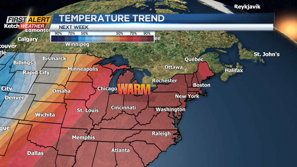
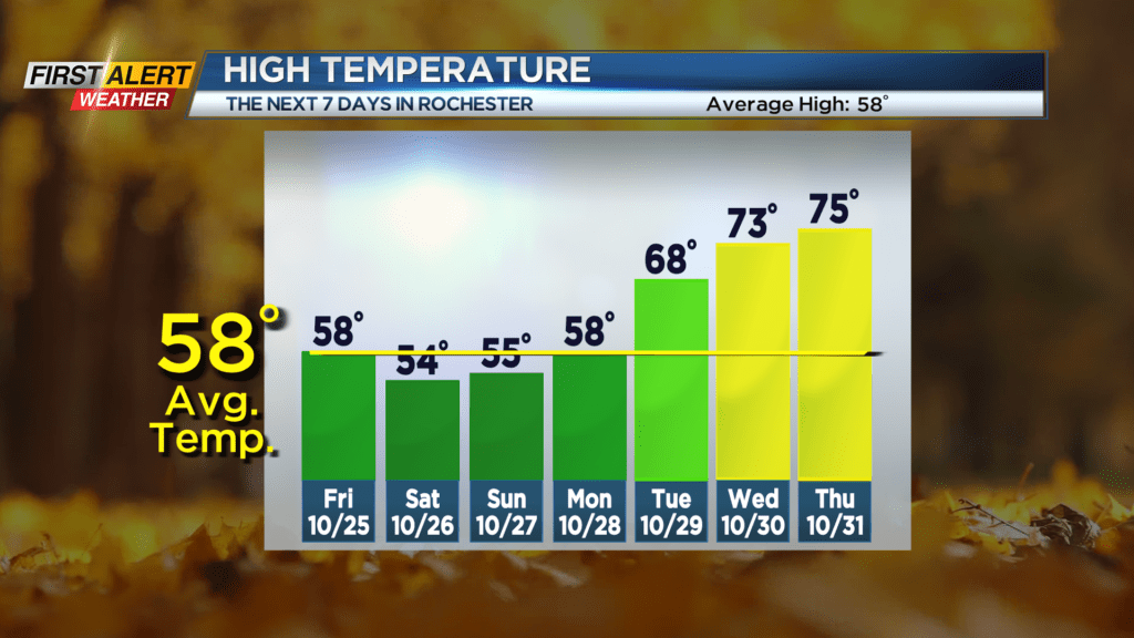
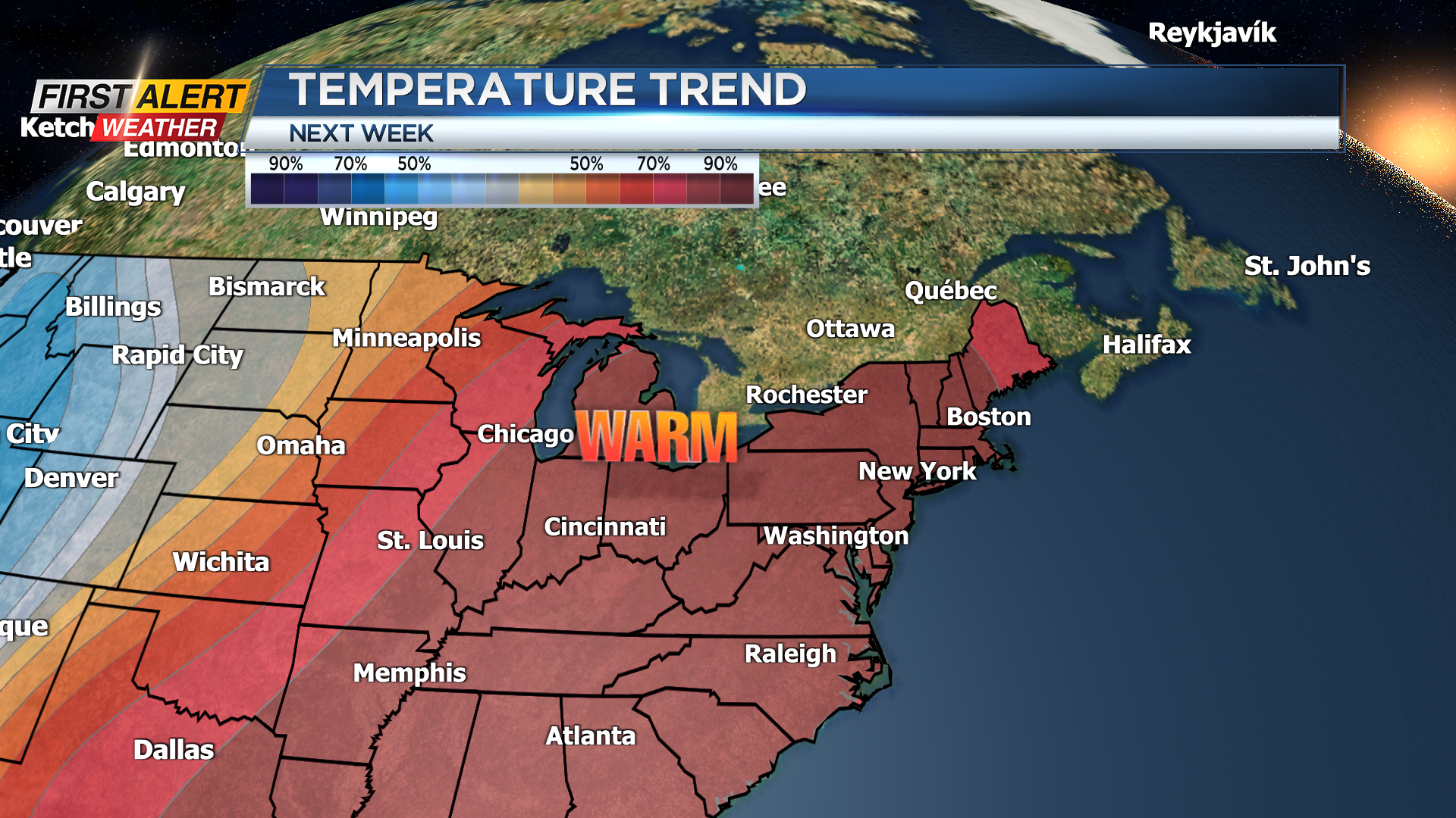
We’re heading into another warming trend next week, with highs in the 50s on Monday, 60s on Tuesday, then 70s likely both Wednesday and Halloween. So, it is looking like the kids won’t need to wear coats over their costumes this year, we may have to contend with a few rain showers later in the evening. This is still about a week away and we expect some adjustments to the timing of the rain, so stay tuned! We’ll update the Trick or Treat forecast as we get closer.

