First Alert Weather: After some overnight rumbles, a mild and breezy Thursday ahead
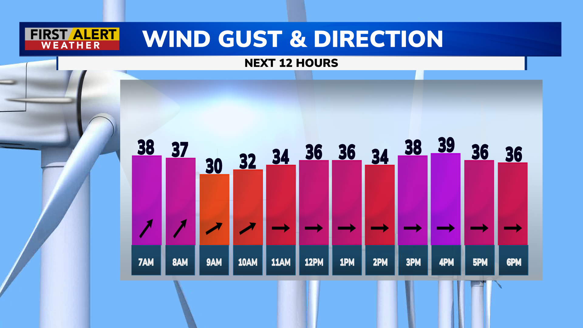
ROCHESTER, N.Y. – A deadly severe weather outbreak has been ravaging parts of the Southeast and Midwest over the past day, and severe weather is expected to continue through today. The northern end of that system gave us some rumbles of thunder overnight, but these were quick and small thunderstorms that have passed on to central and eastern New York. We may see another brief shower in the mid morning to early afternoon as a weak cold front passes, but for the most part, today’s story will be the mild temperatures and strong winds.
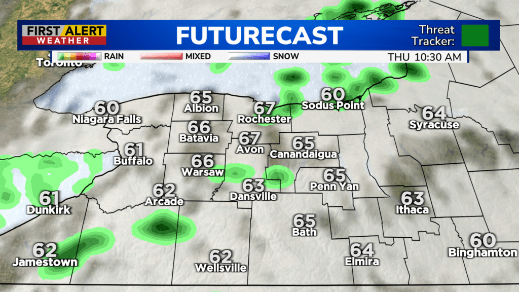
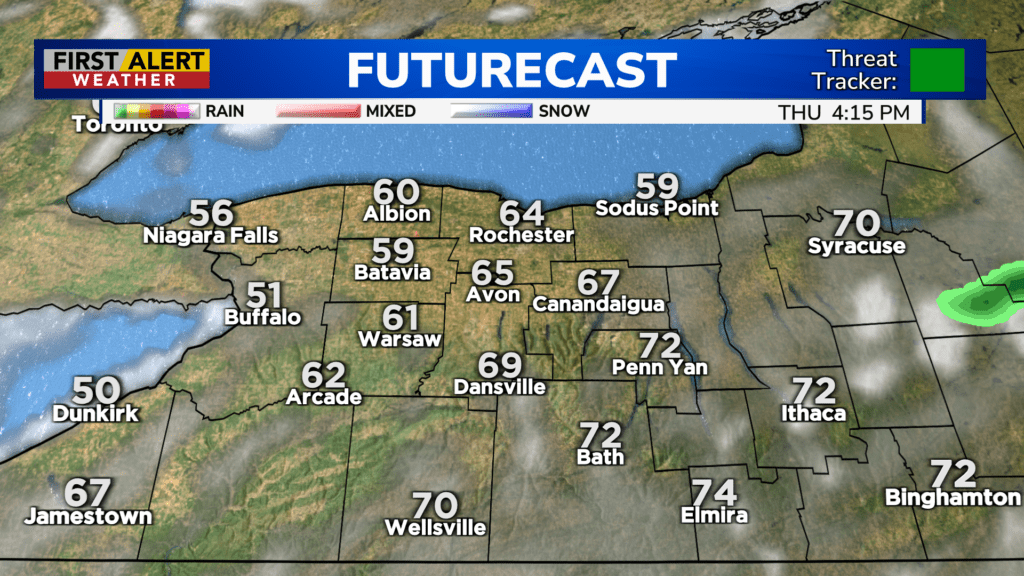
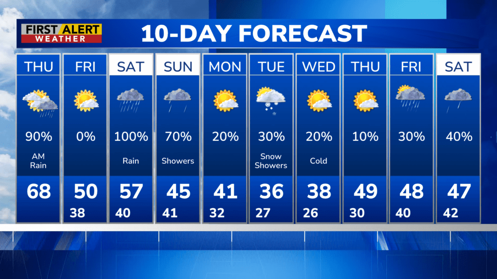
High temperatures will reach into the upper 60s/low 70s as strong southwest to west flow drives in warmer air, and gusts behind the front could reach 40 MPH, perhaps more in some local spots. We remain Green on the Threat Tracker however, as significant or damaging winds are not expected. Skies will turn mostly sunny in the mid afternoon, before clouds return this evening.
Look forward to a dry and mostly sunny Friday, with cooler temperatures that will start in the high 30s and peak around 50 degrees. Widespread rain showers make a comeback this weekend, and a clipper system coming out of Ontario (An Ontario Scary-O?) will bring us SNOW showers on Tuesday. It’s too early to make a call on snowfall amounts, but right now accumulations are looking minor. We’ll update you as we get closer to Tuesday.
Stay tuned to News10 NBC for all your First Alert Weather updates.