First Alert Weather: Another clipper, another day of rain and snow
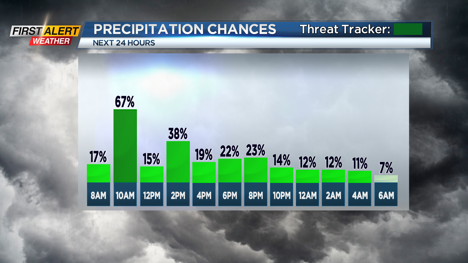
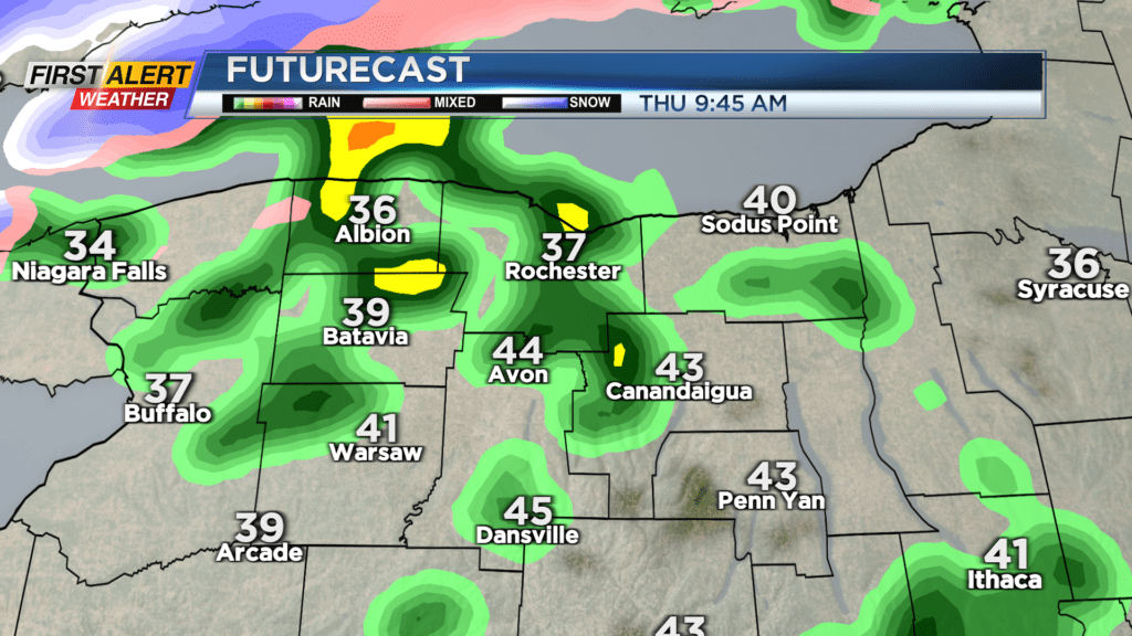
ROCHESTER, N.Y. — We’re waking up to some light drizzles on Thursday morning, with more rain showers on the way.
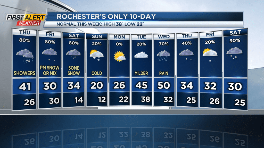
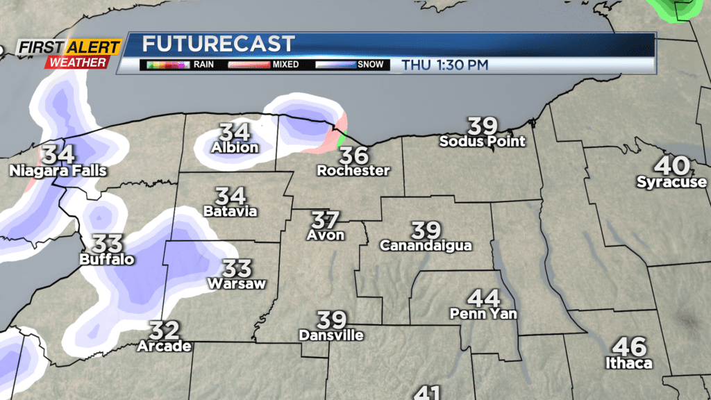
Our stretch of warmer temperatures (at least, high temperatures) continues on Thursday, with the mercury peaking at 41 degrees. This will ensure our A.M. precipitation stays as rain, but as colder air begins to wrap around the center of the clipper and into our area in the afternoon, the rain will transition to a rain/snow mix. No accumulations are expected through the evening, and we remain Green on the Threat Tracker.
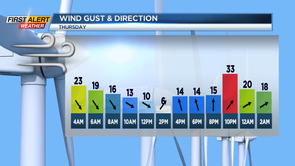
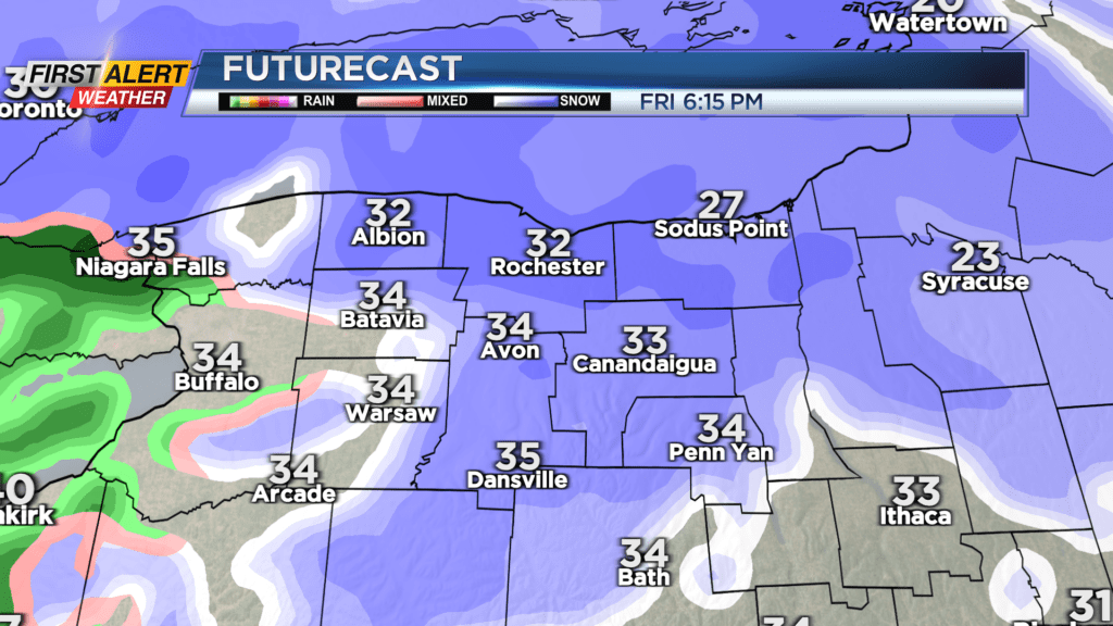
Northwest wind will bring some light lake effect snow and wind in overnight, ending Friday morning as the winds shift ahead of yet another clipper system. This one will bring some more widespread snow starting in the afternoon and lasting until the 7-9pm timeframe, when it shifts to rain. Temperatures Friday start out very cold in the low 20s and wind chill in the low teens, peaking in the mid 30s. A coating to an inch or two of snow is possible before the transition to rain/snow mix.
Rain/snow mix showers continue into early Saturday morning, then there will be a transition to yet more lake snow in the late morning/early afternoon all the way into the night. Again no major accumulations expected, but Saturday and Sunday will be much colder with temperatures in the low twenties. Winds will also be a nuisance, with northwest gusts at 30 MPH.
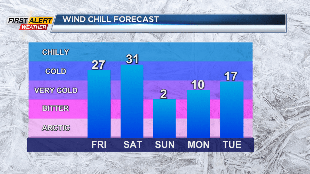
Our pattern stays active next week, with chances for large-scale systems on Wednesday and next weekend; ahead of the system on Wednesday temperatures could climb to 50 degrees again, and will feature lots of rain. The system next weekend could be a much snowier one, but we’ll continue to track where conditions might be headed.