First Alert Weather: Blustery winds in Rochester for Championship Sunday, Yellow Alert Monday as winds increase
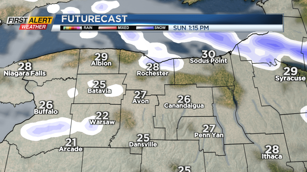
ROCHESTER, N.Y. – Stepping out the door on this Championship Sunday you’ll notice two things: First, it’s windy. Gusts this morning reached 25-30 MPH, and are expected to get up to 35-40 MPH later this morning before dropping off a bit this afternoon. Second, it doesn’t actually feel super cold out, at least compared to last week! We’ll hover around 30 degrees for our high today, and this morning we were already at 32 — a whole 14 degrees warmer than yesterday morning.

We may see some nuisance flakes this afternoon, but no significant accumulation is expected; A dusting at most. If you’re going out for the big game Sunday night, there may be some clearing in the clouds, so you won’t have to worry about any snow but of course, there will be that chilly air and moderate winds. Gusts are expected to drop off in time for kickoff and will pick back up Monday. Over in Kansas City, there won’t be any wind, so conditions are looking prime for a Bills win .
.
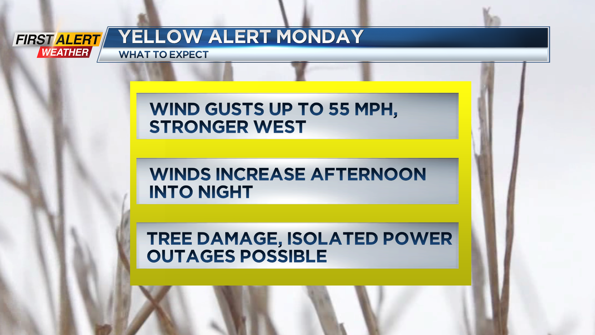
We’ve issued a Yellow Alert for those high winds on Monday… They’ll pick up ahead of a cold front in the afternoon, perhaps reaching 50 MPH at one point before sunset, and then some snow will move in with that cold front around 8 p.m. The cold front will pass overnight, and that is when the winds will peak with gusts up to or a little above 55 MPH. This could cause isolated tree damage and power outages.
Looking into the rest of the week, we’re in for a bit of a rollercoaster temperature-wise, and we’ll have a few chances to get some snow. By the end of the month, we’ll finally get above freezing and may even see 40+ degrees and some rain for Groundhog Day!

Stay tuned to News10 NBC for all your First Alert Weather updates, and GO BILLS!!!!!