First Alert Weather: Cold Monday ahead with another midweek warm-up
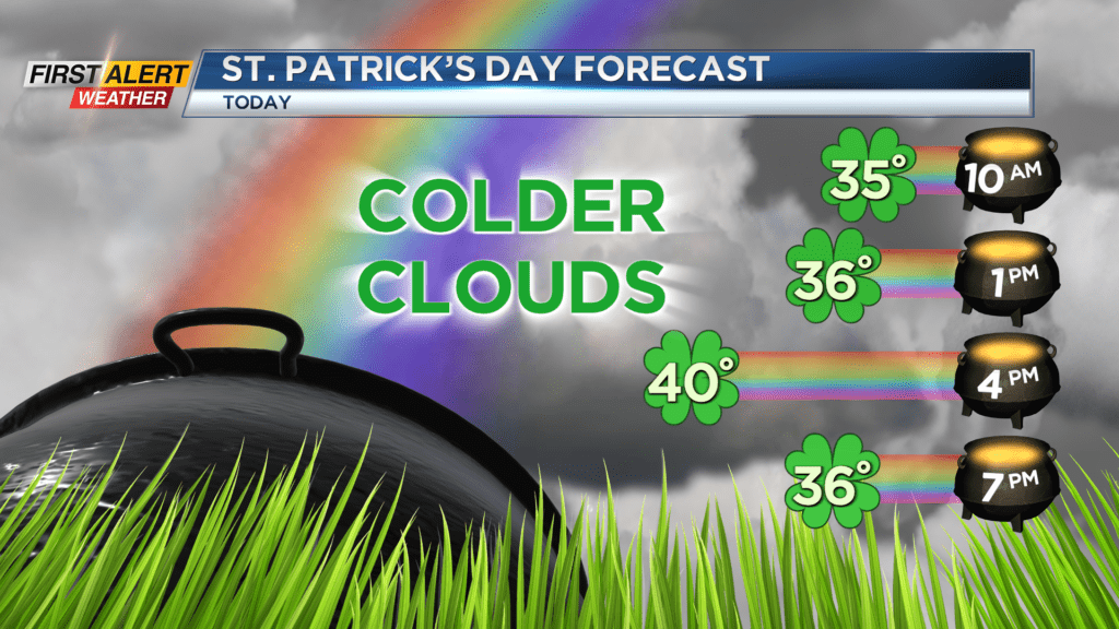
ROCHESTER, N.Y. – Happy St. Patrick’s Day. It’s much colder weather to start the week behind the strong cold front that brought the wind and severe storms on Sunday.
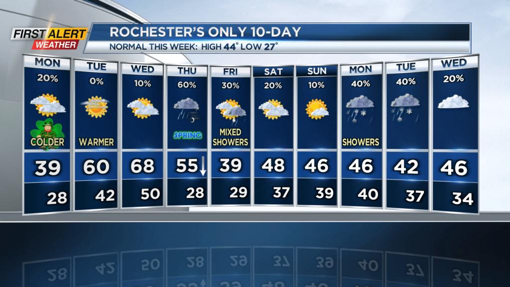
Expect cloudy and mainly dry weather with temperatures in the 30s to near 40 for Monday. Skies may clear for a little sun later into Monday afternoon. Clearing skies on Monday night will allow temperatures to drop near 30 on Tuesday morning.
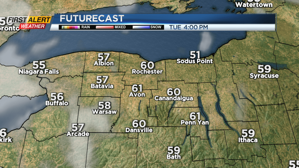
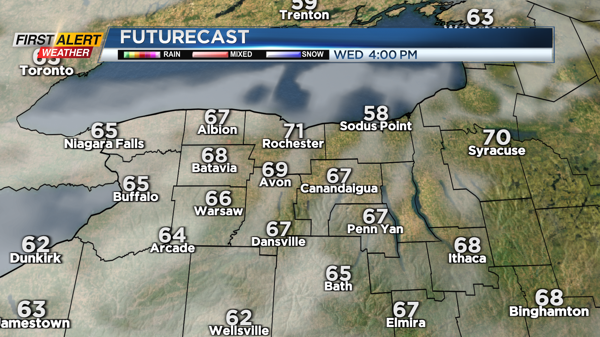
Even though Tuesday will start on the chilly side our next fling with spring warmth will arrive in the afternoon. Lots of sunshine will help to get temps to near 60 degrees. Even warmer weather on Wednesday with highs closer to 70 for the middle of the week.
Spring officially arrives Thursday morning and a cold front will also move through on Thursday. This front does not appear to be nearly as strong as the one over the weekend but will monitor how it develops. The cold front will bring some rain and gusty winds as temps fall during the day from the 50s into the 30s and 40s. Colder on Friday with perhaps a few snow showers to end the week.
Long range forecast looks more seasonable with temps mainly in the 40s this weekend into next week so enjoy the warmth Tuesday and Wednesday as it may be some time before we see temps that warm again. Stay tuned to News10NBC for the latest on the timing and strength of the rain and wind Thursday.