First Alert Weather: Storms wind down Sunday evening
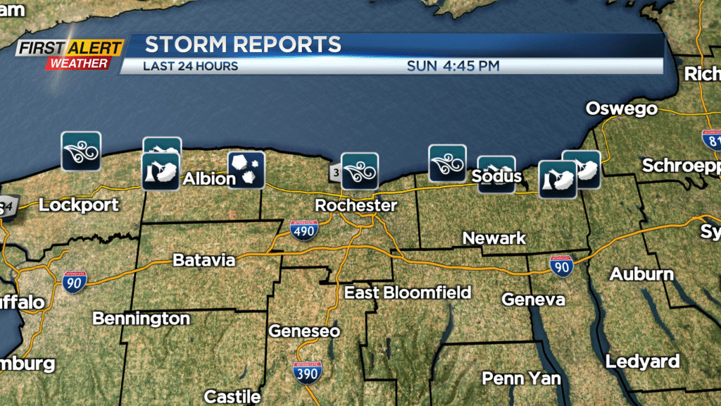
ROCHESTER, N.Y. — There were a few downpours and pockets of hail across our northern towns of Western New York on Sunday afternoon.
It was the Route 104 corridor that had a few brief thunderstorms roll through during the mid-to-late afternoon hours. There will continue to be a chance of a passing shower or thundershower into this evening as a vigorous upper-level disturbance rotates across the eastern great lakes.
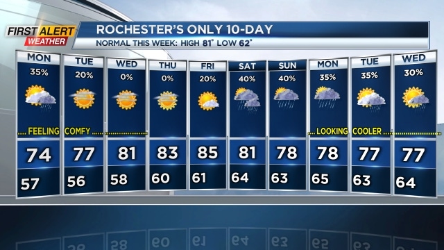
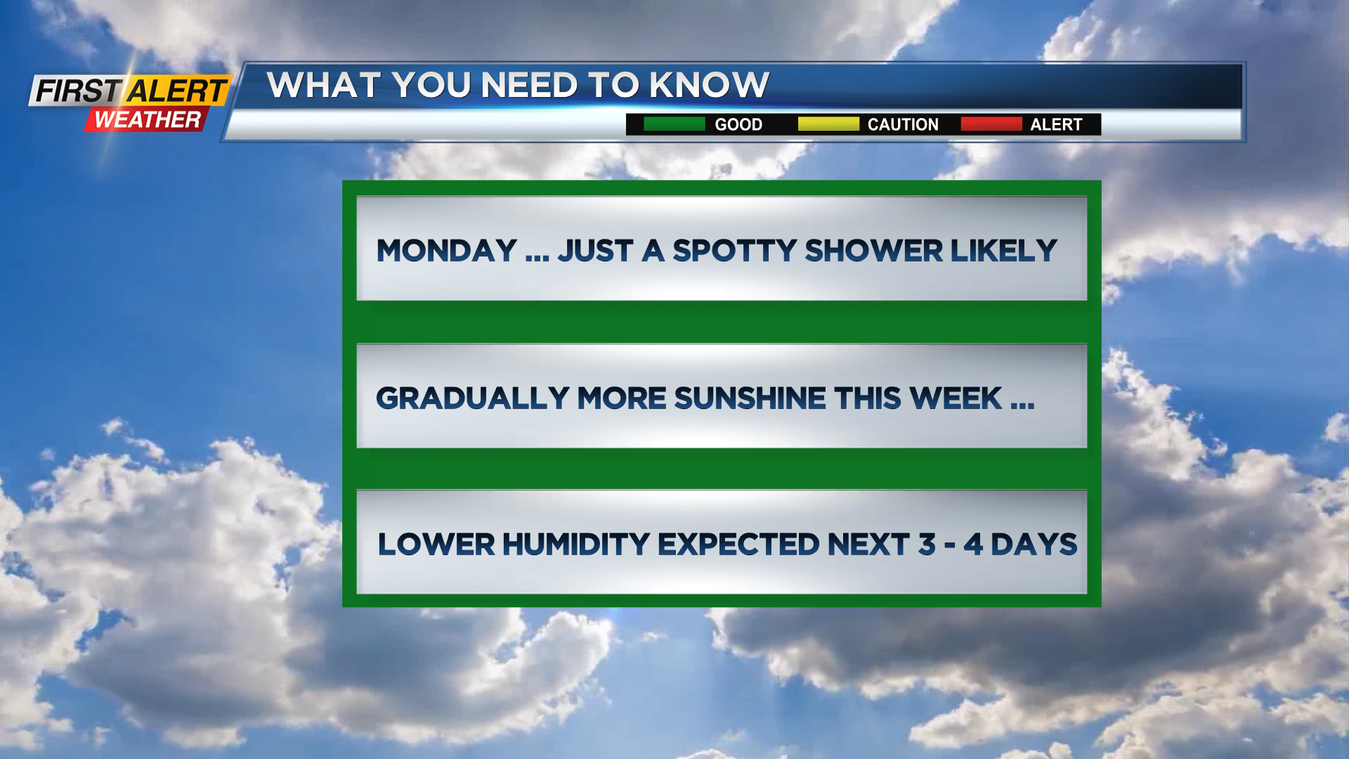
The threat of a shower or thundershower will continue into Monday. But as high-pressure builds, several days of dry, sunny weather can be expected this week. On Sunday night, look for a another passing shower or thundershower. Otherwise, partly cloudy skies can be expected with the low temperature in the upper 50s.
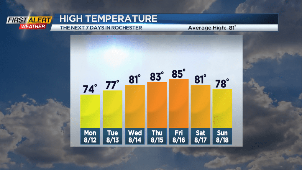
On Monday, partial sunshine can be expected for most of the day. However, a spotty shower is also possible. It will be a comfortable day with the high temperature near 74 degrees.
More sunshine returns for Tuesday and Wednesday. On Tuesday, the temperature will be in the upper 70s with Wednesday closer to 80 degrees. The warming trend should continue into the end of the week.