First Alert Weather: Cooler but sunny to start the weekend
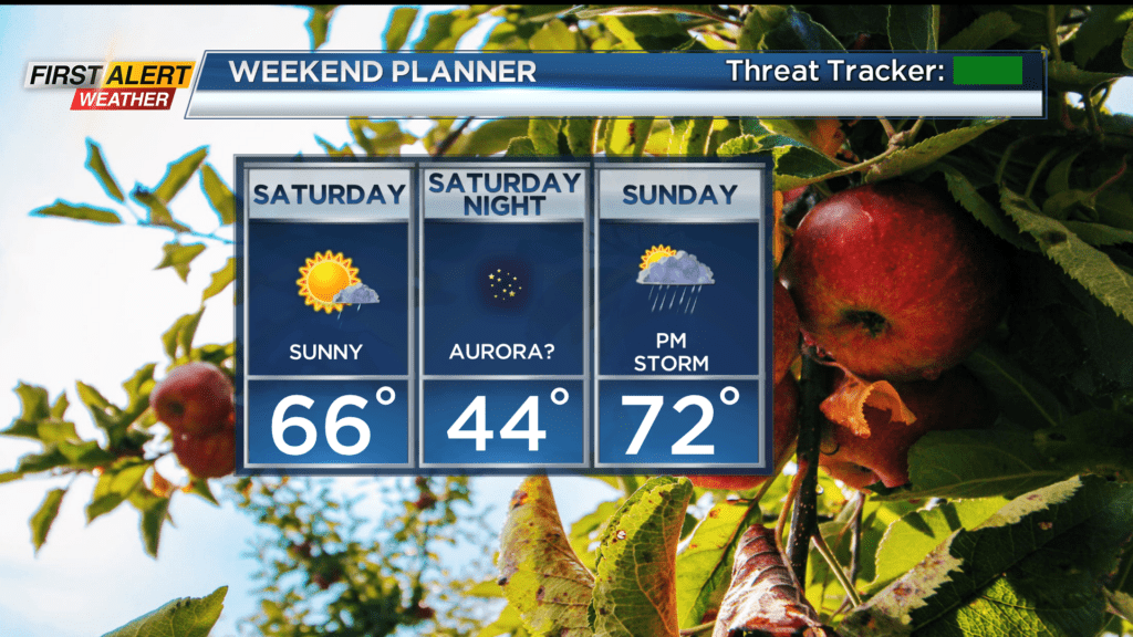
ROCHESTER, N.Y. — A cold front Friday evening clears the area, taking any stray showers with it, and high pressure builds in quickly through Saturday morning. This will set us up for a gorgeous early fall day on Saturday.
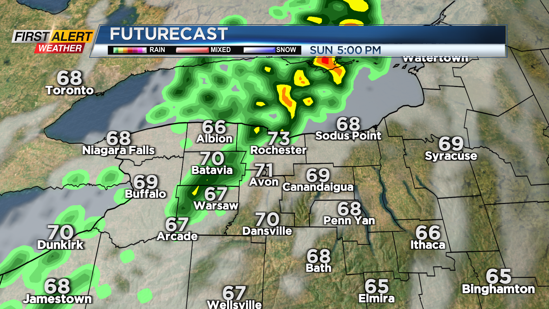
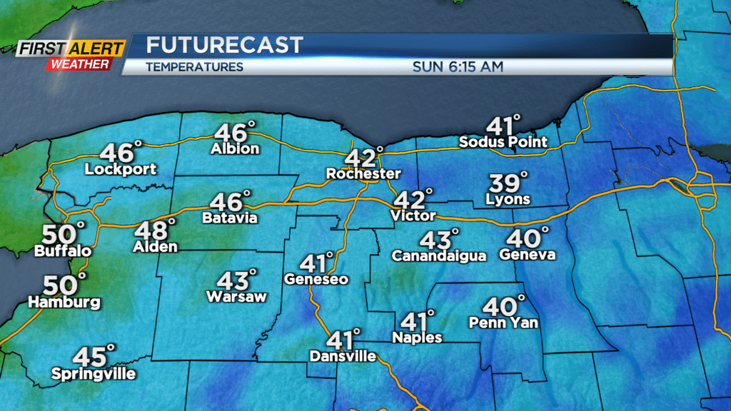
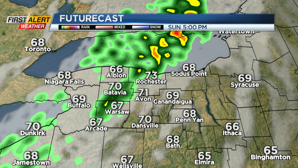
We’ll see ample sunshine, and cooler but seasonable temperatures in the mid 60s. The clear sky will last into Saturday night, which will set us up for a chilly night with lows dropping into the lower 40s away from Lake Ontario by Sunday morning. Sunday starts beautifully with sunshine and temperatures climbing rapidly into the 70s ahead of another cold front. This will bring a much better chance of scattered showers by mid to late afternoon into the evening hours, along with a few thunderstorms. So the first 2/3 of Sunday should be just fine for outdoor plans, but you’ll want to take them inside later in the afternoon.
This front will also bring a much more fall-like feel to our weather for much of next week. An upper level low will meander overhead next week, keeping our temperatures in the upper 50s and lower 60s through the middle of next week along with some scattered showers. This pattern looks to start breaking down by the end of next week, with milder air making a return.
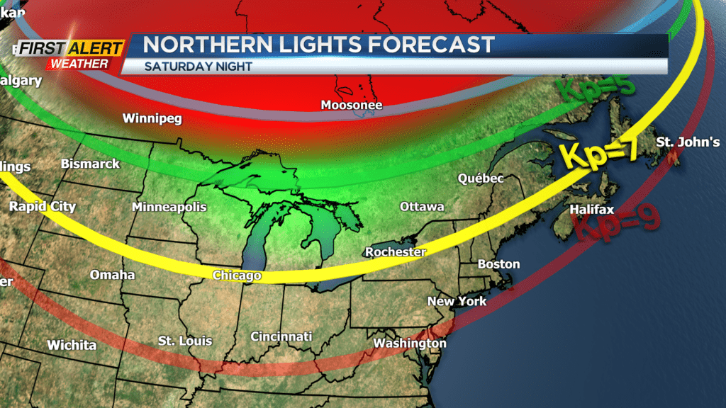
The Northern Lights may be visible over the next few nights, as we recently had two strong solar flares in the last few days. If the aurora is in fact visible Friday and Saturday nights, the sky will mostly cooperate. Friday night will feature some clouds with that cold front, but the sky will clear as the night goes on. Saturday’s sky should be clear, so if things line up just right, Saturday could feature great conditions for the northern lights. Now we wait and see!