First Alert Weather: Dangerous cold is gone, but a chill remains
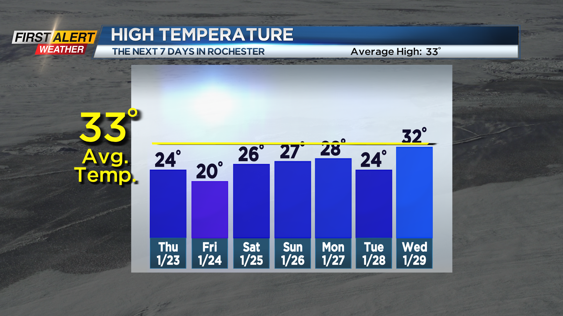
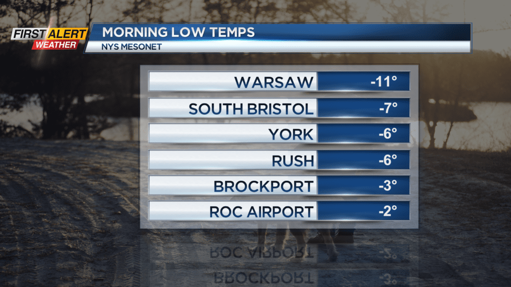
ROCHESTER, N.Y. – The temperature at the Rochester airport dipped below freezing for the first time in almost 2 years Wednesday morning. In fact, much of the Rochester area and Finger Lakes woke up to sub-zero temperatures. That, combined with a slight breeze made it feel well below zero. The worst of the cold is behind us, but colder than average temperatures will linger. We’ll hold in the mid 20s on Thursday, then fall back into the lower 20s on Friday following a weak cold front and brief shot of colder air. We’ll hold in the 20s until next week, when we’ll occasionally flirt with the lower 30s, but overall, we’ll continue with our colder than average weather pattern.

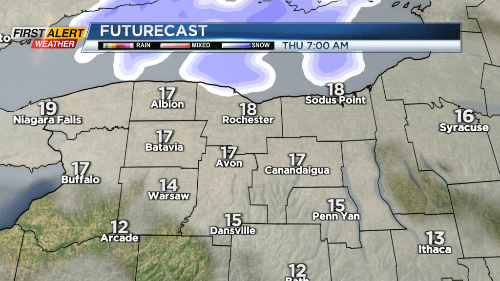
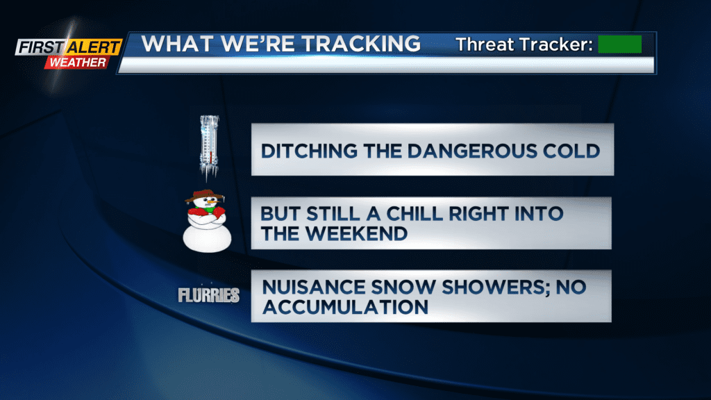
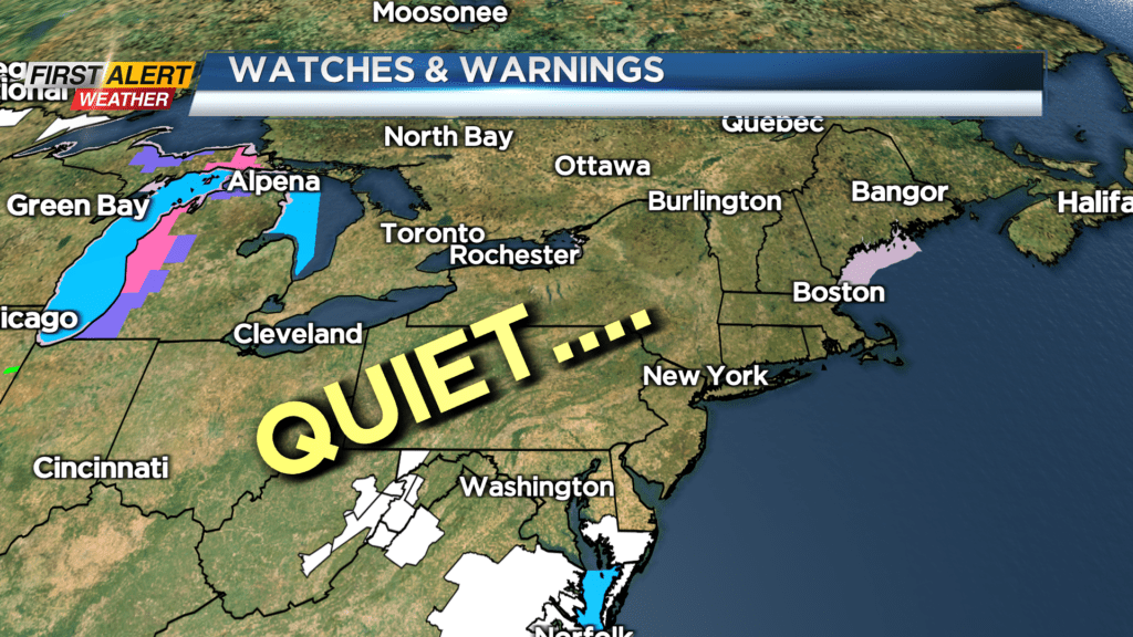
The good news is we’ll remain fairly quiet as far as the storm track goes, at least into the weekend. We’ll see a few passing snow showers on Thursday, followed by some very limited lake effect Thursday night and early Friday, but no accumulation is expected locally. Friday and Saturday should see some limited sunshine from time to time, but overall clouds will win out.
The storm track may get a little more active next week, with a few shots of colder air, and a few chances for some snow, but at this point, we don’t have any First Alert Weather days, nor do we have any big snows in the foreseeable future. We’ll see how long that lasts. Stay tuned!