First Alert Weather: Enjoy the last warm day before colder temperatures return
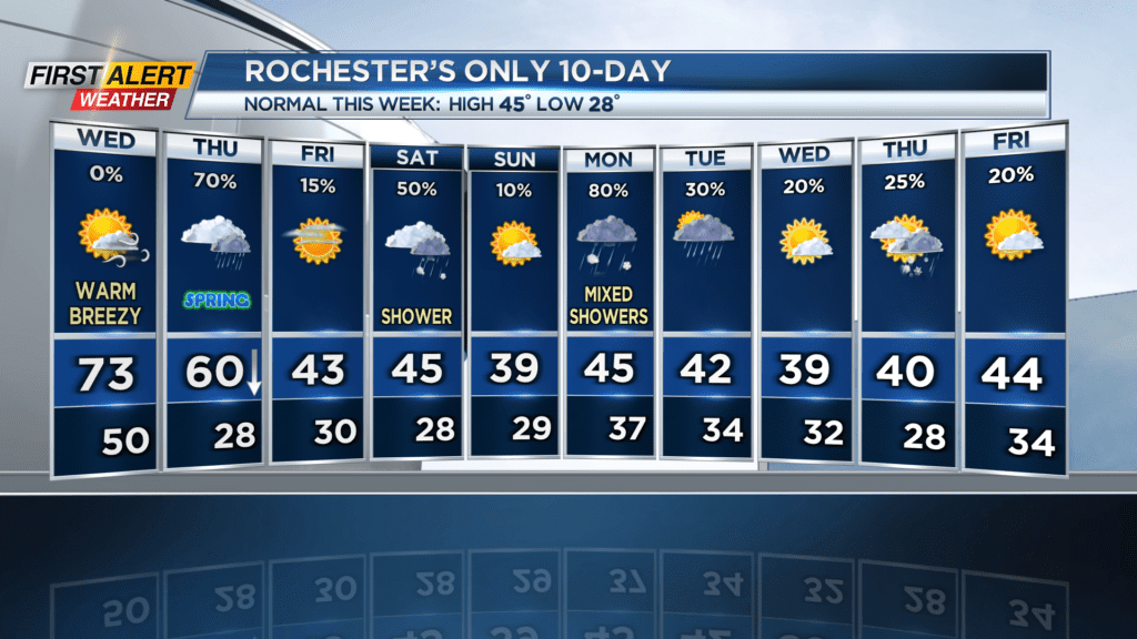
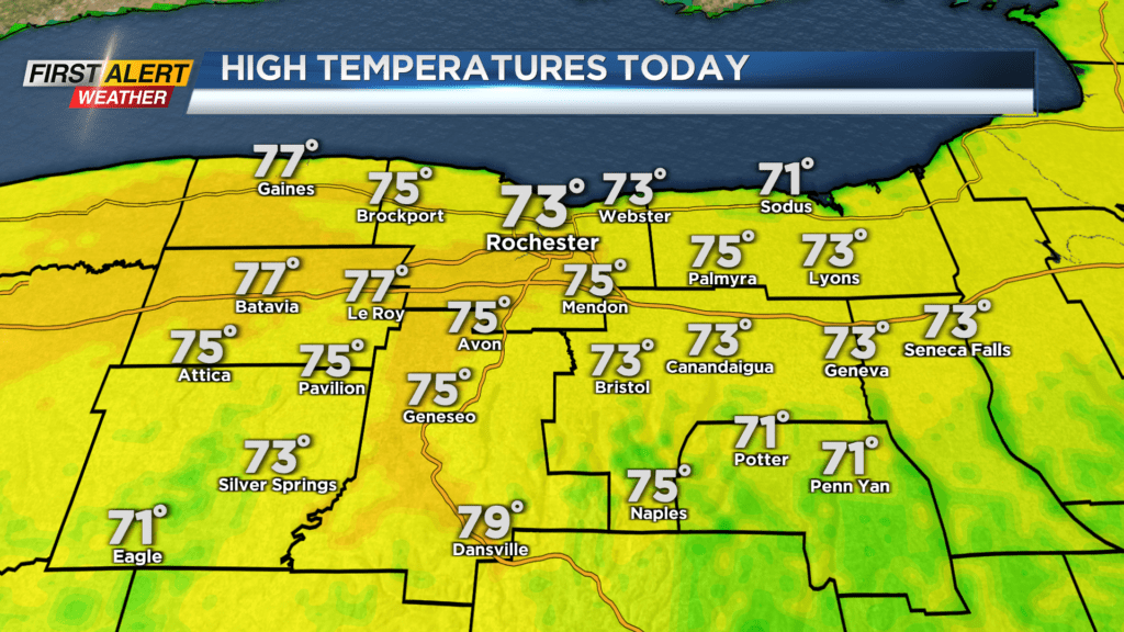
ROCHESTER, N.Y. – We have been treated to above-average temperatures for the last 8 out of 10 days. It’ll be warm again on Wednesday, and in fact, it’s going to feel more like late May.
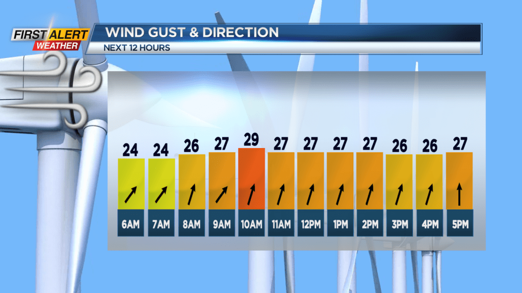
With a decent amount of sun poking through the clouds and a bit of a breeze to go along with it, it’s going to be a beautiful day to get outside. Quite the sendoff for the winter season.
It seems it’s “opposite day” for the seasons, as on the first day of spring on Thursday, we’ll have a rainy system come through that will kick off a much cooler weather pattern.
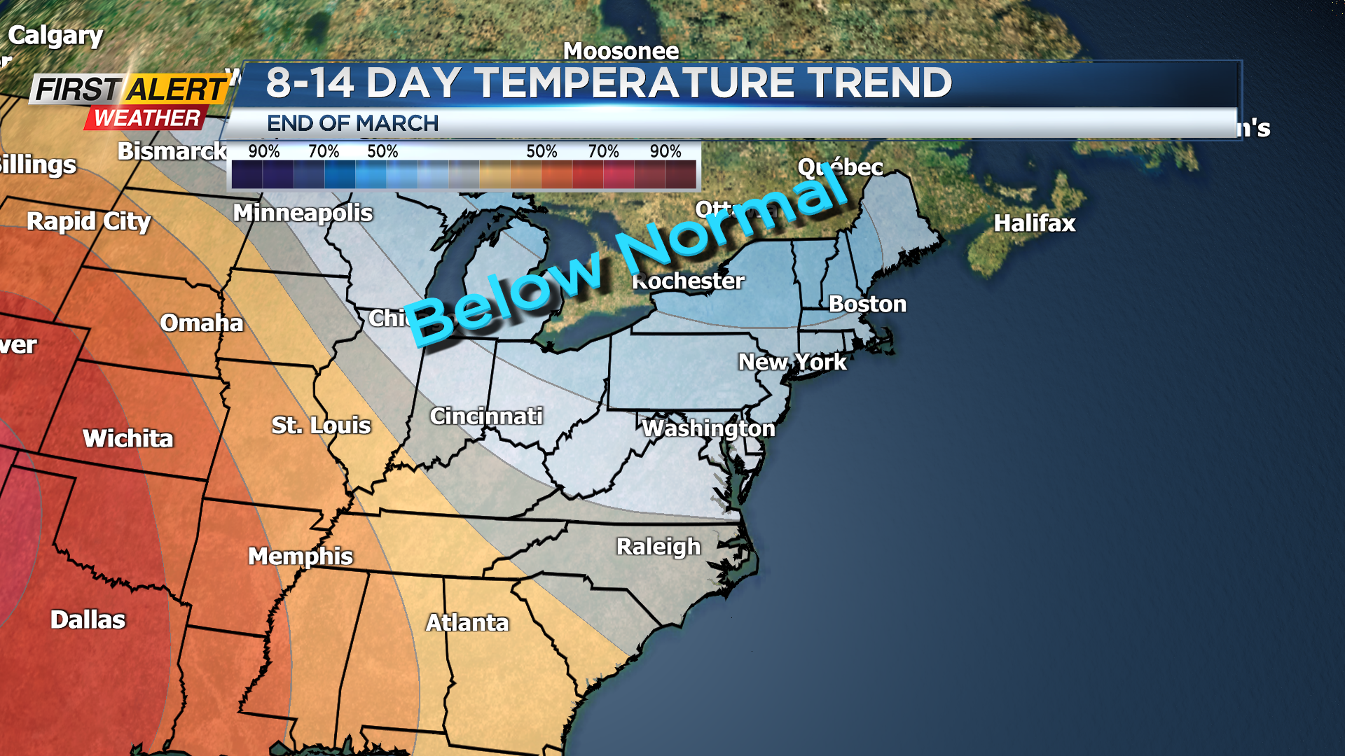
Due to an eastern dip in the jet stream, we’re about to plunge back down to seasonably cool temperatures for at least the next week, perhaps the next two. So even though this “cold” air is in reality quite normal for this time of year, it’s certainly a very rude awakening. Mother Nature has spoiled us for too long. Happy spring everyone.
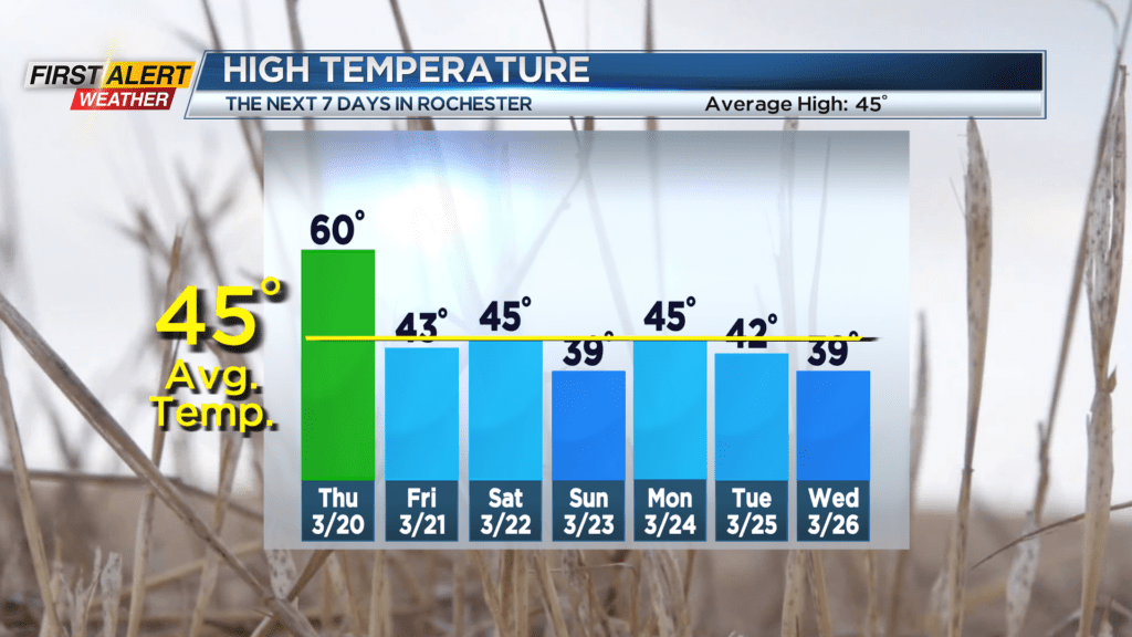
With that cooler weather pattern also comes an altered storm track that will give us multiple chances for precipitation over the next 10 days. The system that is giving a good wallop of snow out in the Midwest on Wednesday will reach by Thursday, but we’ll just see rain during the day and chance light snow showers overnight that won’t amount to anything.
More chances for rain and snow include Saturday and Monday, then more rain on Tuesday and another mix on Thursday. All in all, make sure you get outside today while these pleasant conditions last. Stay tuned to News10 NBC for all your First Alert Weather updates.