First Alert Weather: Fool’s Spring? Snow is back in WNY
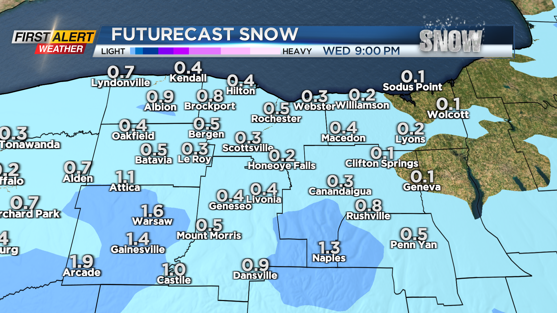
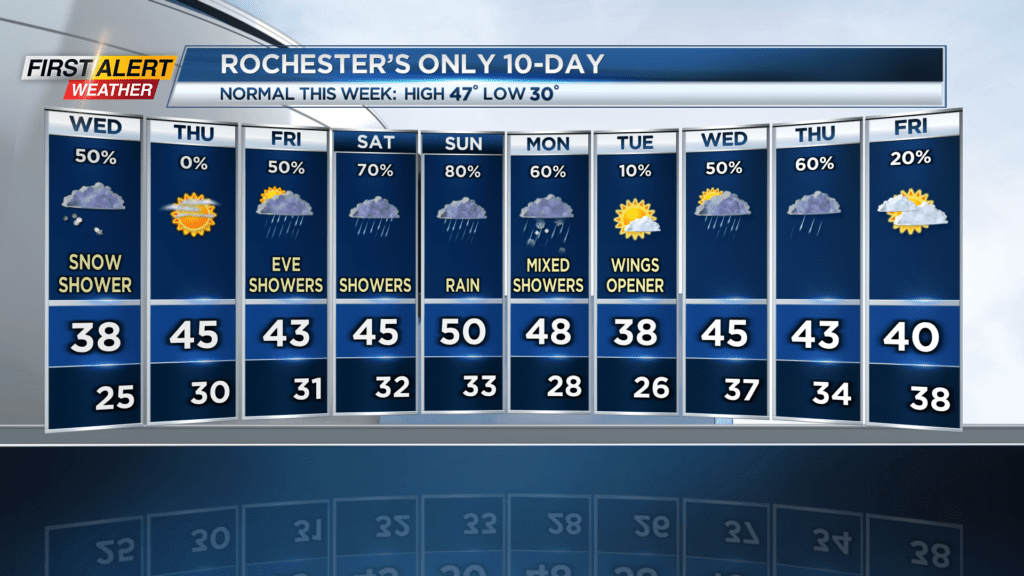
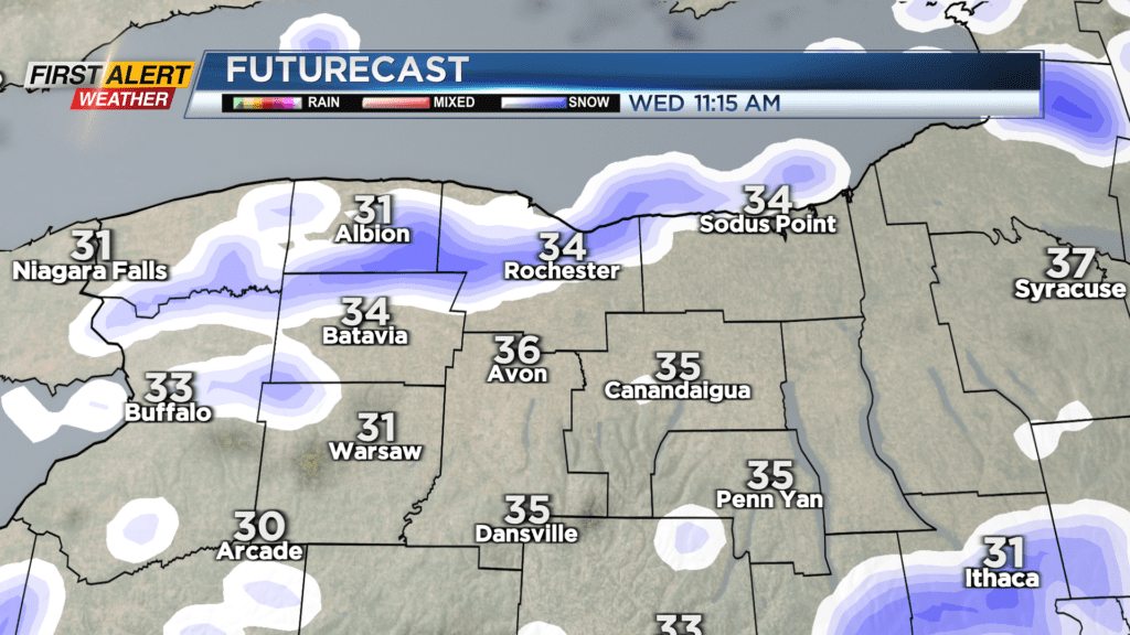
ROCHESTER, N.Y. – Thanks to a large scale rotating system north of us, cold air and moisture is being driven in and giving us accumulating snow for the first time in two and a half weeks. We’ve only gotten 3.3 inches of snow so far this month – a far cry from our average of 18. Snow showers will be relatively light, and only a few tenths of an inch is expected for most. Areas in the higher elevations could see 1-2″. Temperatures will rise to the mid 30s, and winds will be a nuisance with gusts up to 30 MPH. Expect snow showers to end in the late evening.
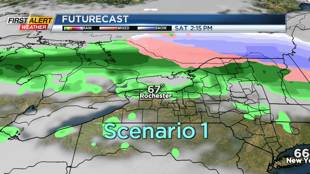
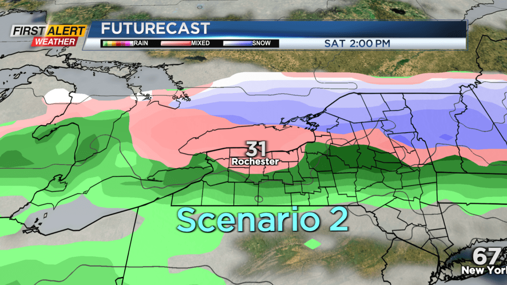
Thursday will see high pressure scoot in and clear our skies, with temperatures getting up to the mid 40s, then Friday there will be some evening rain showers with temperatures just a little colder. After that, we’re tracking a trough of low pressure stretching all the way from the Rockies to over the Atlantic that will give us a conveyor belt of precipitation through the weekend into early Monday. This line of precipitation marks a strong boundary between mild southern air and cold northern air, and there is still uncertainty on just how far north or south that line will fall. Unfortunately for Rochester, this means right now we’ve got a fifty-fifty shot at seeing near 70 degrees… or freezing. Over the next few days we’ll be able to fine tune which scenario will win out, so stay tuned for the latest details. What we can tell you now is that both scenarios have been trending ever so slightly north recently, so my guess is we’ll land more towards the warmer side. As we meteorologists like to say, the trend is our friend!
Stay tuned to News10 NBC for all your First Alert Weather updates.