First Alert Weather: Friday will have Yellow Alert for snow and a wintry mix
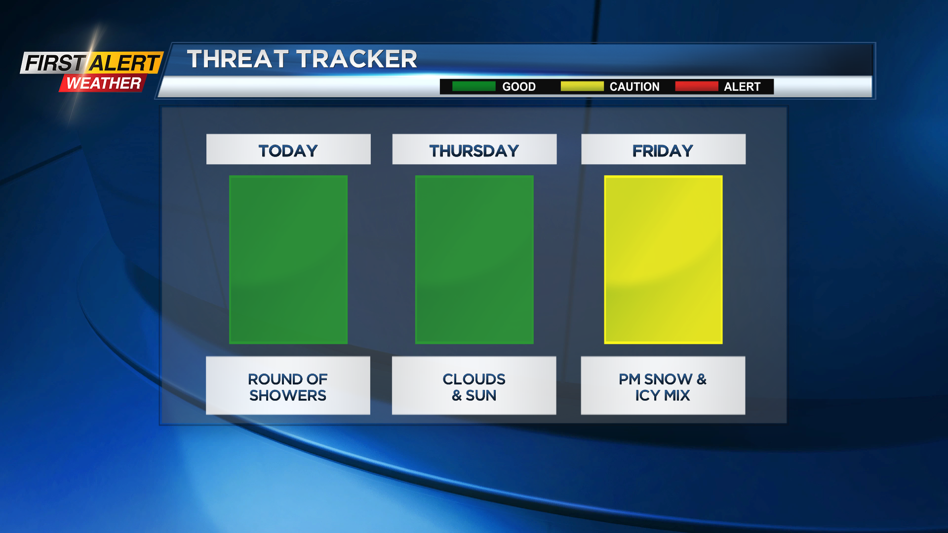
ROCHESTER, N.Y. — Our Threat Tracker continues to highlight Friday with our next sizeable storm threat, with quiet weather expected for Wednesday and Thursday
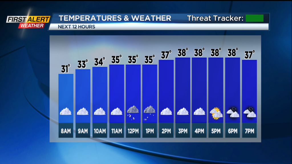
Plan for a round of showers from midday on Wednesday into the early afternoon. Thursday looks nice with dry weather and temperatures in the 30s.
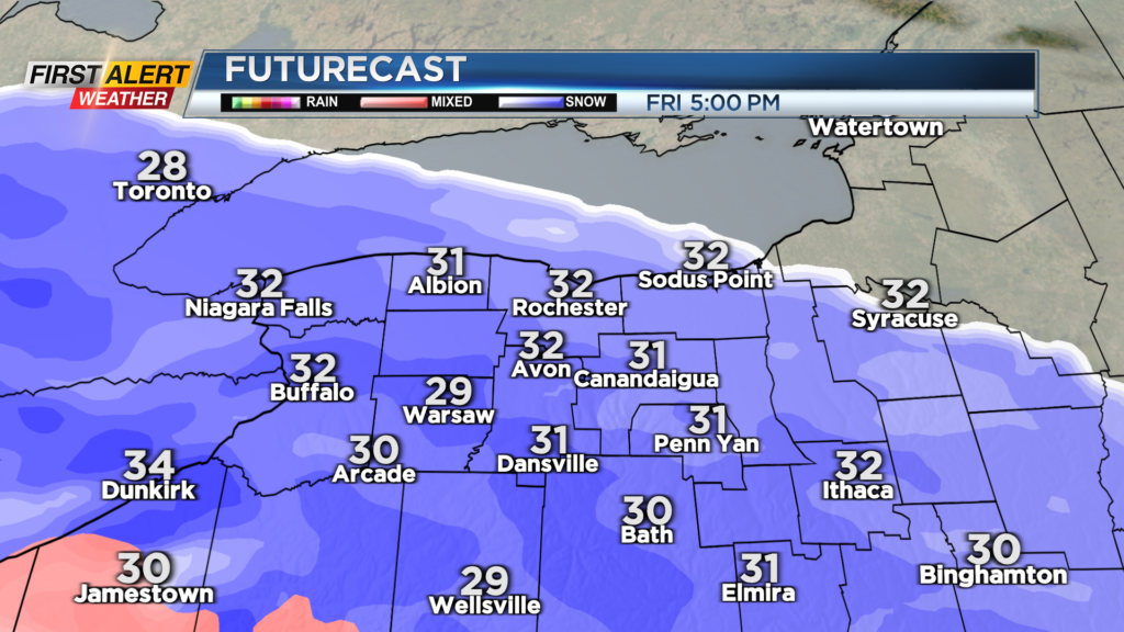
Friday starts dry and nice in the morning, but the weather will go downhill Friday afternoon into Friday night. Plan on snow overspreading the region close to the evening commute Friday and continue into the night.
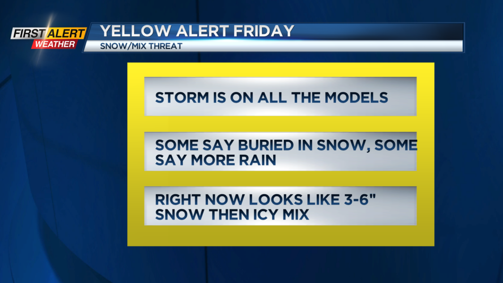
Warmer air will try and move into the region as well and we may see a change to sleet and ice or even plain rain at some point overnight Friday into Saturday morning. Right now it looks like a solid 3-6″ snowfall with ice on top of that.
There is still much uncertainty in the exact details of the mixed precipitation part of the storm. If it stays mainly snow than those totals will go higher, if the mix arrives sooner than the snow totals go down.
Stay tuned to News10NBC for updates later today and tomorrow as we get a better idea of the timing and the amounts of each precip type on the way with this next storm.
______________
Download the WHEC First Alert Weather app to stay up to date while on the go.
Watch the latest full forecast online.