First Alert Weather: Less humidity and more sunshine returning Thursday
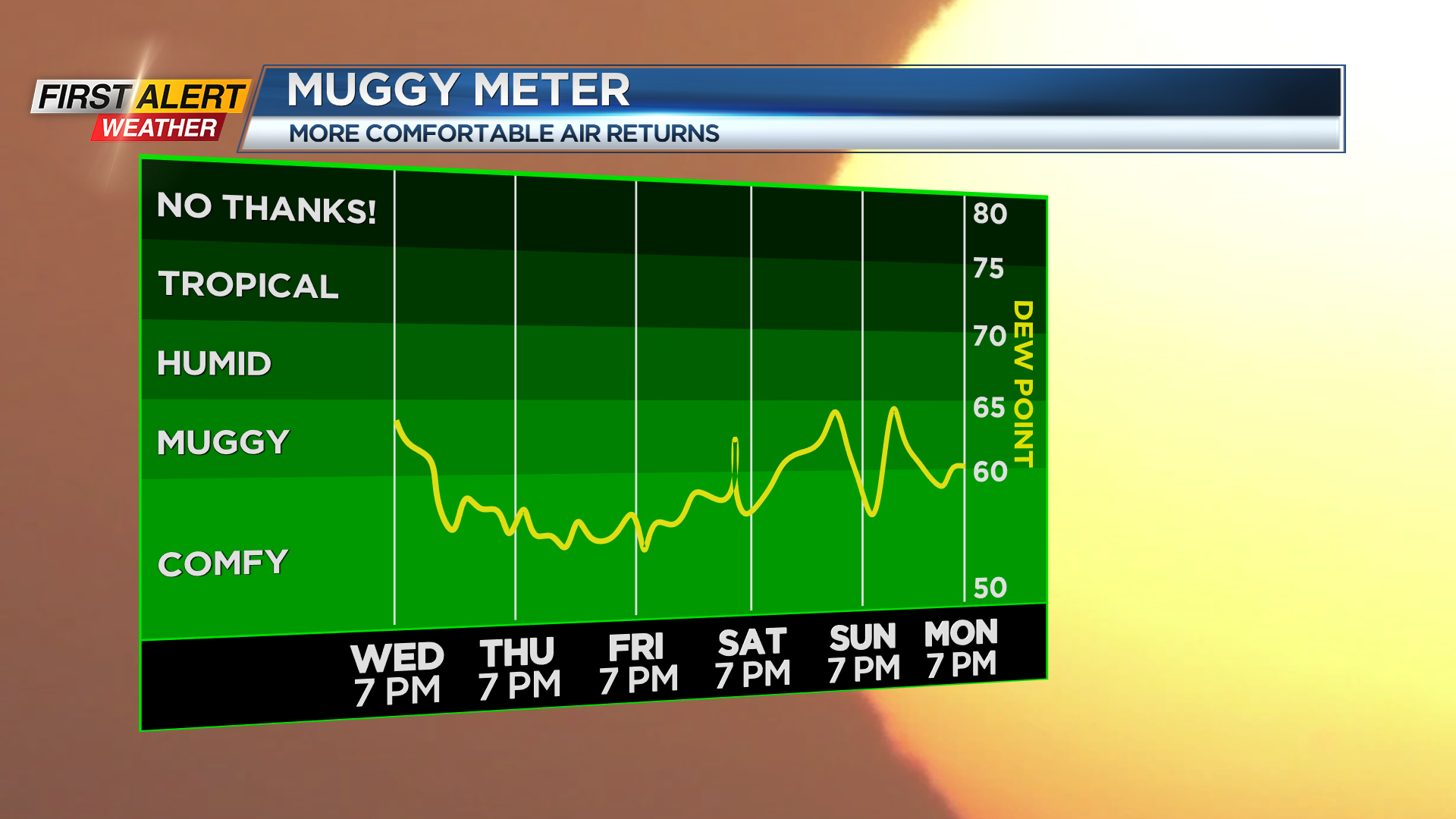
WEBSTER, N.Y. – A cold front passing through the area Tuesday night will bring much more comfortable weather to end the work week and start the weekend. Dew points will be dropping back into the 50s, getting rid of the sticky air we’ve felt lately. High pressure also building in will bring us dry weather and a fair amount of sun both Thursday and Friday. Temperatures both days will be a little cooler than average to end the week, but still very comfortable.
The weekend also looks pretty nice. A disturbance moving through the Mid-Atlantic may increase the clouds, especially in the Finger Lakes on Saturday, but we should stay dry.
Sunday will see a weak and moisture-starved cold front try to drop south Sunday afternoon. It is possible we see an isolated shower or two, but most of Sunday and the weekend should be dry. In fact, we’ll keep the dry weather into Monday and much of Tuesday, before rain and storm chances start to up by the middle of next week. At this point, no severe weather is expected, so we’ll be “green” on the Threat Tracker.