First Alert Weather: Local lake snow Friday, then Yellow Alert for a weekend winter storm
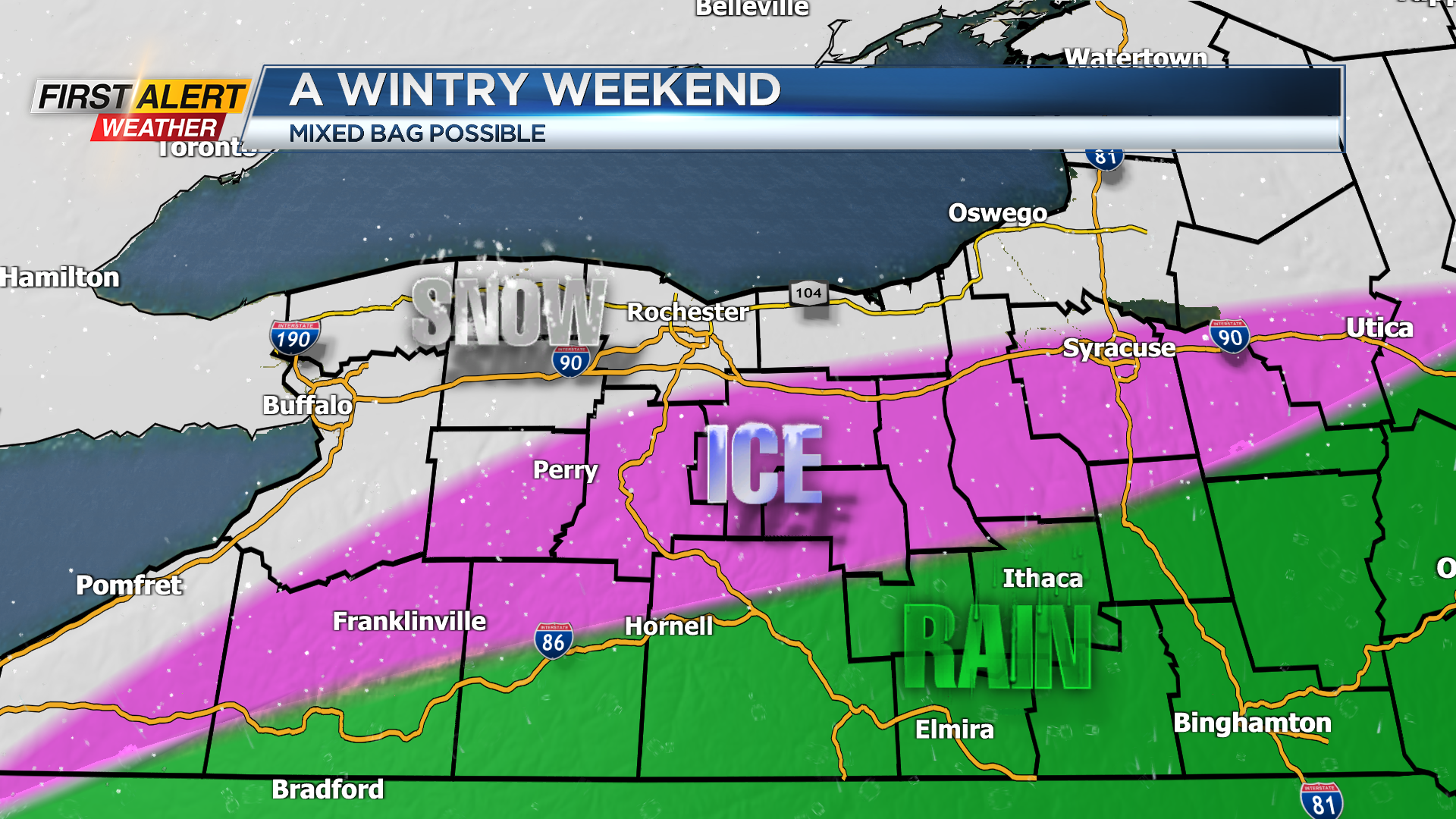
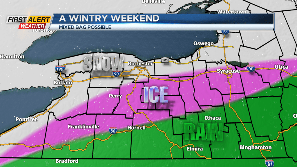
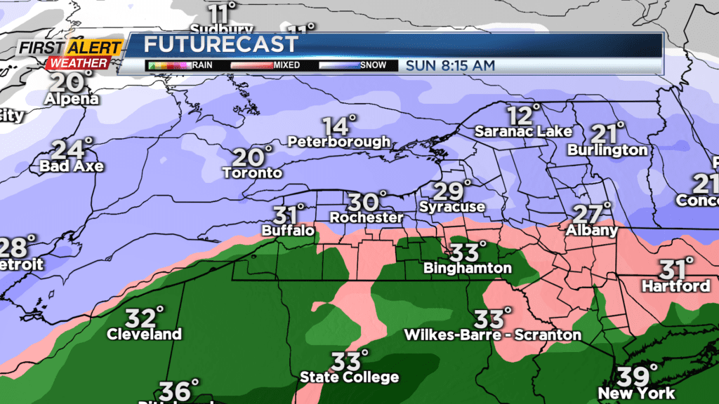
ROCHESTER, N.Y. – The First Alert Weather Team has hoisted a Yellow Alert for Saturday evening and through the day Sunday as a winter storm impacts the area. Snow will begin to develop Saturday afternoon, and accumulate a few inches by evening. Roads will begin to become snow covered and slippery as the evening progresses. Depending on the exact track of the area of low pressure, there’s the chance we could see some sleet, freezing rain or even rain developing Saturday night and into early Sunday. This would cut down on total snowfall amounts where some ice mixes in. As the low slowly pulls away on Sunday, we’ll change back over to a period of snow, which could come down heavy at times. Sunday will likely be the higher impact day, with a plowable snow continuing. Exact snow amounts will vary greatly, based on who sees all snow, and who sees some mixing. The First Alert Weather Team will be fine tuning the forecast details through Friday, and likely as the storm moves in. But, this will likely be a moderate to high impact winter storm with snow covered and snowy roads.
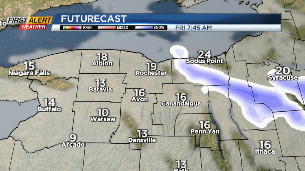

Before that winter storm moves in, we’ll see some lake effect snow developing off of Lake Ontario Thursday night into Friday. Areas from Rochester and points north could see an inch or two of snow into Friday morning, with as much as 3-6″ of snow into portions of Wayne County. Aside from the lake flakes, we’ll see some sun and feel a chill to the air.
Speaking of a chill, next week will see a return to frigid temperatures and some lake effect snow.