First Alert Weather: March is in like a lion
ROCHESTER, N.Y. – Happy first day of Meteorological Spring! Unfortunately, this weekend will be feeling more like early January…
A strong low pressure system is passing off to our northeast, and behind it comes frigid subarctic air and strong winds, which will pass over the open waters of Lake Ontario and produce some lake effect snow showers.
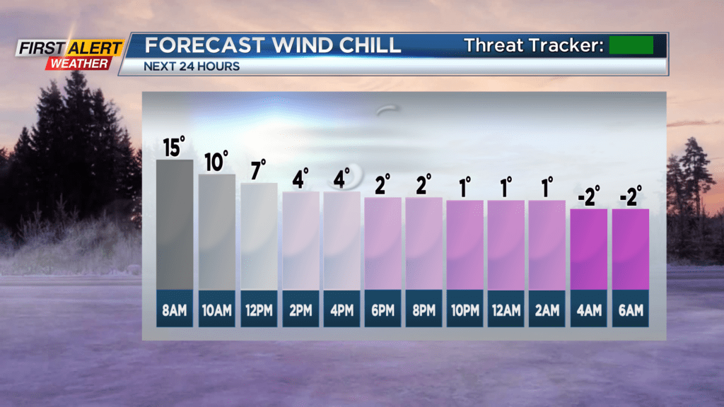
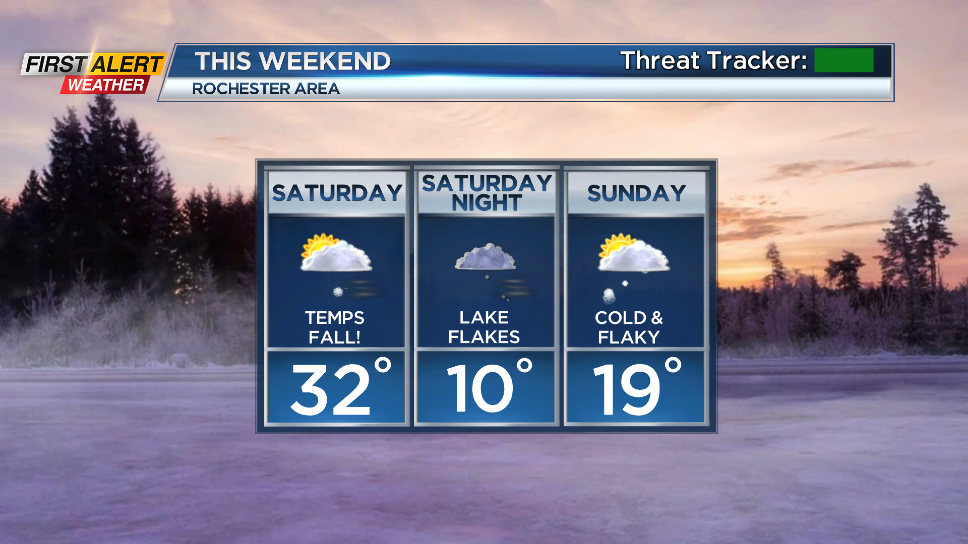
Temperatures this morning started off in the low thirties, and that’s as good as it’s going to get for us… Winds gusting near 40 MPH through the mid-morning and staying in the 30-35 MPH range the rest of the day will produce wind chill values in the single digits across WNY, becoming negative overnight.
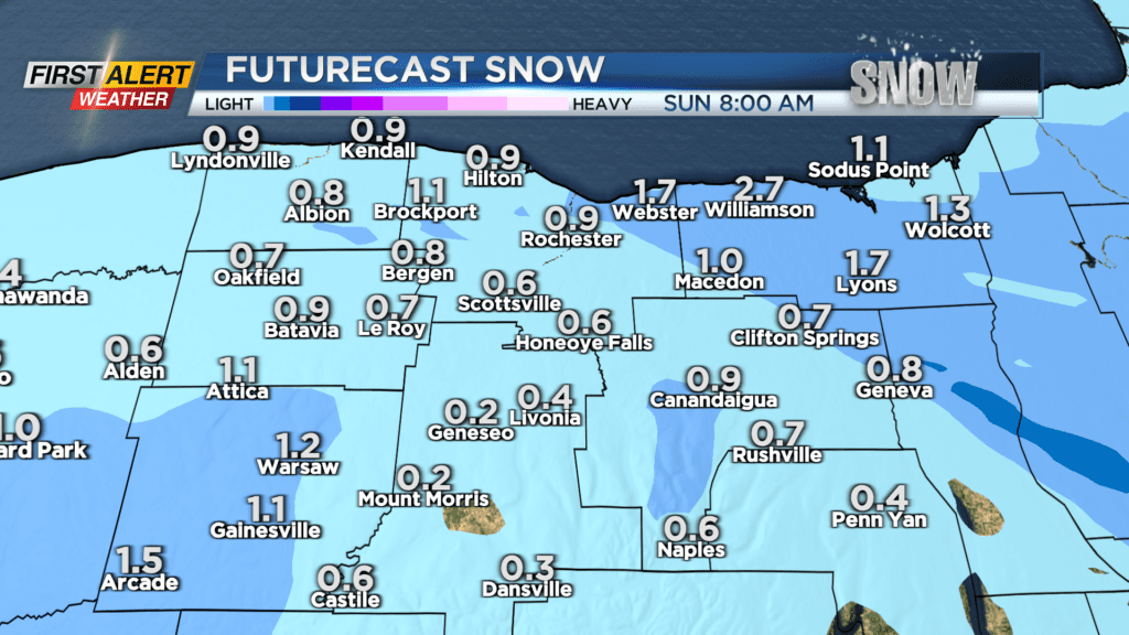
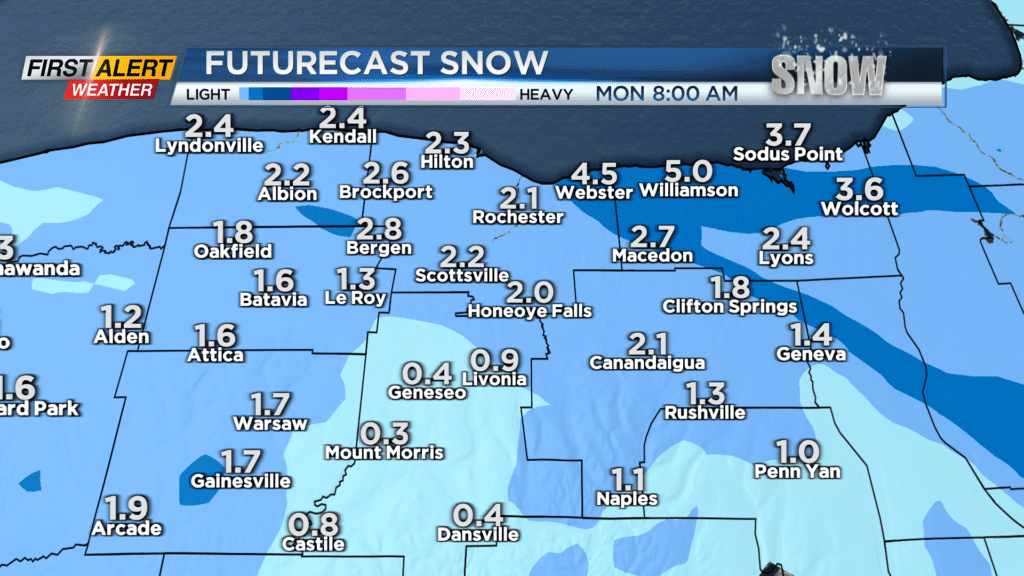
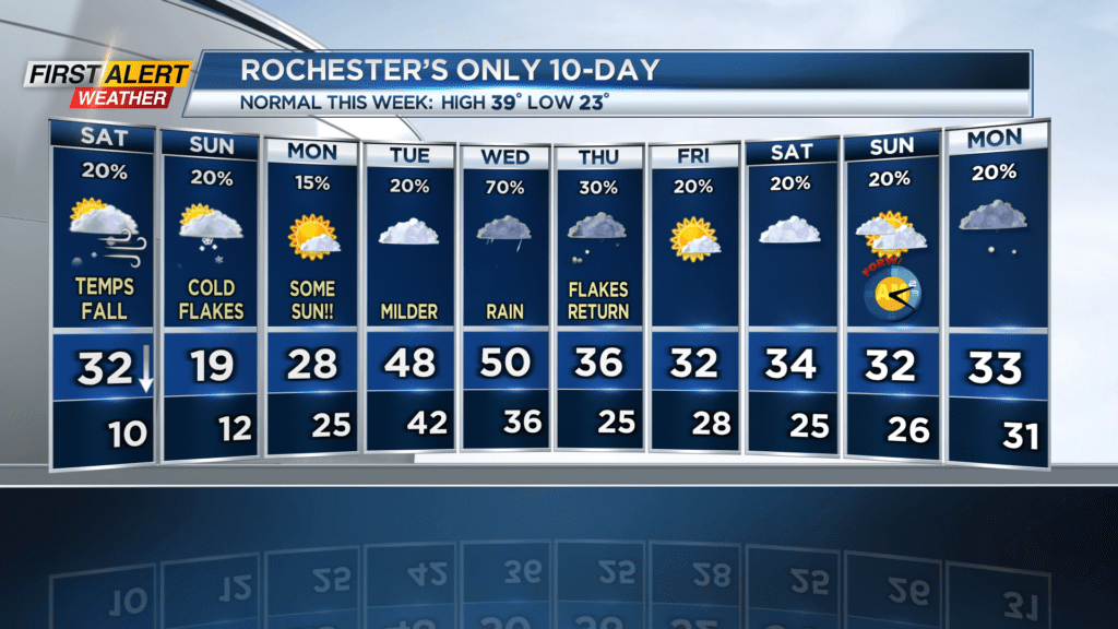
The lake effect snow won’t be terrible, but it will be there. Chances of snow showers will persist all day, so everyone will see a few flakes in the A.M., but the majority of the snow overall will be concentrated in areas east of Rochester; namely Wayne County and northeastern portions of Ontario County. That more persistent snow will set up early this afternoon and last into tomorrow morning. There will be a break in the snow mid-late tomorrow morning through the early afternoon for everyone, but snow showers will return late Sunday afternoon/early evening. Heavier snow falls over the lakeshore Sunday night, but it will cease by Monday morning. All in all, we’re not looking at any major accumulations… A coating to an inch or two today, and possibly 2-5″ by Monday morning (the higher end being in Wayne County).
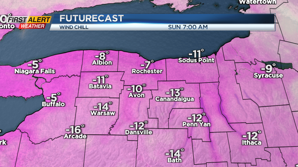
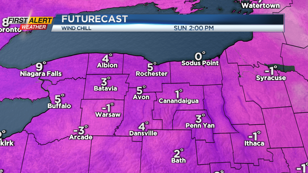
Wind chills are the bigger issue than the snow this weekend. As mentioned above, things will feel like the single digits today… That trend continues tomorrow, although the winds themselves won’t be as bad. Sunday morning will feel like below negative ten in many spots, and the afternoon wind chill won’t even crack five degrees.
There is some good news… Monday, while still cold, will not be AS cold — and we’ll get plenty of sun! Skies will be mostly sunny for the day, and winds will be light. If you haven’t yet had the chance to go out and see the Planetary Parade, Monday night is a great time for it as most of the clouds will be to the north, opposite the horizon where the “parade” begins.
Temperatures rise going into Tuesday and Wednesday, with Wednesday possibly getting up above 50 degrees! There will be a healthy amount of rain that day, though, so Tuesday will be the more pleasant day to be outside. Snow returns on Thursday, but amounts will be minor, and then you can expect temperatures to stay near freezing going into next weekend.
Stay tuned to News10 NBC for all your First Alert Weather updates!