First Alert Weather: More snow on the way for western New York
ROCHESTER, N.Y. — We’ve seen flakes flying every single day except 1 since 2025 began, and we’ll continue with the snowy theme to end the week.
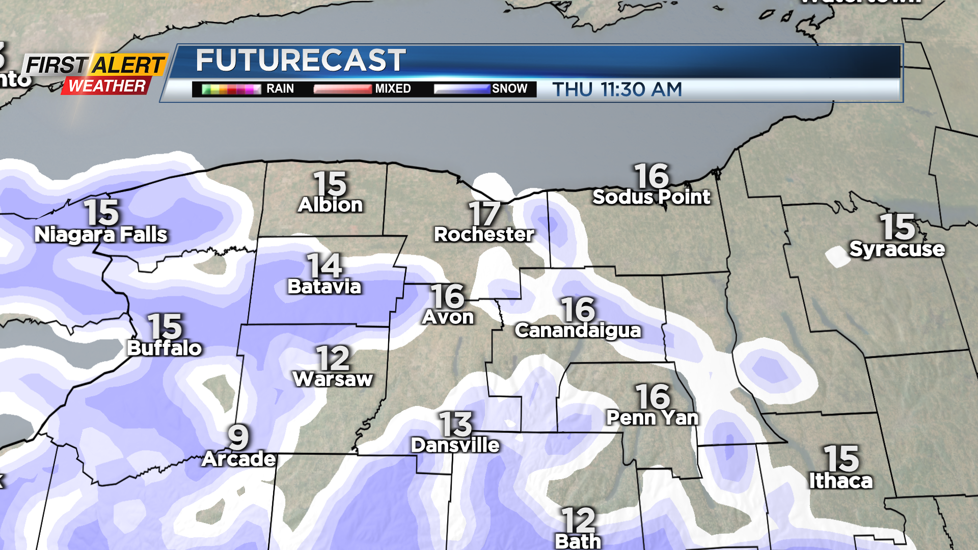
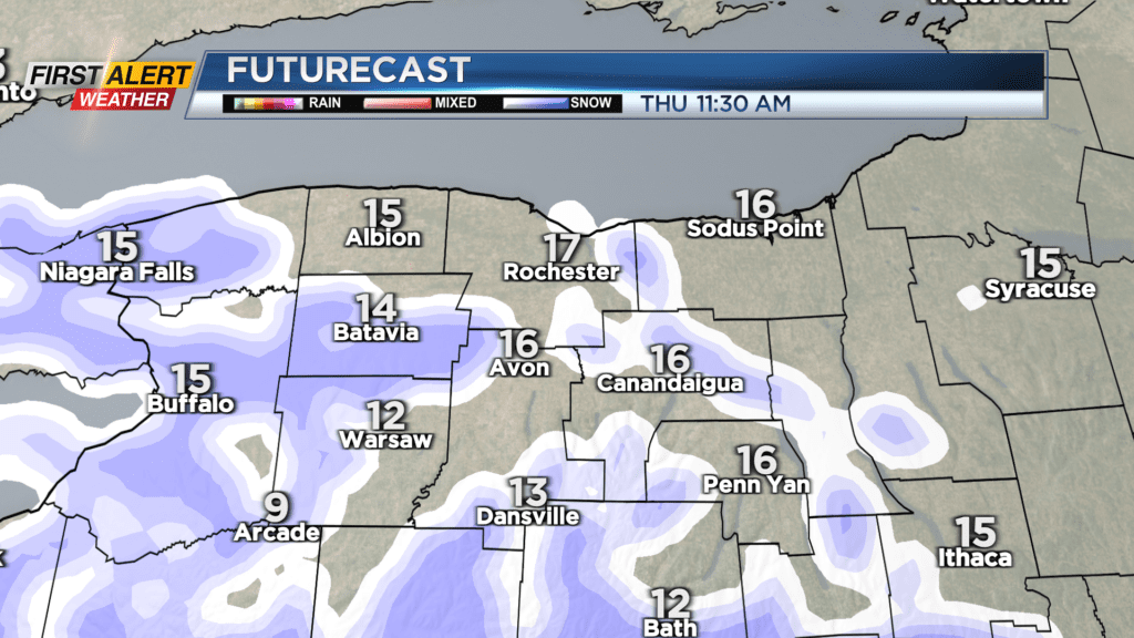
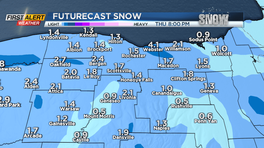
Lake flakes will persist Wednesday night, with less than one inch for most by Thursday morning. A weak disturbance passing overhead on Thursday will cause an uptick in snow showers for the entire region, but some lake enhancement will tend to boost snowfall near Lake Ontario slightly. In all, expect a coating to an inch or two on Thursday, another inch or two Thursday night, and possibly another inch or so into Friday morning. In all, most of the area will see a few more inches of fresh fluff by the end of the week, with up to five to six inches possible near Lake Ontario. Winter Weather Advisories are posted for Orleans, Monroe and Wayne Counties, but this snow should be manageable. If we do happen to get a burst around the commute, we’ll issue a brief Yellow Alert, but at this point that isn’t something that is in the forecast. We’ll monitor.
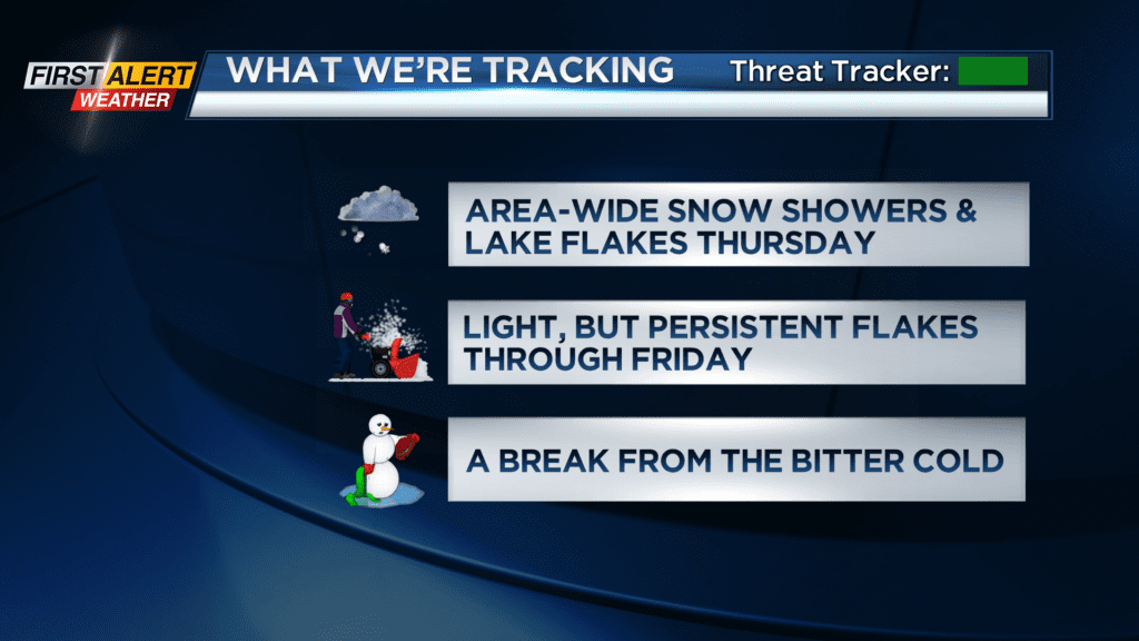
Outside of the snow, it’ll be a cold end to the work week, with highs in the lower 20s both Thursday and Friday.
The weekend starts off quiet, with some sun on Saturday. At this point, we do NOT have snow in the forecast on Saturday, which would only make it the second day this year without flakes! Some flurries will likely return on Sunday, and it’ll turn mild enough for a mix of rain and some wet snow showers through early to mid next week.