First Alert Weather: Quiet on Thursday before Yellow Alert for snow on Friday evening
ROCHESTER, N.Y. — It’s not that bad out the door on Thursday morning as temperatures are hanging out in the mid 30s under cloudy skies.
However, temperatures will not warm up much on Thursday afternoon as we are expected to see highs in the mid and upper 30s. Cloud cover will also stick around through a good chunk of the day but we will see some sunshine in the afternoon.
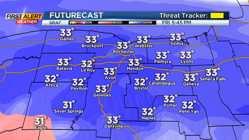
We will remain partly cloudy and quiet through Thursday night and into the early afternoon hours on Friday before the snow arrives late.
Snow looks to move in across our region from south to north around 4 p.m. Snow will roll in for the evening commute Friday which will limit visibility and create slick conditions across our region.
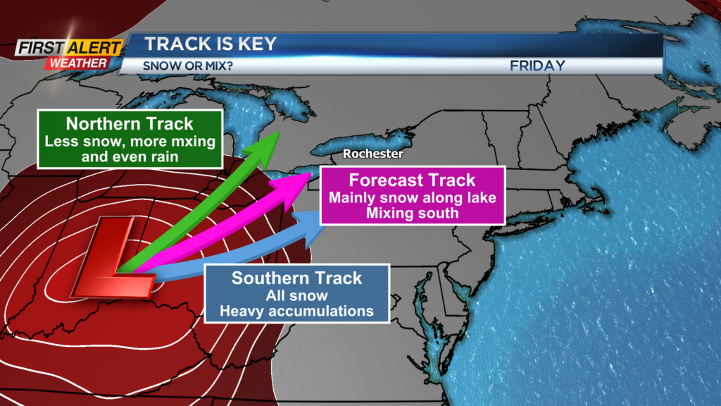
Regardless of how much mixing we see Friday night, we will start off with all snow. Mixing will be something to track after 8 p.m. on Friday as that will limit or enhance our snow totals. More mixing will limit our totals to less than 4″ while remaining all snow could bring totals near 10″ by Saturday morning.
A lot will be determined on the track of low pressure. The forecasted track does include some mixing, but a more northern track will introduce more mixing while a more southern track keeps us mainly snow.
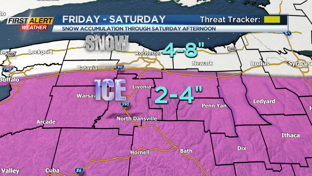
We are expecting some mixing Friday night before we swing back over to snow showers by Saturday morning. So, our forecast is unchanged from last night as folks north of the thruway could see 4-8 inches of snow.
Areas south of the thruway will likely see between 2-4 inches of snow as they will have the greatest chance for prolonged mixing. Things can still change, and hopefully we get much more of an agreement later today. So, make sure you stick with the First Alert Weather Team for any updates.
______________
Download the WHEC First Alert Weather app to stay up to date while on the go.
Watch the latest full forecast online.