First Alert Weather: Rain, any thunder end, with fine weather to end the work week
ROCHESTER, N.Y. — Heavy thunderstorms through the Southern Tier and northern Pennsylvania, along with rain showers for the rest of the area will move away by midnight, leaving us with a partially clearing sky, but also some areas of fog.
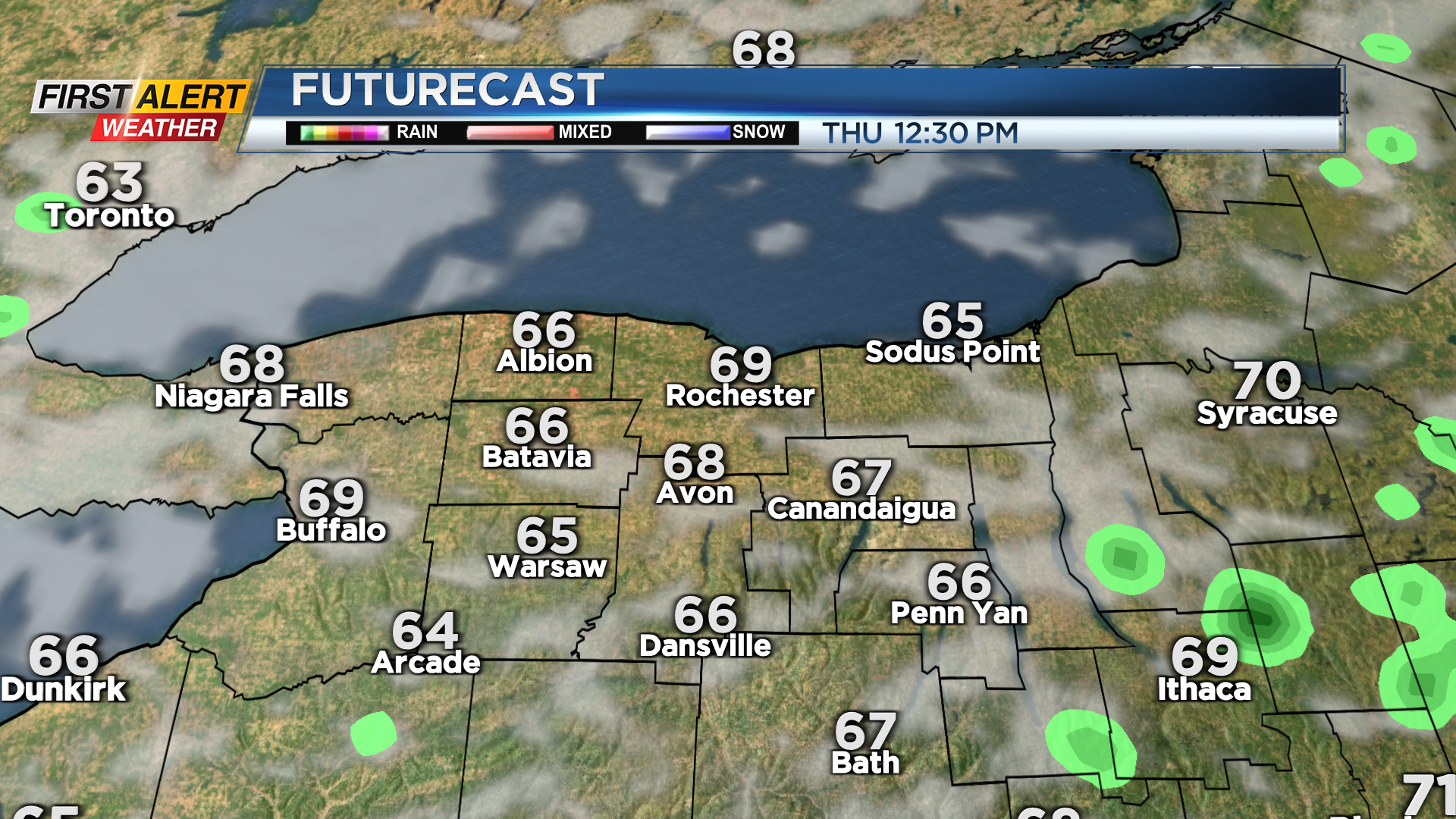
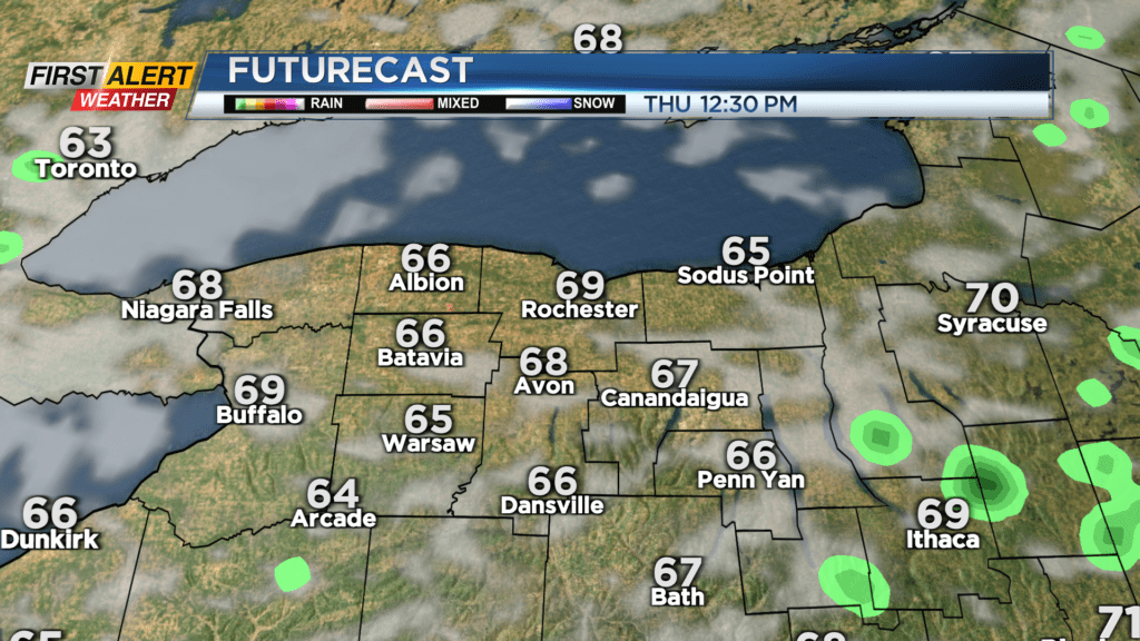
The cold front responsible for the wet weather Wednesday will be gone by Thursday morning, leaving us with a clearing sky into the afternoon, and noticeably cooler temperatures in the lower 70s. Friday should be a spectacular end to the work week, with sunshine and temperatures in the upper 70s to near 80.
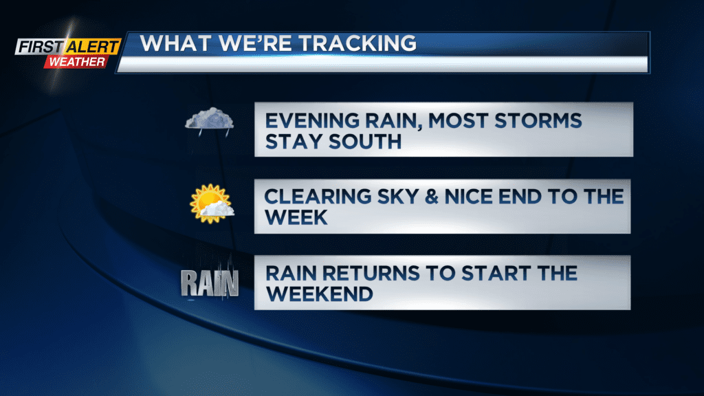
The weekend starts off on a soggy note, with another wave of low pressure bringing scattered showers, periods of rain and perhaps a few thunderstorms. The thunder threat isn’t overly impressive at this point, but if we do get some convection going, we have the potential to see some locally heavy rain.
We remain “green” on the Threat Tracker for now, but the heavy rain threat needs to be monitored. The second half of the work week will see some big improvements, with a clearing sky and dry weather (aside from an early morning shower) on Sunday.