First Alert Weather: Some rain to end the week, followed by big heat wave next week
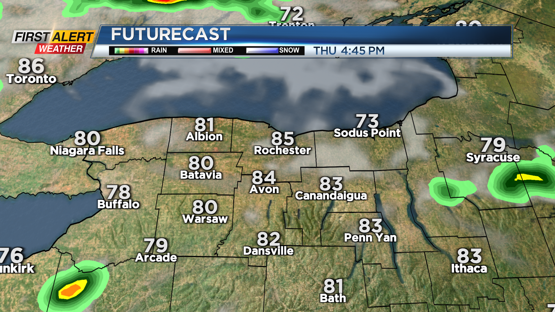
ROCHESTER, N.Y. —The sun that finally returned on Wednesday will stick around on Thursday, along with warmer air as we climb into the mid 80s with a little more humidity.
A few showers may pop later in the afternoon or evening ahead of a cold front, but most of the rain from this front will fall overnight and into early Friday morning. The best chance of some thunder should be in the Finger Lakes and south of Rochester as the front pushes through later in the morning.
Once the front clears, Canadian high pressure will usher in much drier air and somewhat cooler air for Friday afternoon and to kick off the weekend.
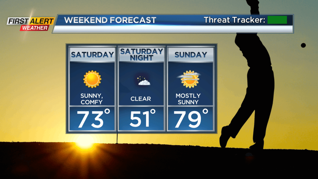
Saturday will see a mainly blue sky, and temperatures in the lower 70s and low humidity. Father’s Day on Sunday is also pretty much perfect, with highs in the upper 70s to near 80 and a mostly sunny sky.
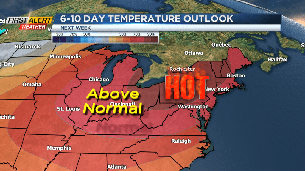
Then the heat is on next week! Confidence continues to grow for a heat wave not only across the Northeast, but here in western New York. We’re forecasting temperatures in the upper 80s and lower 90s much of the week.
We may see a few hit or miss showers or storms to help cool us down, but Heat Advisories will likely be issued. Stay tuned, and make sure you have ways to stay cool!