First Alert Weather: Tracking a weekend warmup, then tumbling temperatures
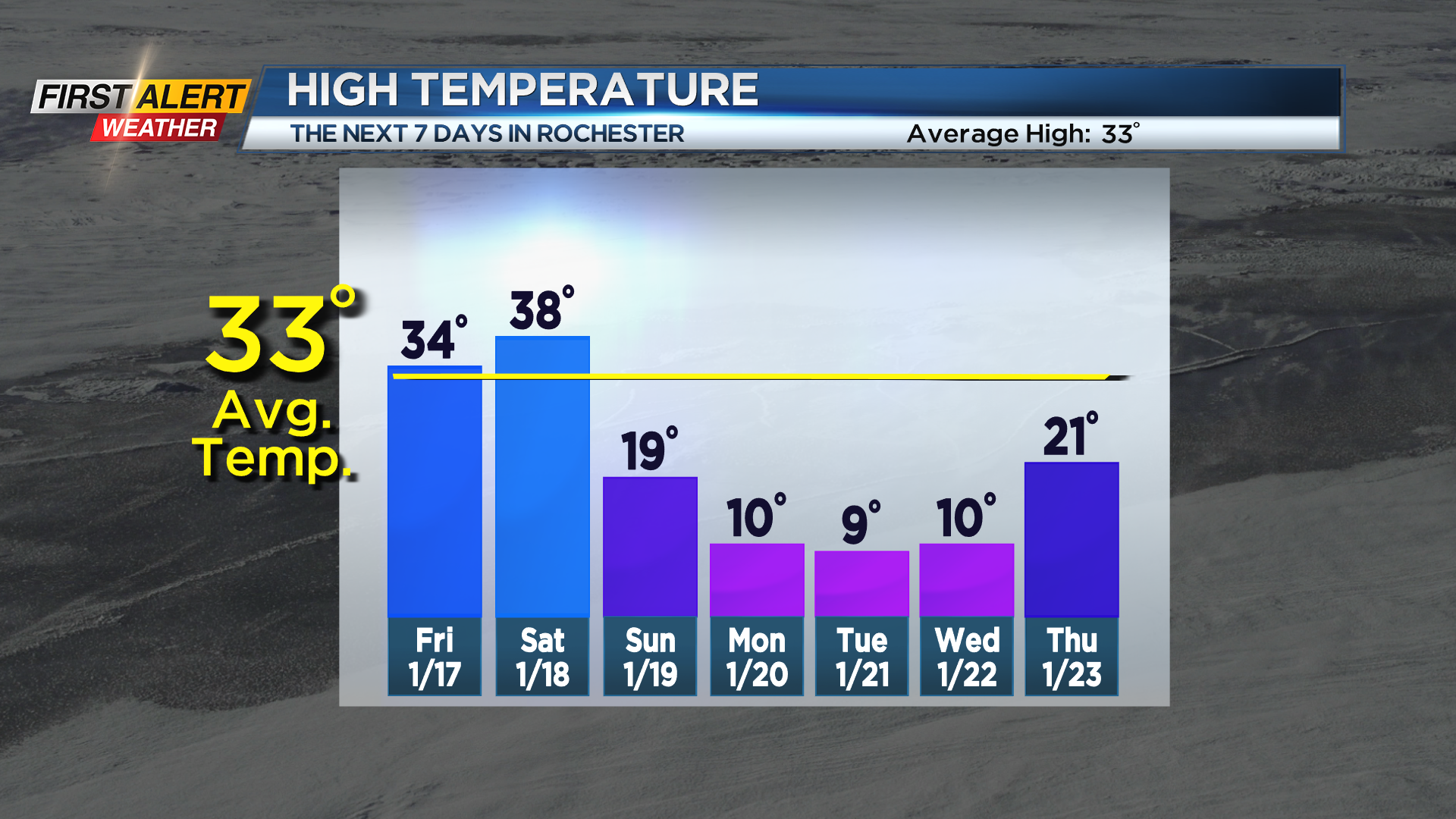
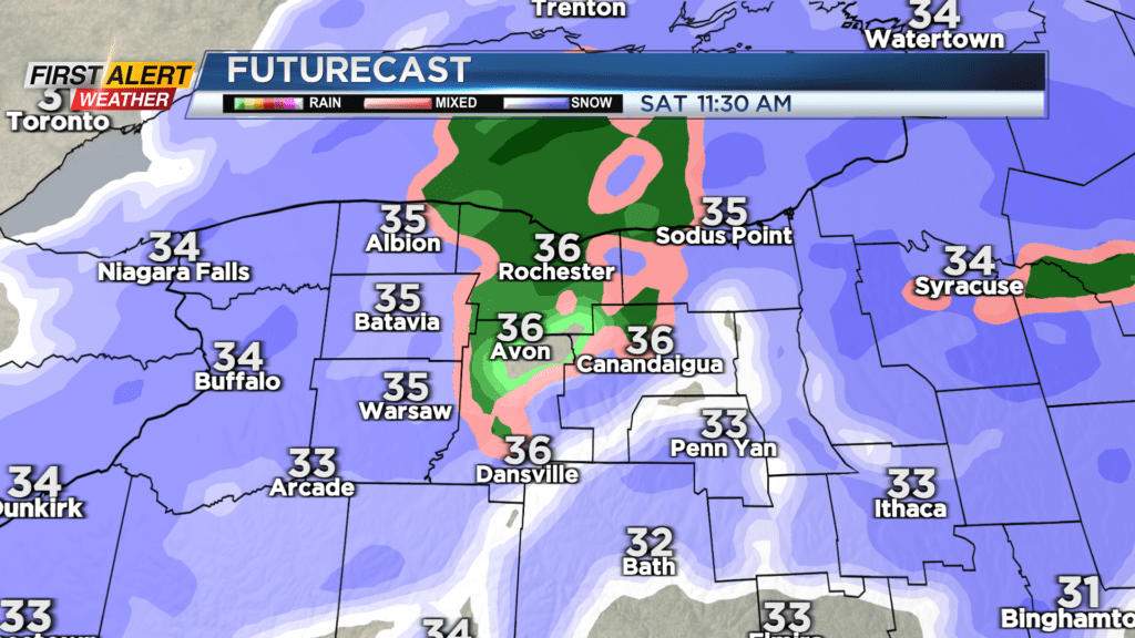
ROCHESTER, N.Y. – The area-wide snow that moved through Thursday moves out Thursday night, with just a few lingering lake effect snow showers left over. We will end the work week with less chill and quiet weather on Friday. Temperatures should make it to or slightly above freezing on Friday with the help of some limited sunshine. We’ll kick off the weekend with the milder trend, as temperatures should rise into the mid and upper 30s. A cold front knocking on our door will bring wet snow, mixing with some rain showers at times on Saturday. Due to the milder air, any accumulation should be minor, and we’ll actually be able to melt some of the ice or snow that has been building up on driveways and sidewalks.
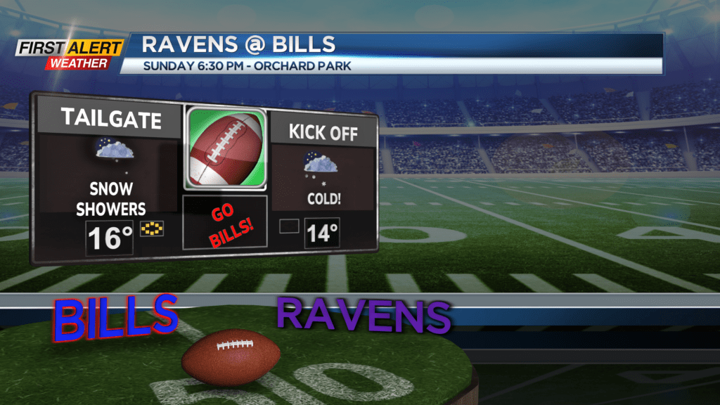
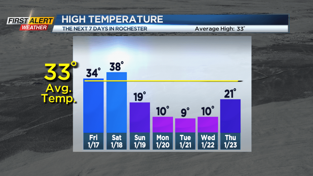
Everything comes crashing down on Sunday as an Arctic airmass invades the Great Lakes. Temperatures will tumble through the teens on Sunday, and we’ll see some scattered lake snow showers developing. At this point, the Bills vs. Ravens game in Orchard Park likely won’t be a snow game (though there may be some flurries), and it won’t be a wind game, but it will be a cold game with temperatures in the teens.
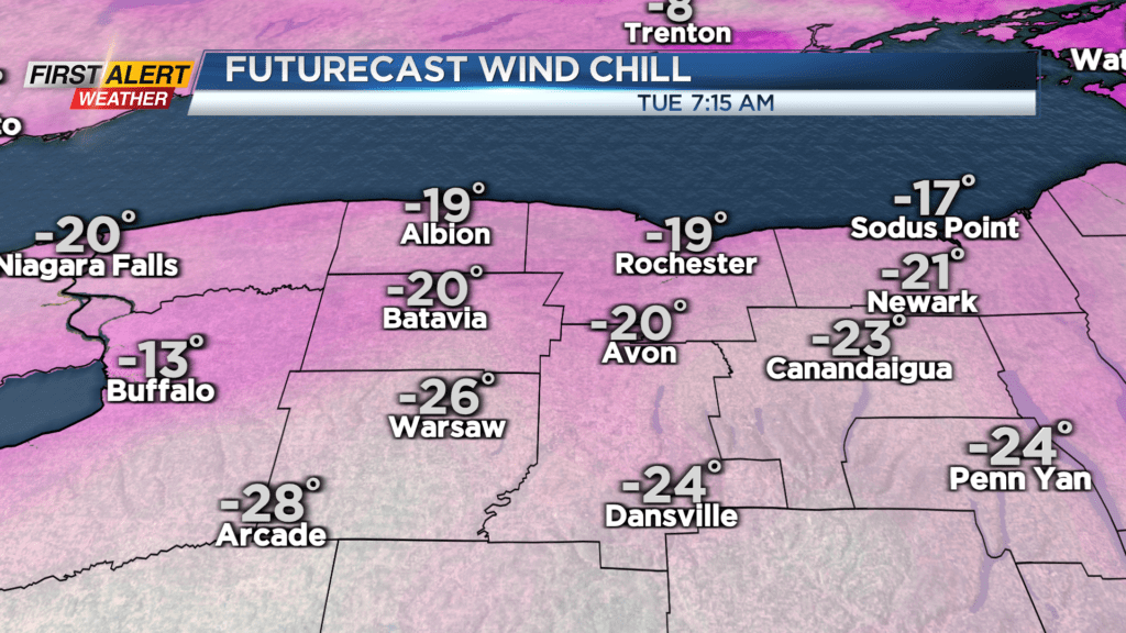
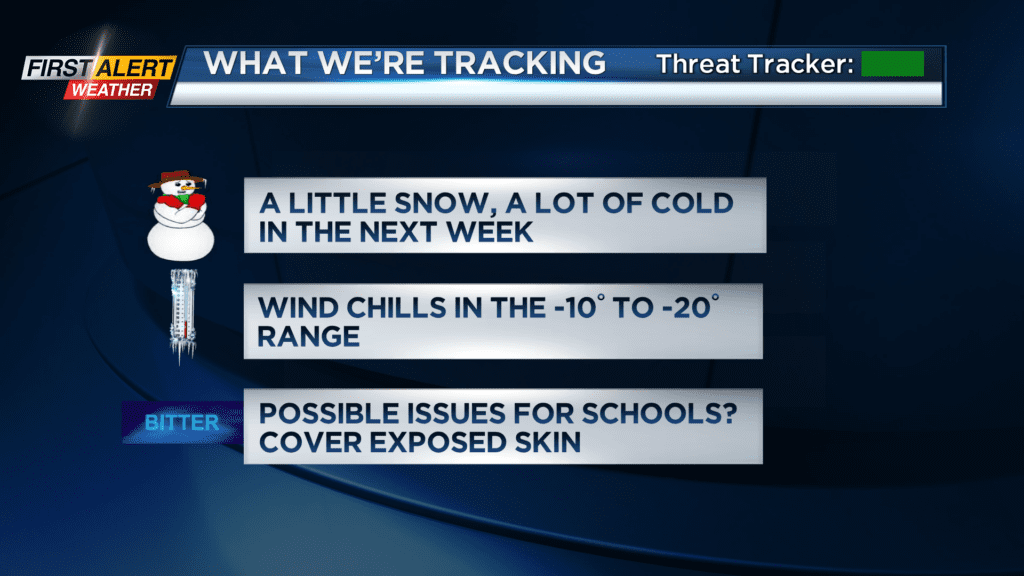
The big push of cold air moves in by Monday, with high temperatures in the low teens on Monday, single digits on Tuesday, and back into the lower teens on Wednesday. Overnight lows will flirt with, and at times, drop below zero. The biggest issue may be the wind. A gusty wind will make it feel much colder on exposed skin than what the thermometer reads. The wind chill may reach -10 to -20 degrees at times Tuesday and Wednesday. It has been a while since we’ve felt that caliber of cold, so start preparing now.