First Alert Weather: Tracking freezing rain this afternoon and tonight
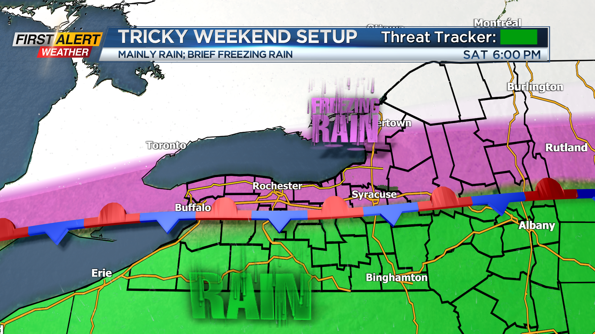
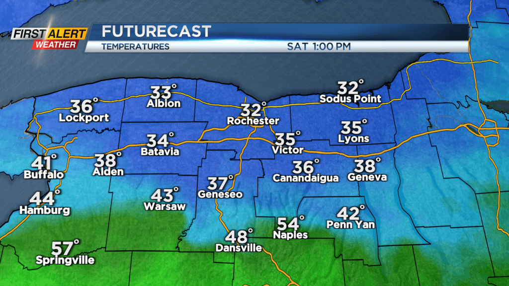
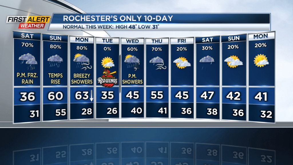
ROCHESTER, N.Y. – A stationary front sitting over Western New York is causing big differences in temperature between the north and south today. Most of us are seeing morning temperatures in the 30s, while parts of the Southern Tier are near 60 degrees… And showers dropping in from Canada means places that reach freezing or below freezing will get some ice on the ground.
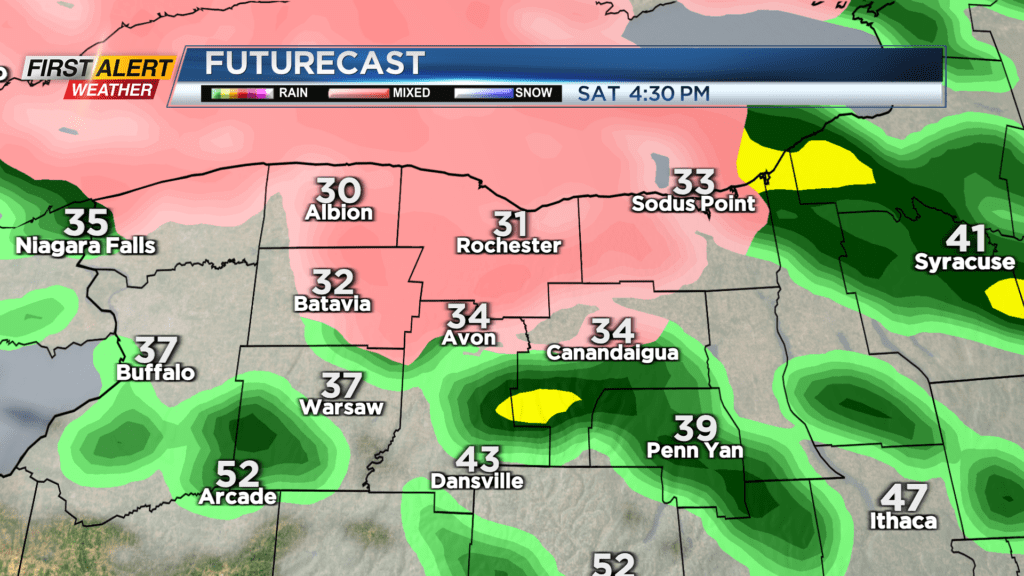
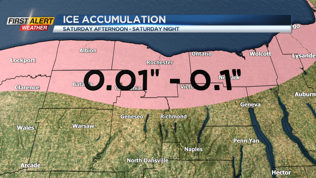
The good news is that this will not be very impactful freezing rain, for several reasons: 1) Showers will be light and intermittent, so only a tenth of an inch or less of ice is expected. 2) Temperatures will only be barely below freezing starting in the afternoon and they’ll rise above freezing overnight, so any ice we do get will not stay around for long. 3) Winds are not going to be bad, which means if we do have a little ice on the power lines, power outages will stay unlikely.
Overall, while this won’t be a very impactful event, staying in later today and tonight is the better plan.
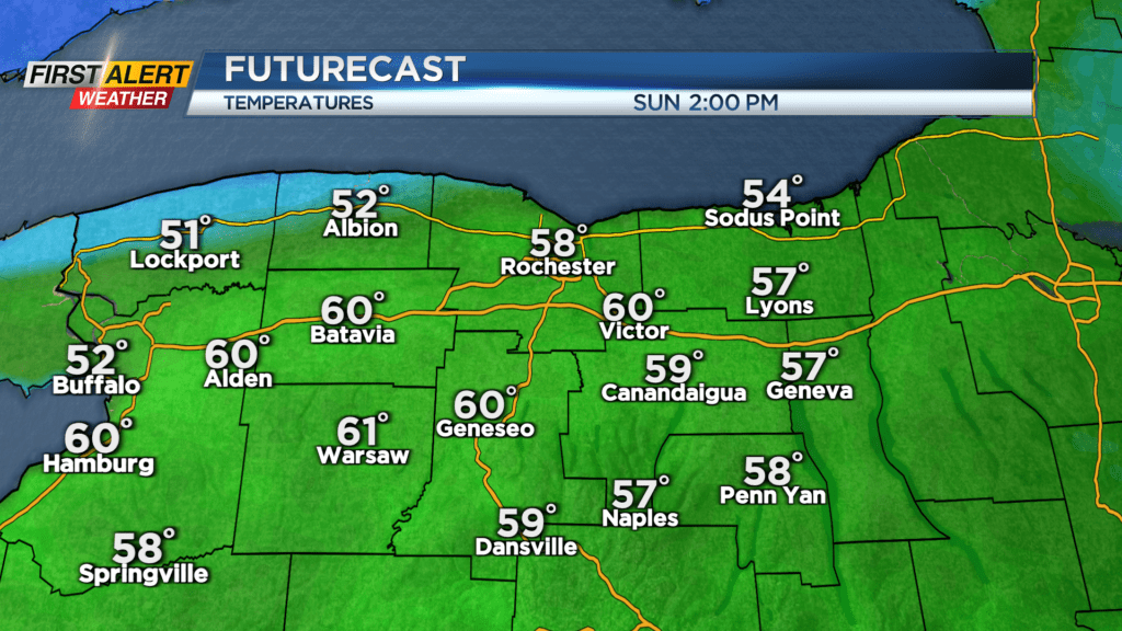
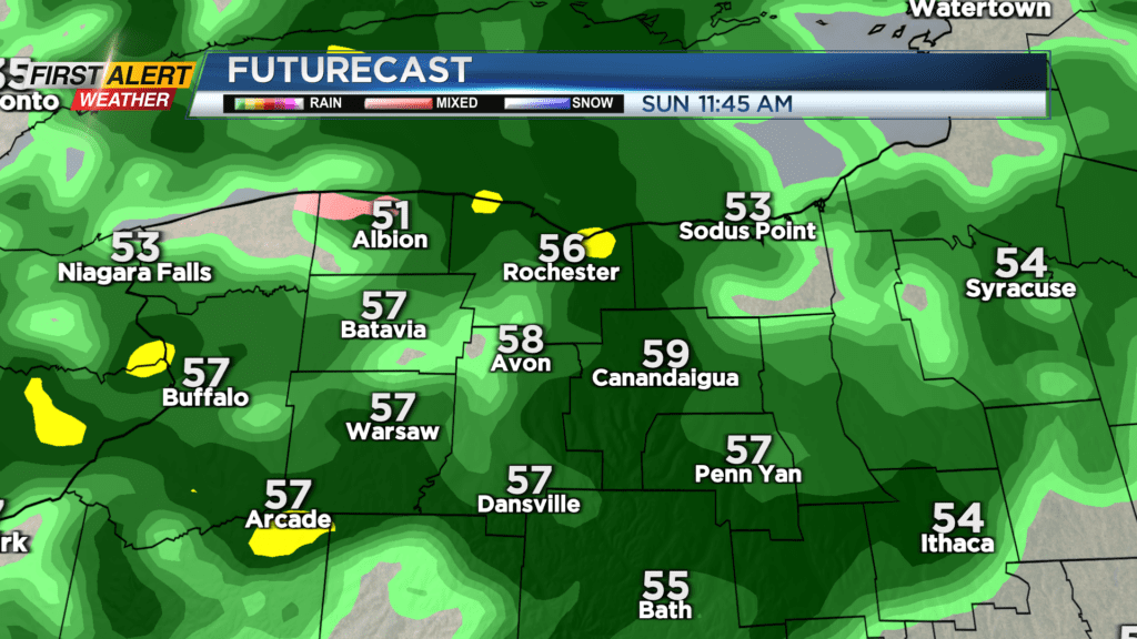
Temperatures rise quickly and significantly tomorrow, reaching 40 degrees at 8am, 50 at 10am, and 60 degrees in the afternoon. Unfortunately, this will be accompanied by widespread rain all the way to Sunday evening. There will still be small chances for spotty showers afterwards, and even a rumble of thunder is possible overnight.
Expect warm temperatures Monday morning and more rain, with temperatures dropping throughout the day all the way to below freezing overnight through Tuesday morning. This means there is a chance of light snow and slick roads Tuesday morning, but the rest of the day will be sunny albeit cold with temperatures in the mid 30s. Good news for Red Wings fans…
Stay tuned to News10 NBC for all your First Alert Weather updates.