First Alert Weather: Tricky weekend setup means spring for some, winter for others
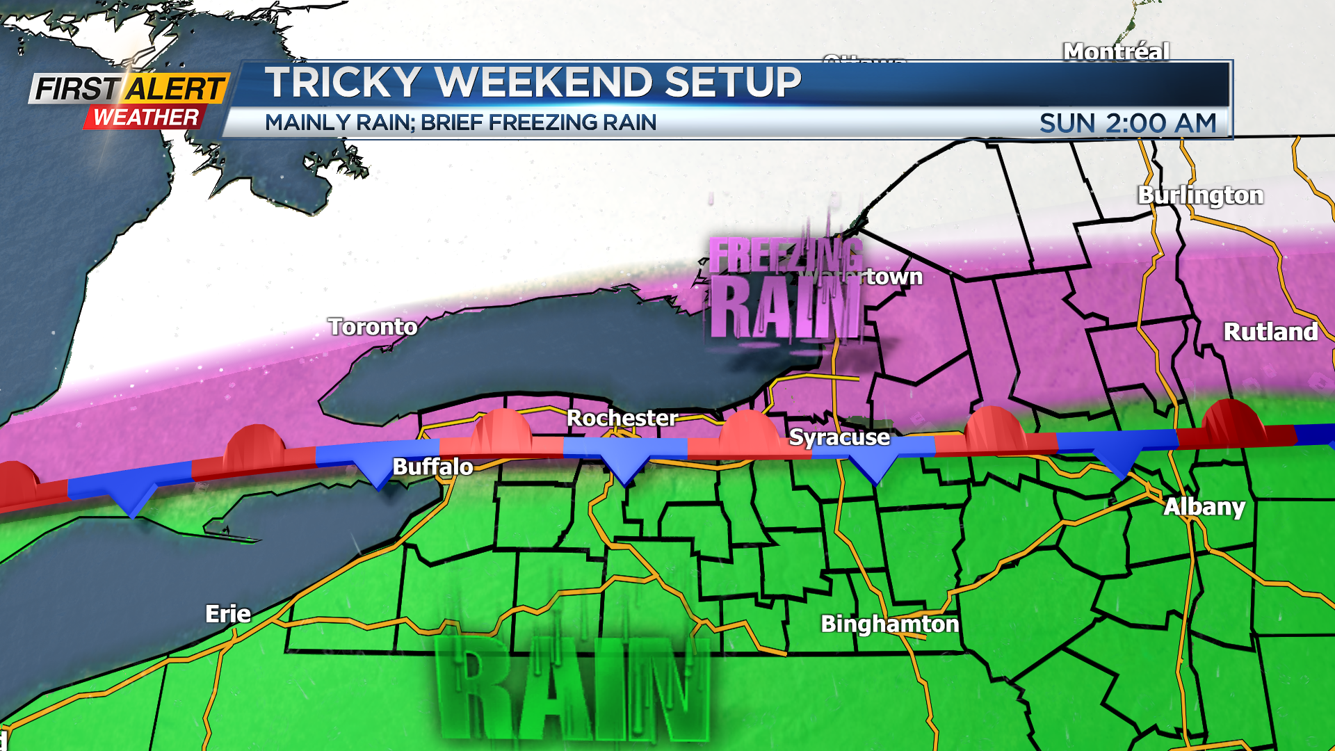
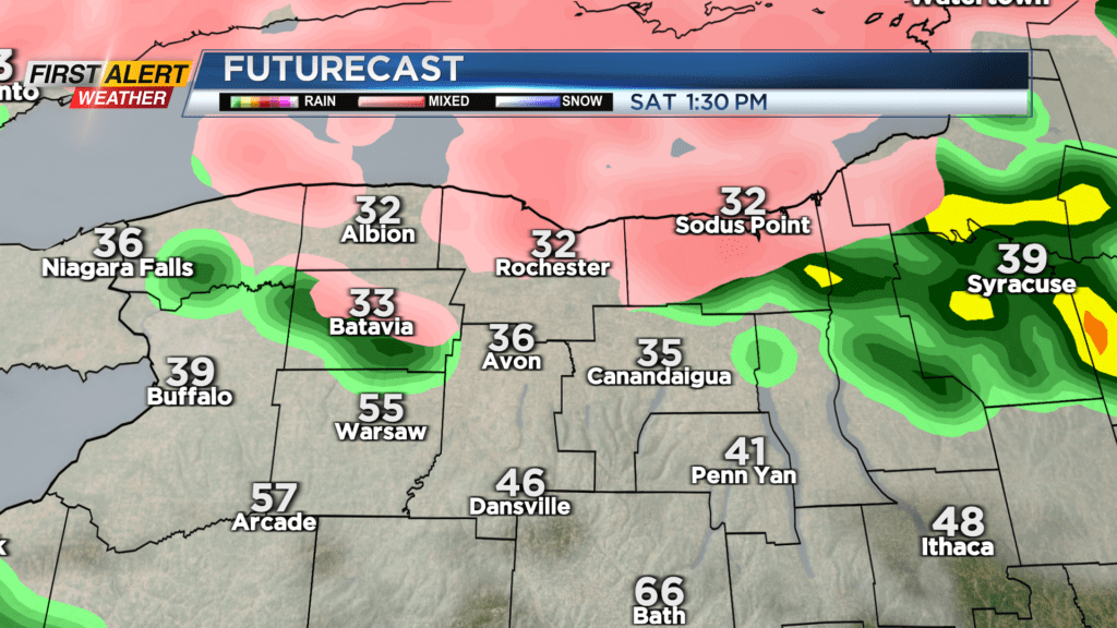
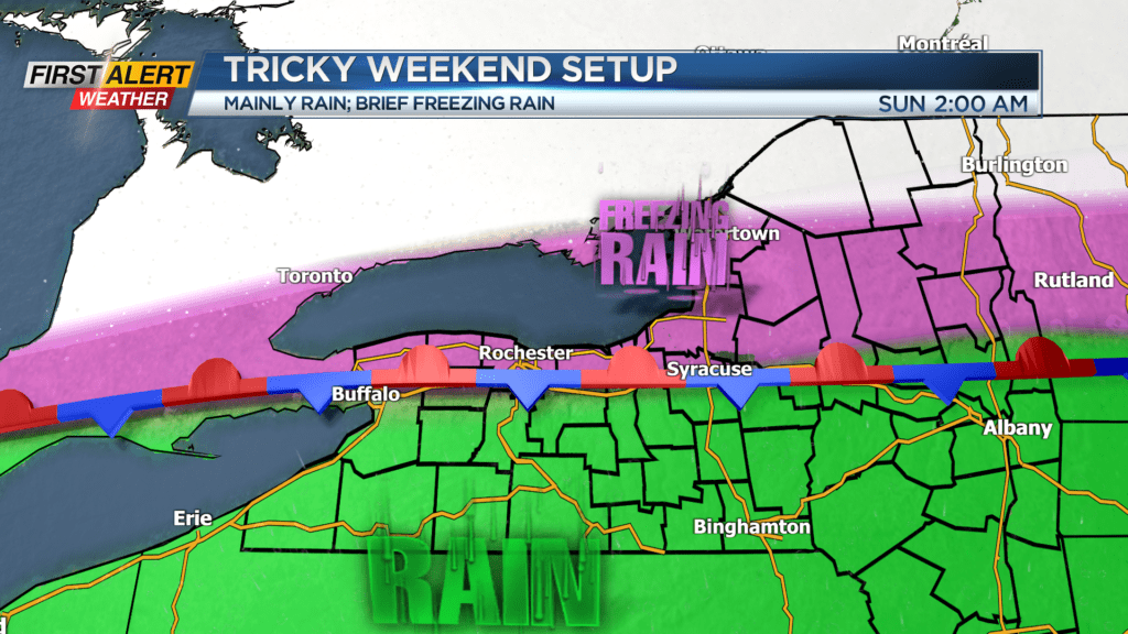
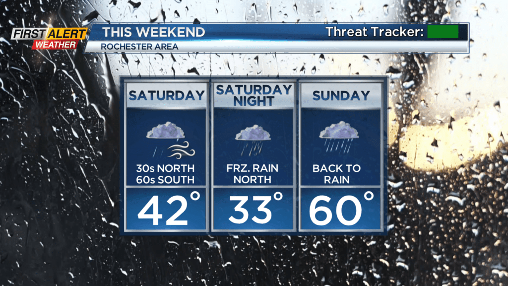
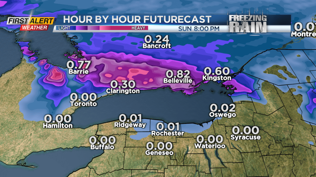
ROCHESTER, N.Y. – A warm front lifting through Friday night will produce periods of rain, but also warmer air trying to move in. The warmer air will succeed for areas south of the Thruway, but it’ll have a hard time making it much further north than that. That means Spring-like temperatures with rain showers if you are south of the Thruway, with temperatures in the 30s and 40s Rochester and closer to Lake Ontario. This is also where we’ll see the best chance of any freezing rain setting up later in the day. Some light freezing rain will continue Saturday night, especially north of the Thruway. Amounts should be fairly minor, with less than 0.1″, so this should have only minor impacts on our area. Meanwhile, freezing rain amounts will be much more significant just north of Lake Ontario into southern Ontario, Canada.
Our temperatures begin to climb once again on Sunday, so any pockets of light freezing rain to start Sunday will quickly change back over to rain. In fact, the warmer air will stay with us straight through Sunday night and into the first half of Monday, with temperatures in the 50s and 60s, along with some periods of rain and even some rumbles.
A cold front moving in once again on Monday will then drop our temperatures later in the day, and the winds will begin to pick up. Our calmest weather of the next week will occur on Tuesday, with dry weather and some sun, but it’ll be chilly with temperatures in the 30s. So, that is good news/bad news for the Red Wings home opener. Bottom line – bring a jacket and a blanket if you’re going to Innovative Field for the baseball game.