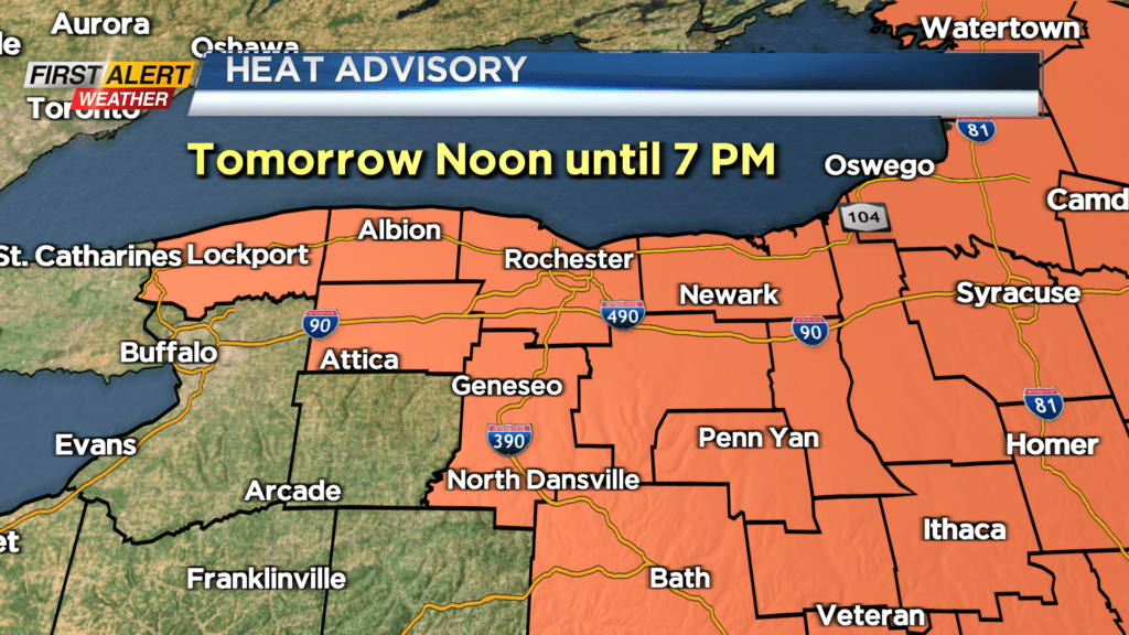
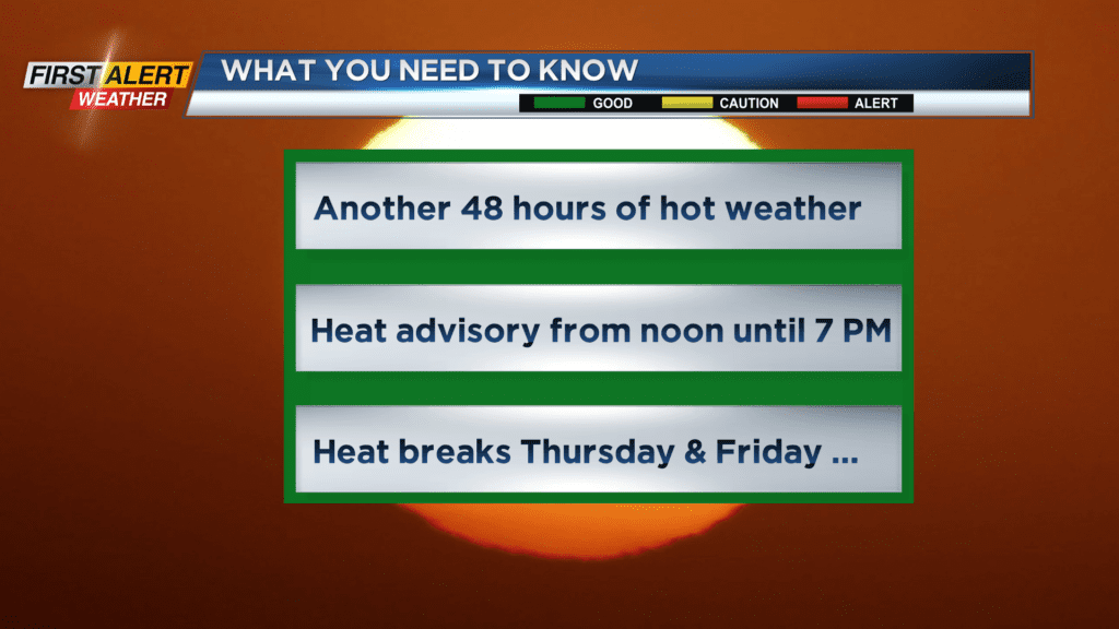
First Alert Weather: Two more days of stifling weather
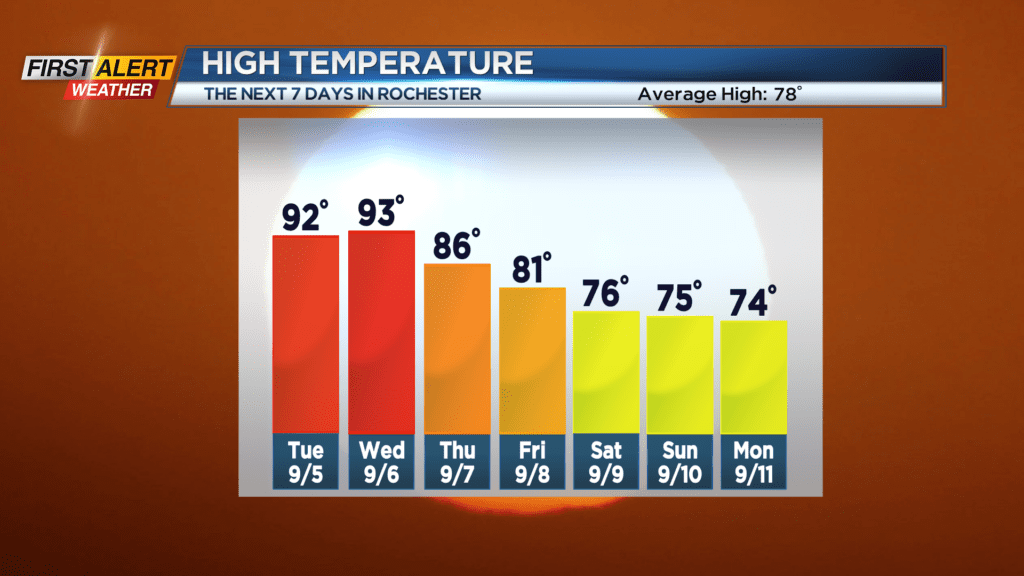
Except for communities along the Lake Ontario shoreline, most of us measured a temperature near or exceeding 90 degrees today. These temperatures were not expected to challenge any records, but it is unusual for a summer season that has produced very little excessive heat. Today makes only two days of 90 degrees or higher for this season. And even though this holiday weekend is considered the unofficial end of summer, another two days of hot weather is expected for Western New York. More significant relief in the form of cooler temperatures is expected for later Thursday and Friday.
Tonight, look for mainly clear skies. It will be a very warm and muggy night with the temperature only lowering to near 70 degrees. Typically, this time of the year the temperature is falling into the upper 50s. Tuesday will bring more of the hazy, hot, and humid weather. No records are expected, but the high temperature will once again reach the lower 90s. Wednesday will again push the lower 90s with plenty of hazy sunshine. Then finally showers and thundershowers will arrive for Wednesday night and Thursday. It will still be very humid, but the heat will significantly diminish for the end of the week.
Stay tuned to News10NBC First Alert weather for updates on the forecast.