First Alert Weather: Winds of change bringing winter weather back
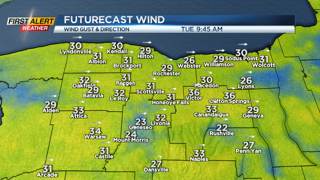
ROCHESTER, N.Y. – The work week started off nice with some sun and mild air, but a gusty wind developing Monday afternoon is bringing some changes to western New York. Much chillier air will return by Tuesday morning, with temperatures in the 30s much of the day, only briefly flirting with 40 degrees. A gusty breeze will make it feel even chillier, with some gusts near 30-35 mph. We’ll also see some mixed snow/graupel showers developing, especially for the 2nd half of the day.
Wednesday will be the chilliest day of the week, with highs in the upper 30s, and a better chance of some scattered snow showers, mixing with some graupel from time to time. It won’t be cold enough, nor will any snow be heavy enough to accumulate, but it’ll look and feel a little like winter at times.
Our weather will improve a bit on Thursday, with high pressure and some sun making a return, along with temperatures back into the 40s, which is more seasonable for late March. We’ll be watching our next storm system arriving by Friday. Initially it’ll bring rain showers, but there’s the chance we could see rain changing over to a wintry mix at times on Saturday.