First Alert Weather: Winter storm moves in today, bringing snow, ice, rain, and wind
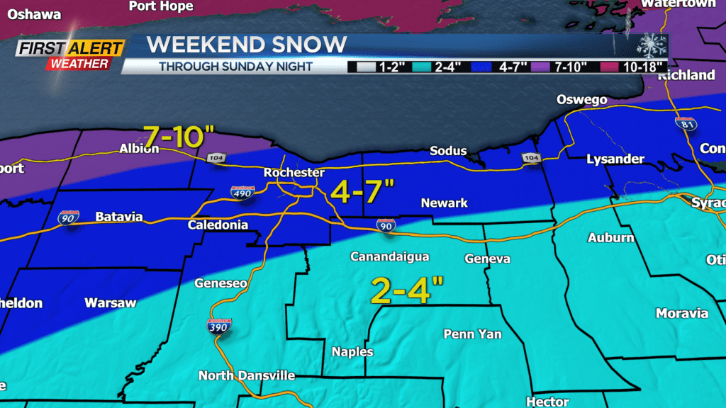
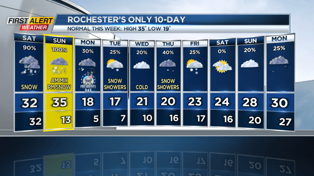
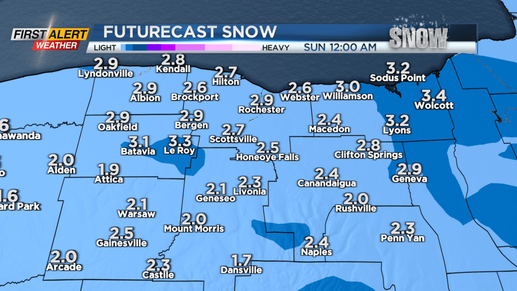
ROCHESTER, N.Y. We’ve been tracking an impactful winter storm all week, and it’ll finally arrive today. This is a very finnicky system; the exact track the center of the storm will take will largely determine how much snow we get and . Widespread snow will arrive later this morning, and go on into the evening before transitioning into sleet/ice/rain from south to north. Snow accumulations will be manageable today, at 2-4″.
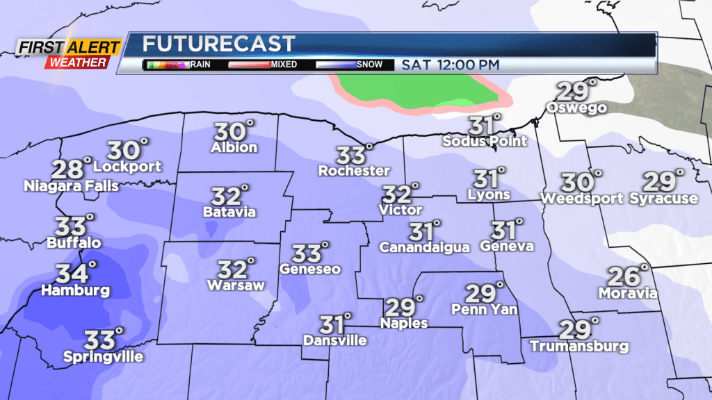
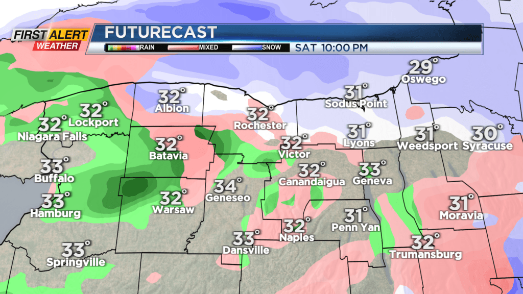
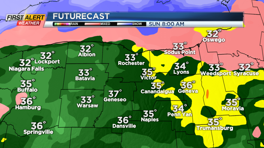
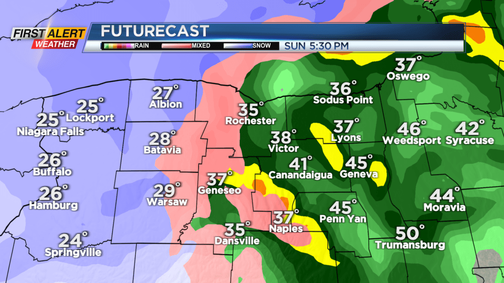
Overnight, the extent of the area seeing ice/rain could vary from all of Western New York to just the Finger Lakes depending on how north or south the center of the storm goes. Even a difference of a few miles is enough to change things… Although the latest model guidance is suggesting a more northerly track, which means less snow and more rain/mix. Either way, this will continue through Sunday until Sunday evening when northwest flow takes over and accumulating snow returns. Temperatures will plummet, which means areas where the salt is washed away by rain are at risk of becoming icy and slippery. No major ice accumulations are expected, but it is enough (as well as the accumulating snow that will fall over it) to cause concern. If you need to be on the road tonight through Sunday, exercise caution.