First Alert Weather: Yellow Alert continues for lake snow and gusty wind
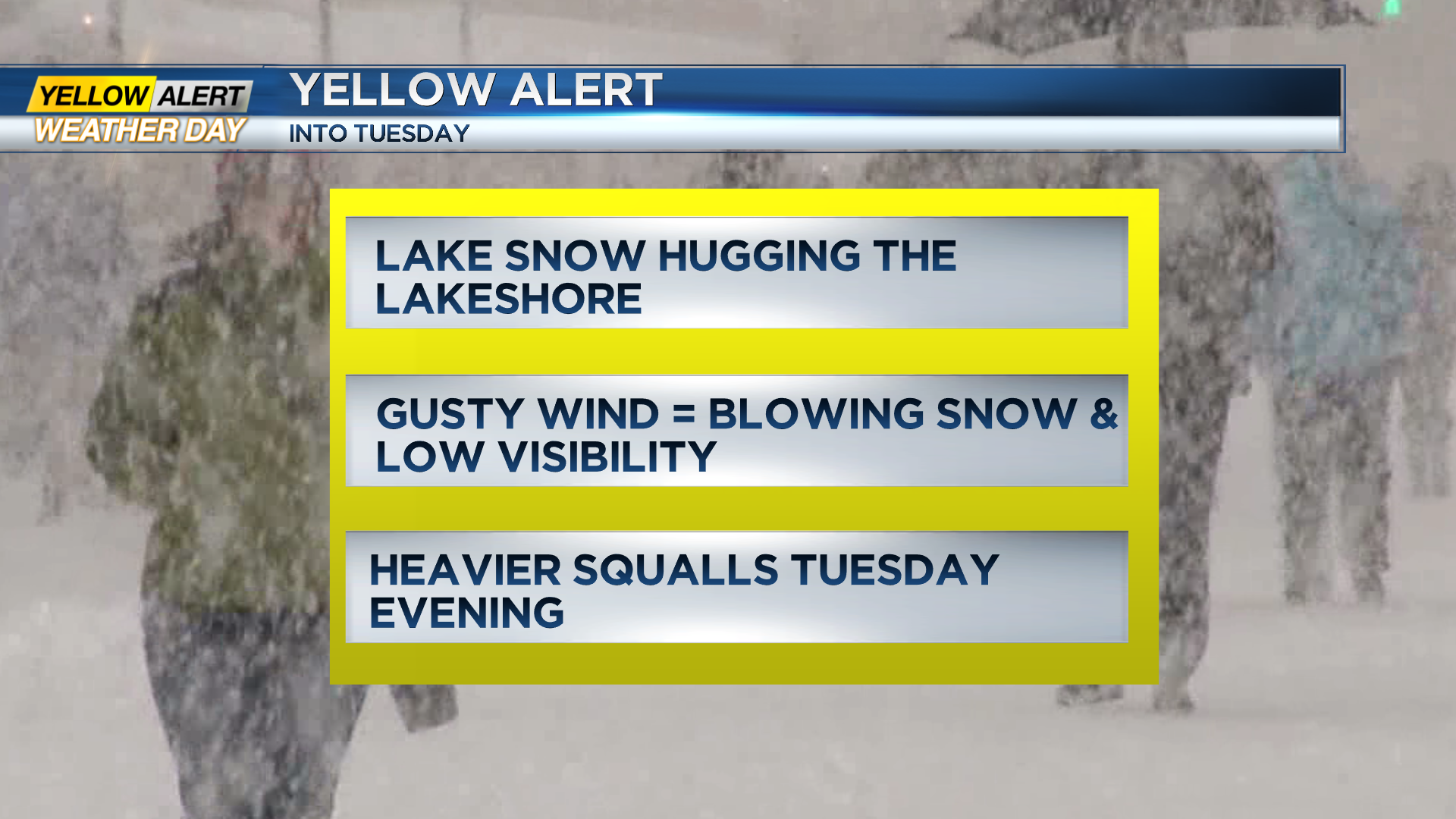
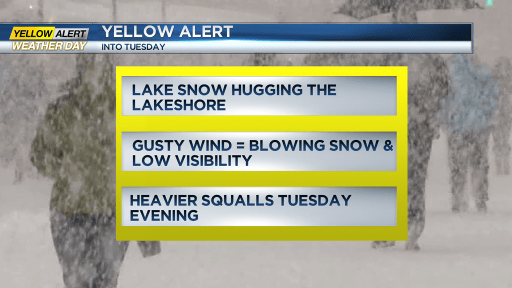
ROCHESTER, N.Y. – The News10NBC Yellow Alert continues through at least Tuesday night, as lake effect snow and gusty winds will persist. This doesn’t necessarily mean everybody will see tough conditions the whole time, but the pattern will continue to produce some localized lake effect snow, especially near the Lake Ontario shoreline. This, combined with a gusty wind will produce areas of blowing snow, in addition to wind chills well below zero. Bottom line – our harsh winter weather continues. The details: a Lake Ontario snow band will hover near the lakeshore Monday night, dropping south at times. Parts of northeast Wayne County could see another 3-6″ of snow into Tuesday morning, with less than an inch or two for the rest of our northern tier counties, and less than 1″ in the Finger Lakes. Wind gusts pushing 40 mph at times tonight will once again produce areas of blowing snow and brief whiteouts on north/south roadways, especially in rural areas. Temperatures will drop into the single digits, with wind chills -10 to -20 degrees below zero into Tuesday morning.
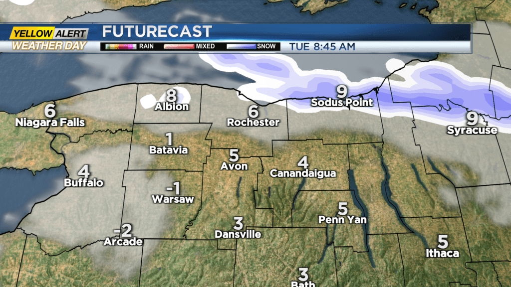
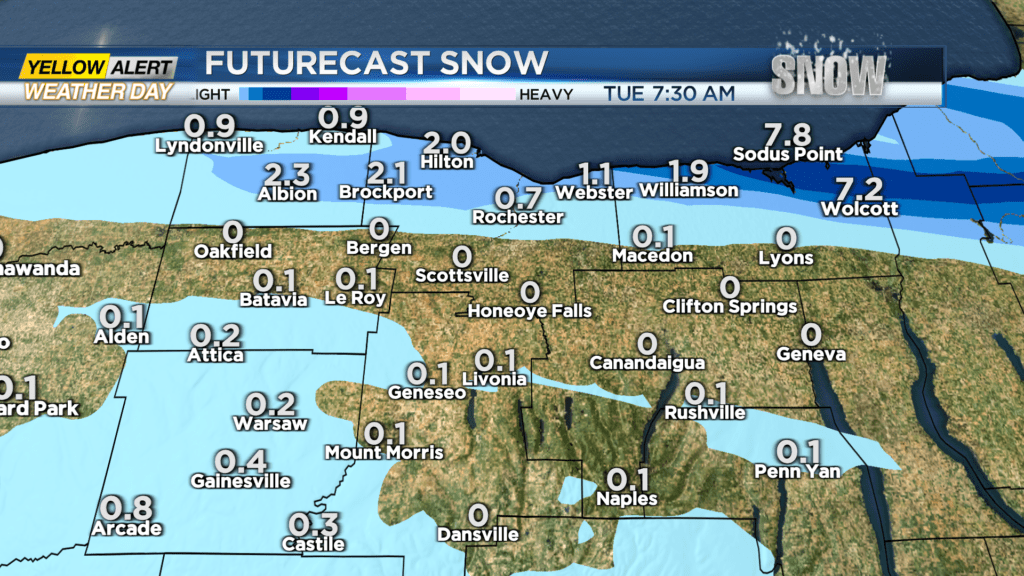
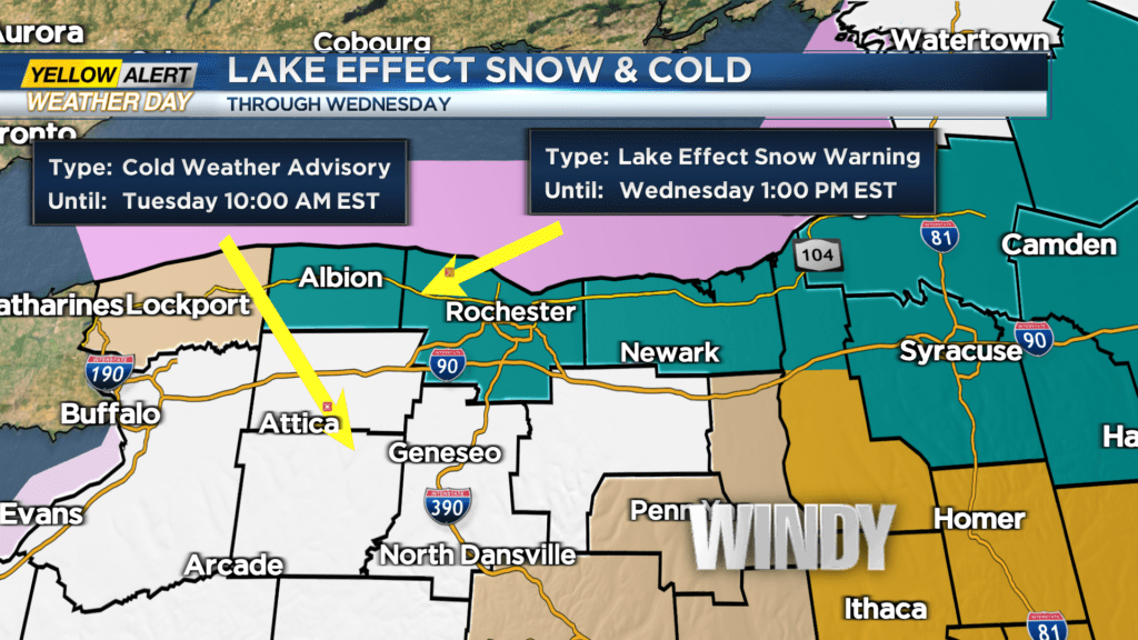
While much of Tuesday will be snow-free for much of the area, lake effect snow will persist near Lake Ontario, and focusing on northern Wayne County, where snow will continue to pile up. The snow band may have more of an impact near Rochester for the evening commute. This is something the First Alert Weather Team will monitor over the next 24 hours. If the snow band persists into Wednesday morning, we may extend the Yellow Alert into Wednesday morning. But overall, conditions will get better through the day on Wednesday, before some light snow showers return on Thursday.