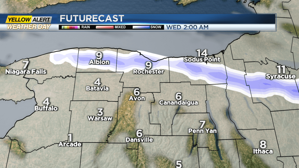
First Alert Weather: Yellow Alert remains up for localized lake snow north
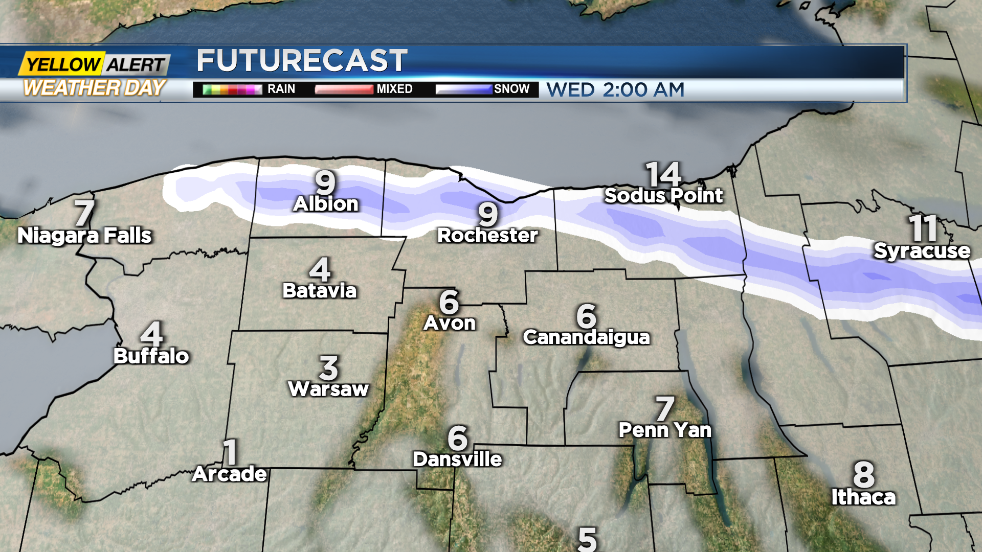
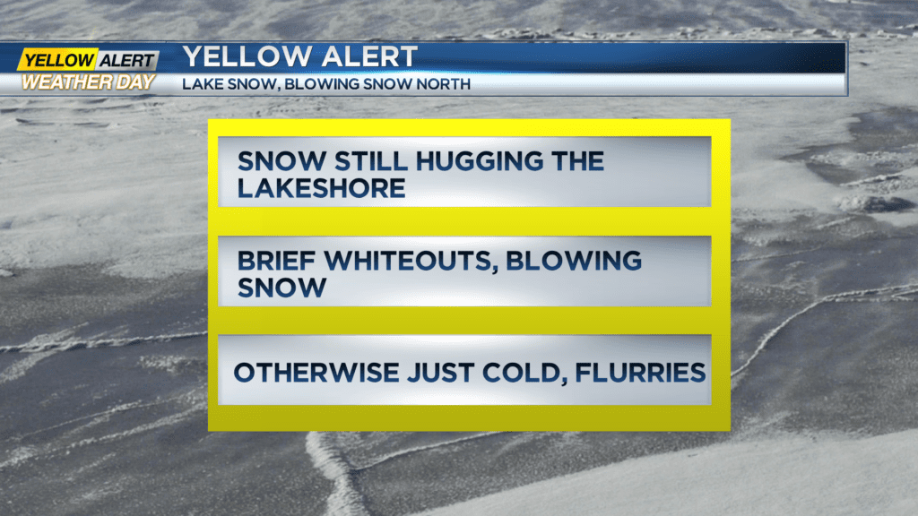
ROCHESTER, N.Y. – While much of the area has remained fairly quiet (but cold and windy) on Tuesday, we’re still watching a band of lake effect snow that is hovering right along the Lake Ontario shoreline. This band may clip our immediate lakeshore communities Tuesday night and first thing Wednesday. Areas that do see this snow, will see a few inches of fresh fluff, and some blowing snow. The winds will remain strong through the first part of the overnight, before easing toward Wednesday morning. Outside of this lakeshore snow, the rest of the area will remain snow-free but cold. The Yellow Alert should end overnight, unless that lake band lingers a little longer than expected Wednesday morning.
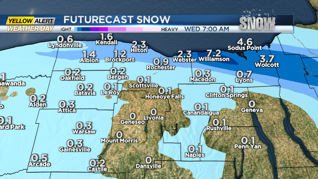
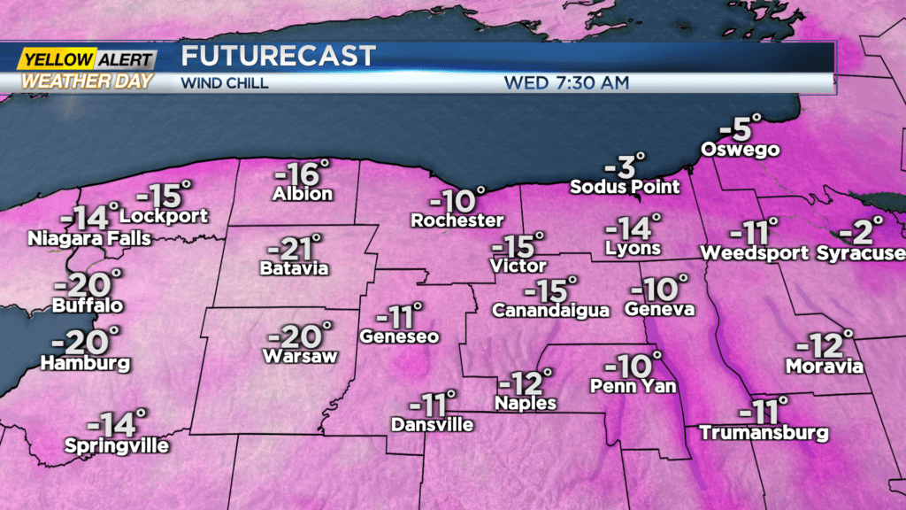
Wednesday will be another cold day, with wind chills below zero to start the day, and air temperatures likely not making it out of the teens once again. But, aside from light lake flakes north, we should see quiet weather and a mostly cloudy sky. A larger storm passing well to our south will shift the wind a bit, bringing some light lake snow showers back to the region on Thursday, but most areas will see less than an inch or two of new snow.
Friday will remain chilly with some lake flakes early, then a little sunshine returns to start the weekend. Temperatures will moderate a bit into early to mid next week, with daytime highs actually climbing above the freezing point! But, winter may not be done with us yet. There are some signs pointing toward more wintry weather for late February and early March. Stay tuned.