Yellow Alert Weather: Sloppy and icy mix develops late Wednesday into Thursday
ROCHESTER, N.Y. We’ll keep things quiet through about lunchtime Tuesday with some limited sun to start the day.
A fast-moving cold front will bring a mixture of rain and wet snow showers by noon, with wet snow showers into the early afternoon as temperatures slowly drop off a bit. Winds will pick up, with some gusts to near 40 mph during the afternoon.
Then we’ll quiet things down again Tuesday night through Wednesday afternoon. A very complicated and potentially impactful winter storm moves in Wednesday afternoon. Light snow begins to move in by evening, with a minor accumulation possible.
Then, we focus on the temperature profile of the atmosphere over our heads. Surface temperatures will remain below freezing. Meanwhile, warmer air nudges in a few hundred feet above the surface. That will cause the snow to begin to mix with and change over to sleet and freezing rain.
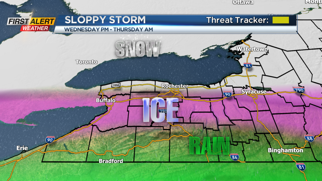
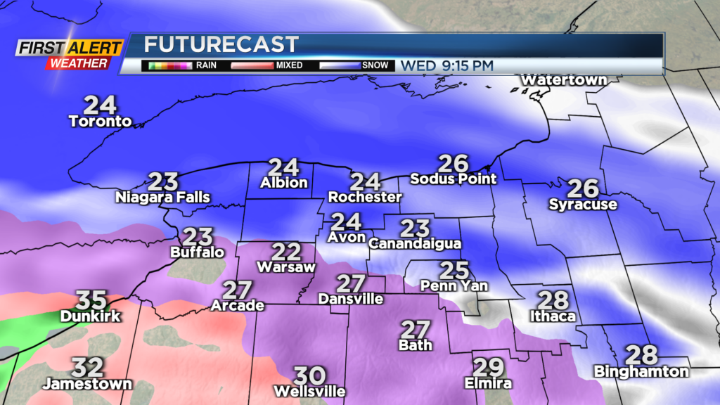
Our forecast area will tend to see all types of precipitation accumulating, but areas closer to Lake Ontario will tend to see the snow stick around the longest, with sleet just south of that, freezing rain hanging on the longest south of Rochester into the Finger Lakes, and rain noses in well south.
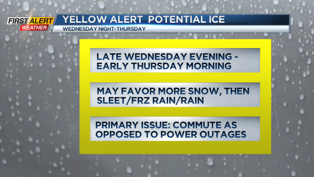
This is a very changeable forecast, and we’ll track those changes closely. A Yellow Alert is up for Wednesday night into Thursday morning, with the Thursday morning commute likely having the main impact of slick roads.
The main takeaways from this storm are: this will not be a major ice storm, but we may see some power outages, depending on location and how long the ice lasts. Road conditions will be the main impact of this storm from the combination of snow, sleet and freezing rain. Stay with the First Alert Weather team as we track this complicated forecast.