First Alert Weather: Yellow Alert this weekend for snow and an icy mix
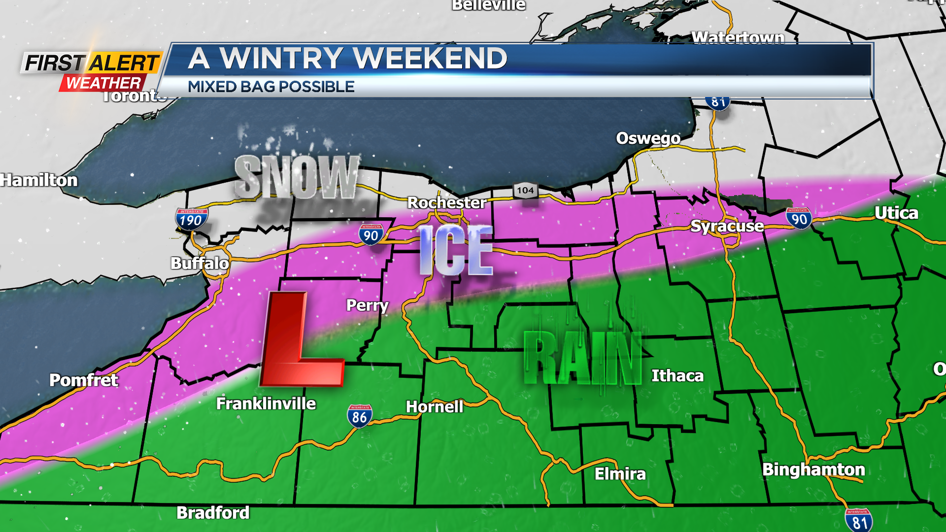
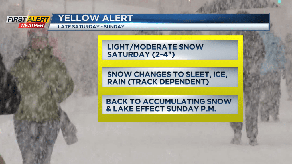
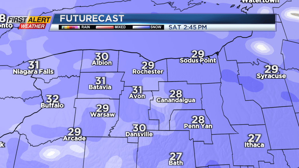
ROCHESTER, N.Y. – Our weather starts off quiet this weekend, with dry weather early on Saturday, but that will quickly be changing. Snow develops during the morning and will continue off and on into the afternoon and evening. The snow will generally be light to moderate, with a 2-4″ accumulation for most areas. Our Yellow Alert will go into effect Saturday evening as road conditions begin to deteriorate, and we begin to see a changeover to some sleet and freezing rain. This will put a pause on any additional snowfall accumulation during the Saturday night – Sunday morning time period, but roads will remain sloppy and slick. Then, we’ll see a transition back over to snow and then lake effect snow Sunday afternoon and evening, with additional accumulations likely.

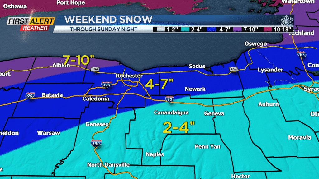

Overall snowfall accumulations will range from 7-10″ near Lake Ontario, to as little as 2-4″ in the southern Finger Lakes. This is due to that wintry mix at times, which cuts down on snowfall amounts. That being said the exact track will make a huge difference in who sees what, and how much. A slight shift northward in the track of the storm will mean more ice and less snow, while a shift southward would mean more snow and higher accumulations. Stick with the First Alert Weather Team for the very latest updates as new data continues to come in and the storm evolves.
Once the main storm moves away, it’ll turn windy and colder, with lake effect picking up. This will likely add on some additional snowfall accumulation into Monday, and wind chills will be dropping into the single digits and below zero by Monday night.
The bitter air and minor lake effect snow will continue through the middle of the week, before another system passing by to our south could bring another round of area-wide scattered snow showers.