First Alert Weather: Fall is feeling like late summer
ROCHESTER, N.Y. — Expanding high pressure stretching from the Gulf to the Northeast is supporting very dry and sunny conditions through much of the eastern U.S. on Sunday.
Any active weather is passing well to our north over the Canadian provinces as high pressure keeps any approaching weather out of our region for the next few days. As this large dome of high pressure moves to the east, strong southwesterly winds will take over, further warming up temperatures as we move into the beginning of the work week.
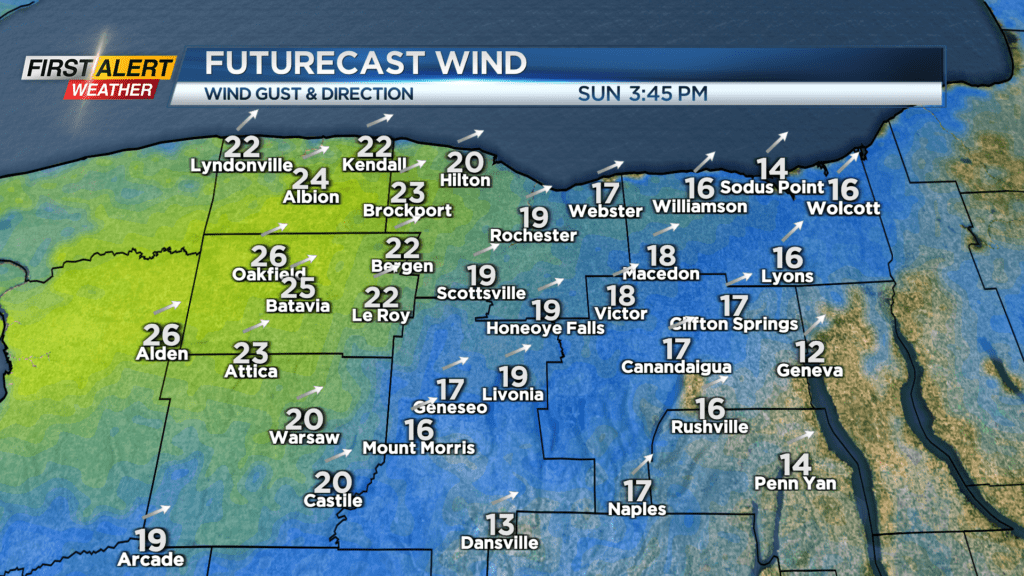
Gustier winds in the low levels of the atmosphere could mix down to surface winds headed across the long fetch of Lake Erie. This setup may cause breezy conditions north of the I-90 corridor on Sunday and Monday with gusts up to 25 mph. Leaves being blown in the wind is really the only active weather that we will be seeing until Wednesday, so now is the time to get outdoors and tidy the lawns before the arrival of the cold season.
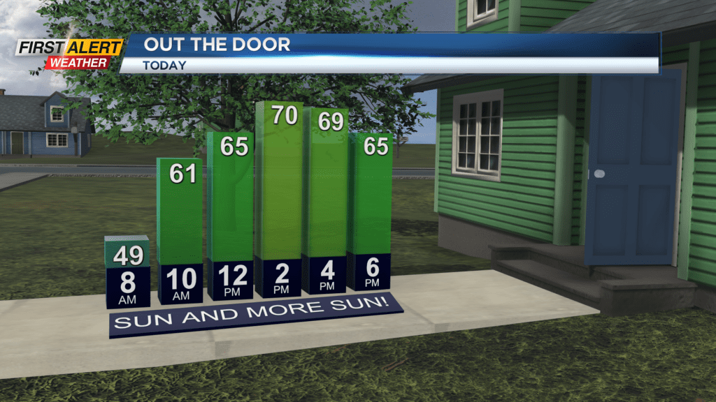
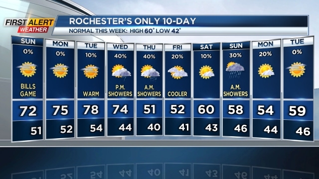
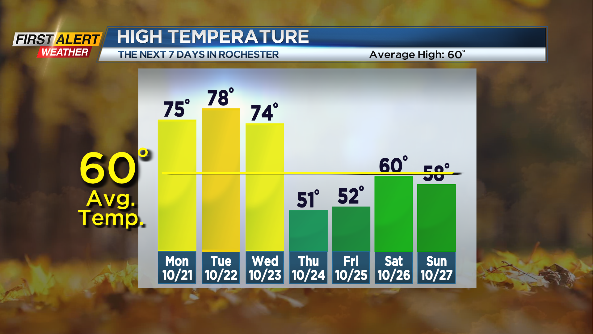
High temperatures on Sunday will climb into the low 70s with overnight lows between 50-55 degrees with clear skies. Fog is not expected for the overnight and early morning hours due the breezy, dry, and warm conditions. Monday and Tuesday will stay warm and sunny with temperatures in the mid-upper 70s. Tuesday’s high will be quite close to the record high of 82 degrees in 1979.
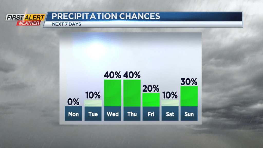
How close we will get to that record high depends on just how much solar heating we can get at the ground and how strong warm air will funnel into our region ahead of the next weather system. This next front will arrive late on Wednesday with showers starting in the evening and lingering into Thursday morning.