First Alert Weather: Fall makes a visit, but summer makes a comeback
An area of low pressure off to the northeast has been funneling in cool, wet weather over the past couple of days. As a result, moisture will linger around through Wednesday and lake-enhanced spotty showers are possible throughout Tuesday evening.
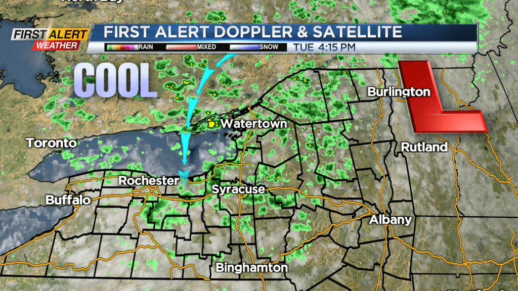
Northerly flow will make for another chilly night with low temperatures in the mid-50s and we should warm up to around 60 degrees heading out the door Wednesday. Daytime highs for Wednesday will still be more than 10 degrees below average for this time of the year with expected highs in the upper 60s. Mostly dry conditions will be present for Wednesday, but due to the lingering low, a spotty shower is possible, especially east of the Rochester area.
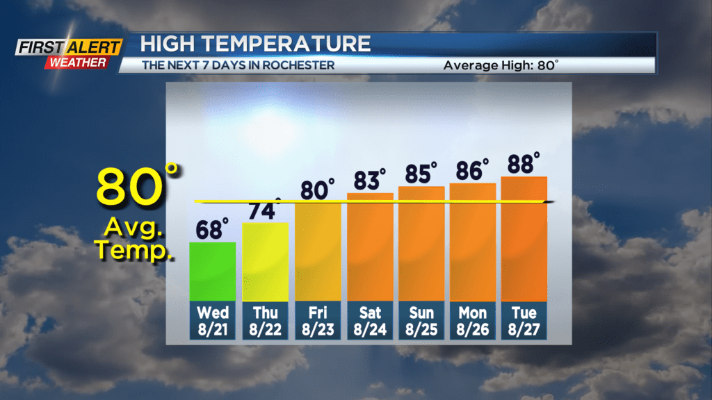
We start to warm up and dry out heading into Thursday as high pressure builds into our area, bringing high temperatures up into the mid-70s for Thursday and 80 degrees by Friday. Plenty of sunshine is in store for us as we head into the end of the week.
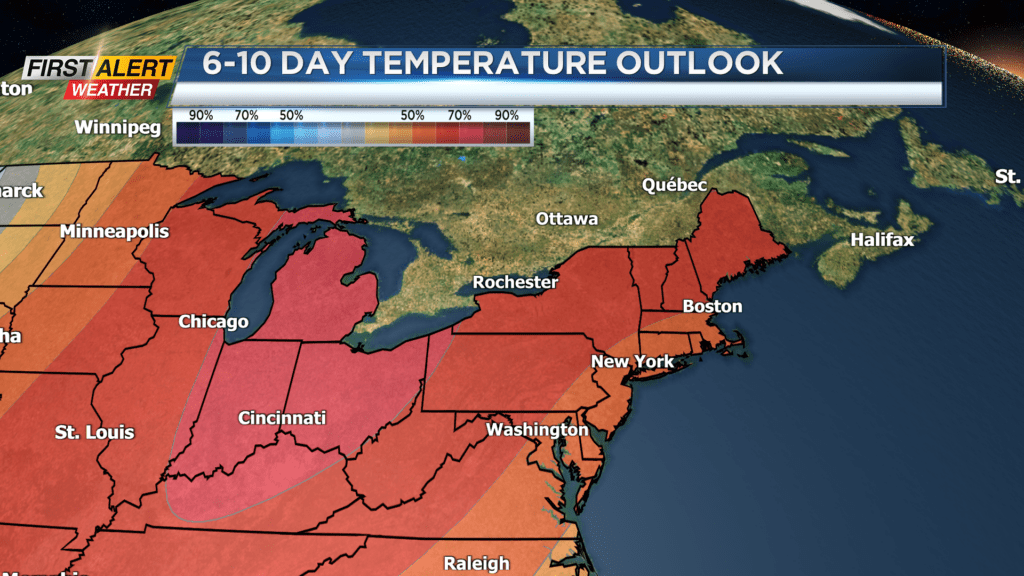
Summer is certainly not over for Western New York, as above average temperatures take us into the mid- to upper 80s headed into the beginning of next week.