First Alert Weather: High humidity soon coming to an end
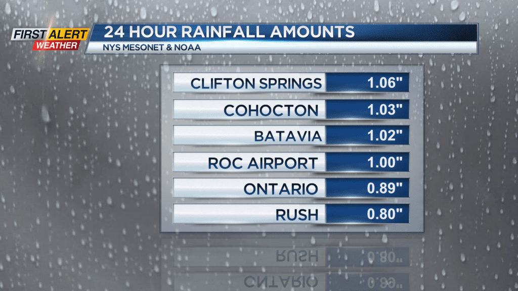
It has been feeling tropical with very high amounts of humidity for this Saturday evening. And this higher level of humidity has been a main ingredient for a few torrential downpours from earlier Saturday. No sign of severe weather, but there is still the chance of thundershower later Saturday night for Western New York.
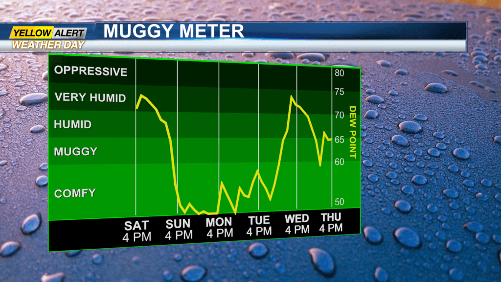
The threat of any storms should slowly decline as we progress through the predawn hours of Sunday morning. As a result of this decreasing threat, our News 10NBC Yellow Alert has come to an end. A cold front will be crossing the area early Sunday, and this will bring an end to the humidity as cooler and drier weather returns for the start of the week.
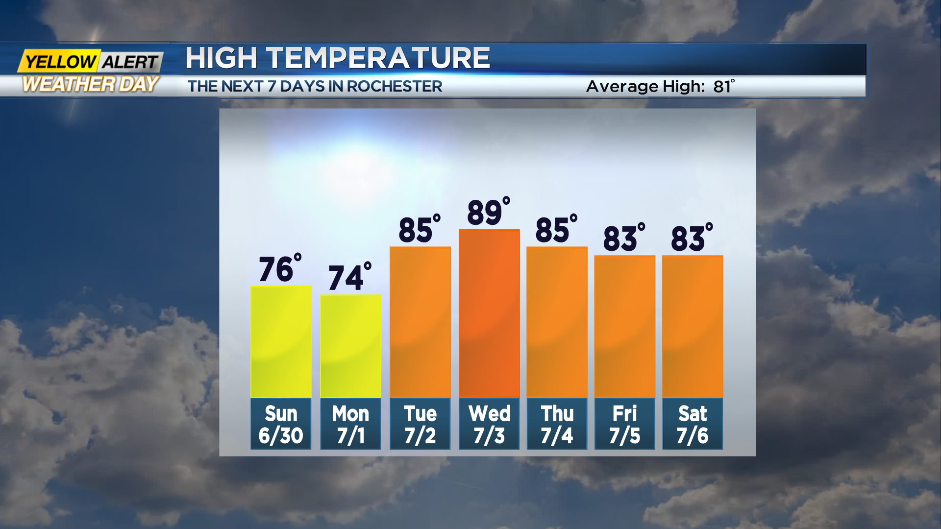
Saturday night, there is the chance of another shower or thunderstorm, but those chances will decrease after midnight. Again, it will be very muggy with the low temperature near 70 degrees. Sunday there is still the chance of a spotty shower, but breaks of sunshine are possible for the afternoon. It will be breezy with the humidity falling throughout the day. The high temperature will be in the middle 70s.
Monday appears to be a beautiful day with lots of sunshine, very low humidity, and a temperature in the middle 70s. The heat begins to build again by Tuesday with the temperature pushing into the low 80s. More air conditioning will be needed by Wednesday with the temperature approaching 90 degrees. Expect a few thundershowers to develop by late Wednesday and Wednesday night. Right now, the Independence Day holiday looks mainly dry with the temperature in the mid-80s.
Stay tuned to News 10NBC First Alert weather for updates on the forecast.