Yellow Alert Weather: Yellow Alert ends Thursday night as the heat fades away
Thursday was our fourth day in a row of temperatures in the 90s, and that should do it. Yellow Alert remains up through late evening for a few more hours of temperatures in the 90s, and at least the risk for a few storms, mainly south of Rochester into the southern Finger Lakes. After the sun sets, our heat fades away, and our storm threat also ends.
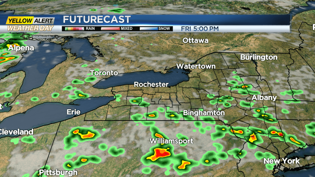
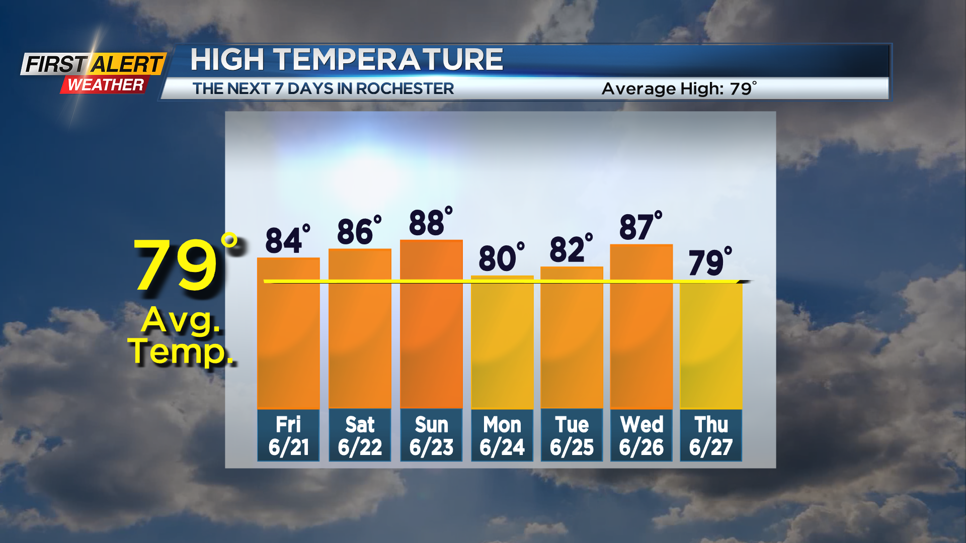
We lose the big heat on Friday with the passage of a cold front, but that front will also spark some showers and storms. The greatest threat for storms should once again be in the Finger Lakes and Southern Tier, as the front will cross that area during the afternoon, when we get peak heating and the most energy for storms. While a few showers or storms are possible closer to Rochester, we’re thinking we’ll see a nice clearing trend into the afternoon and evening as that front has already cleared.
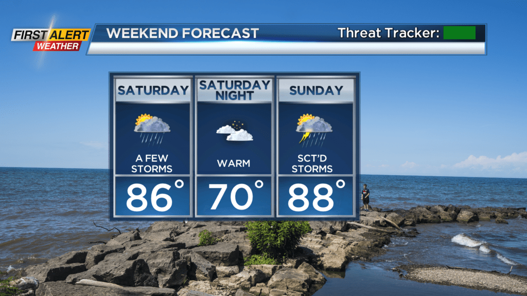
The weekend will remain unsettled, as that same front lifts back north as a warm front on Saturday, pushing us back into some heat, humidity and instability. So off-and-on showers and some storms are possible. Sunday will see that front drop back south once again as a cold front, once again increasing our storm threat as it passes. The timing of the front appears to be afternoon, which will tend to focus the storm threat into the second half of the day, but that could change if the frontal passage timing changes. Check back and watch News10NBC if you have outdoor plans on Sunday that could be impacted by any storms on Sunday.