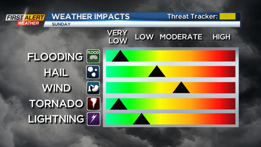
First Alert Weather: Yellow Alert is in effect for later Sunday
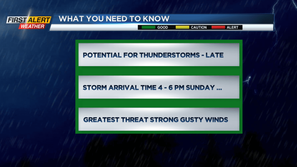
Most of the remainder of the weekend will be pleasant. However, the one exception will be late Sunday afternoon and Sunday evening. A News10NBC Yellow Alert has been posted for all of Western New York, as there is the potential for a strong thunderstorm. As these storms move from west to east Sunday, we expect an arrival time between 4 and 6 p.m. and any storms should be of short duration. Greatest threat potential will be strong, gusty winds which could exceed more than 50 miles per hour in the most damaging cells. In addition, the location for the greatest threat of damaging storms will be south and east of Rochester.
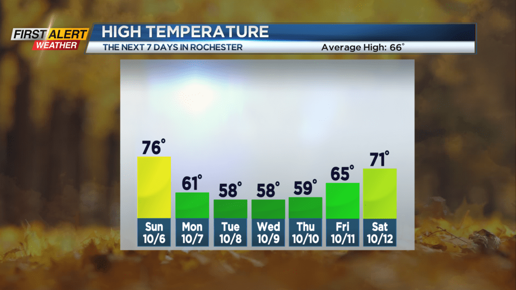
Saturday night, look for clear, starlit skies — and it will turn very cool. The low temperature will be in the middle 40s. Sunday brings sunshine for the morning, then clouds will increase through the afternoon. The high temperature will be in the mid-70s. Then watch for a strong thunderstorm late Sunday afternoon into Sunday evening. These storms will be brief, and the thundershowers will rapidly move east for Sunday night. Monday could bring another morning shower, then a mix of clouds and sun for the remainder of the day. It will be breezy and much cooler with the temperature only within a few degrees of 60.
Stay tuned to News 10NBC First Alert weather for updates on the forecast.