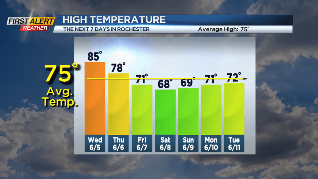
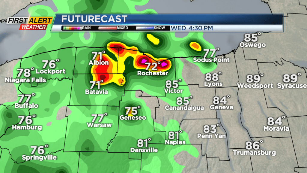
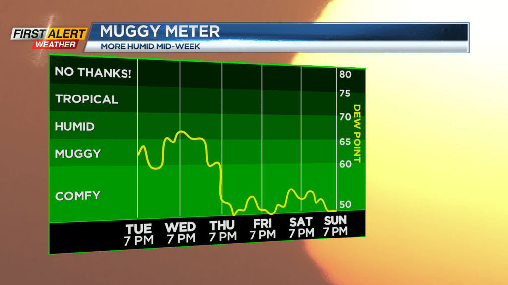
Yellow Alert: a few hours of thundery downpours Wednesday afternoon
A Yellow Alert is up for Wednesday afternoon for a brief period of thunderstorms that may produce gusty winds and locally heavy rain. Widespread strong storms aren’t expected, but the timing of a few storms moving into Monroe County and surrounding areas could impact the afternoon commute, and outdoor plans that you may have. We’re highlighting from about 1 p.m. through 5 p.m. for our window of storms. Impacts should be fairly minor, but you’ll want to have a way to get radar and updates if you will be outdoors. Before that, it’ll be quite warm with temperatures in the mid 80s, which will be the fuel for some of these storms. The cold front moves through by early Thursday morning, taking the most widespread showers and thunder with it, leaving us with some sunshine and drier air in its wake. This sun, along with cooler air aloft, will help to produce a few isolated afternoon showers, especially along lake breeze boundaries from Buffalo to Rochester.
We then start to fall into a cooler and more unsettled weather pattern into the weekend. A trough over the Great Lakes and Northeast will keep temperatures in the upper 60s and lower 70s. We’ll also tend to see pop up showers developing during peak heating. So, we’ll tend to start Friday through Sunday dry with some sun, then see clouds build and showers sprout up midday into the afternoon hours, then fizzle by evening. We should break out of this pattern by the early to middle part of next week, with warmer and more summer-like air returning once again. So, enjoy the break from air conditioning this weekend.