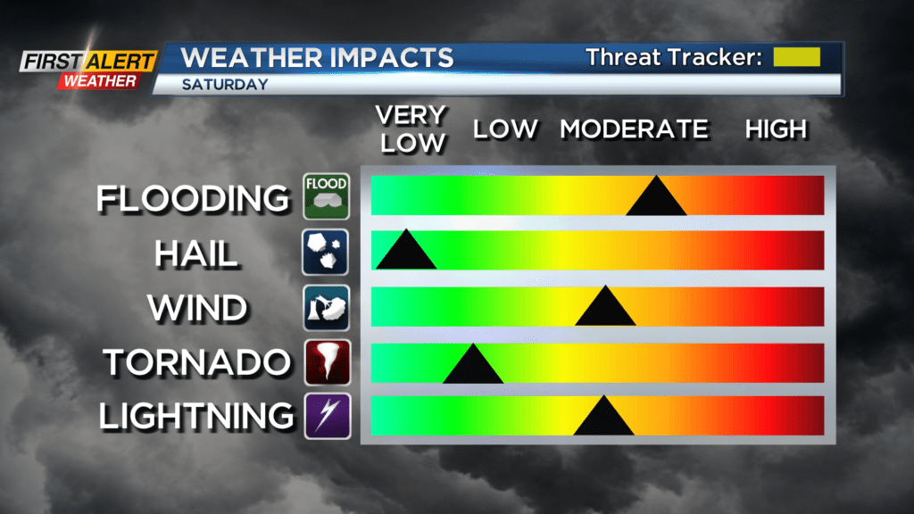
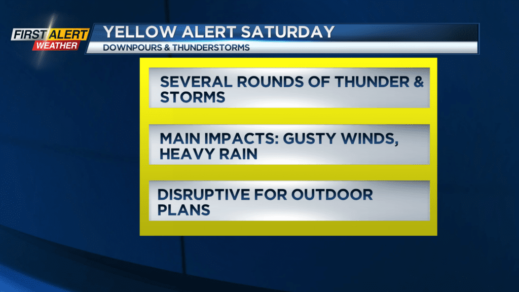
Yellow Alert: Strong storms with heavy rain possible Saturday
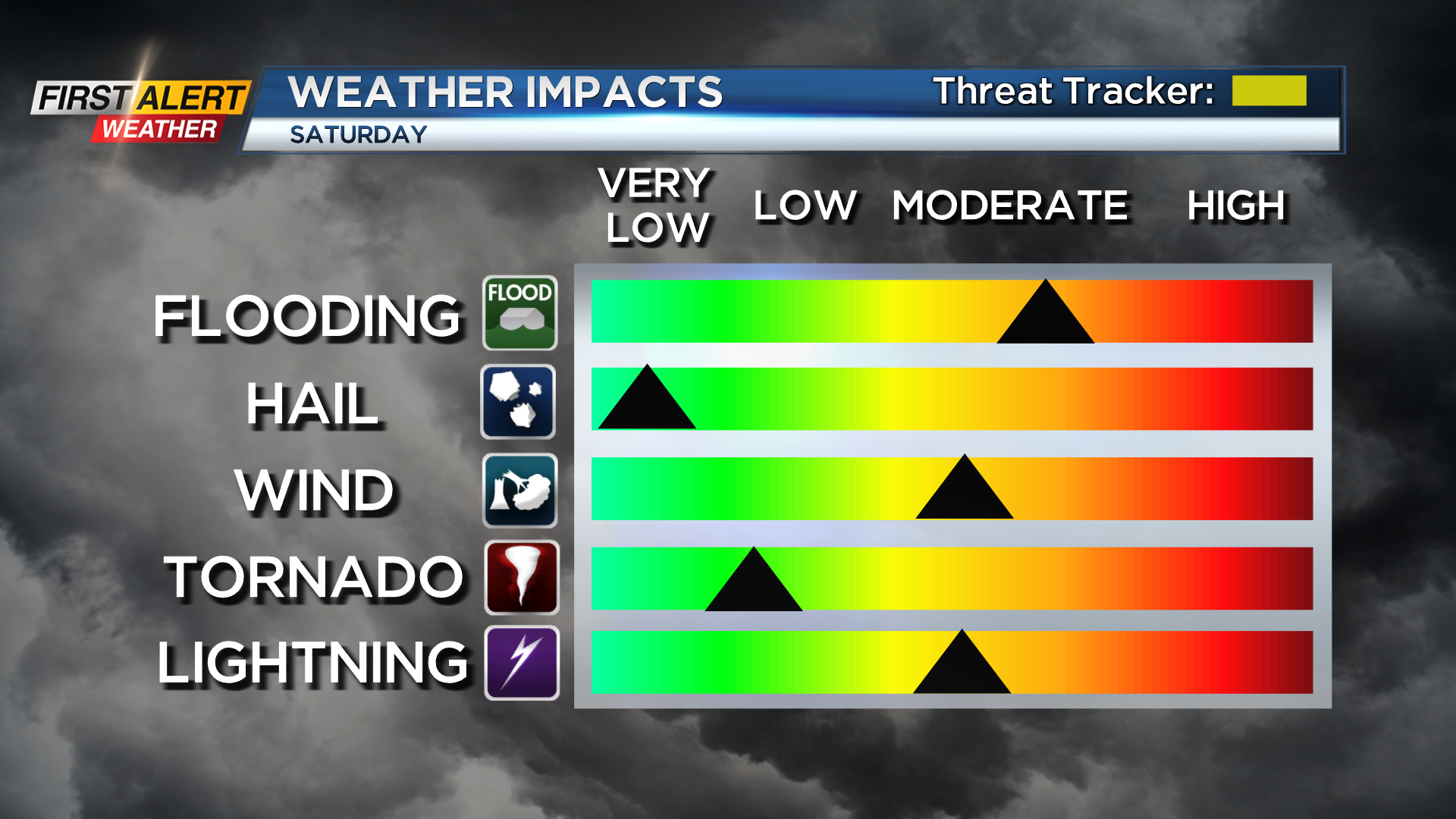
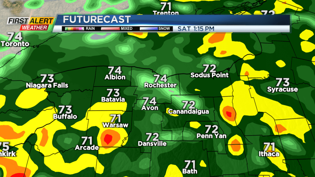
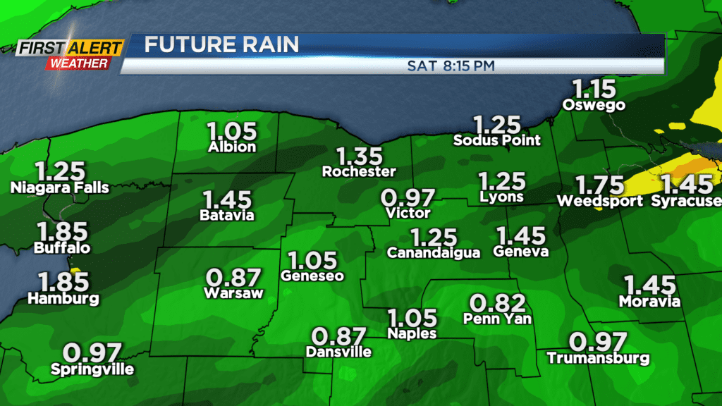
A Yellow Alert remains up for the threat for strong thunderstorms with gusty winds and locally heavy rain on Saturday. While the severe weather threat isn’t a certainty for everybody, there’s a good chance everybody will see at least some rain. If you do get a thunderstorm, some of the stronger storms could produce gusty winds and locally heavy rain. If we get several rounds of storms over the same areas, some localized flooding is possible. Storm fuel is fairly low, but there are enough other factors in the atmosphere that could lead to the development of gusty winds and perhaps a rotating thunderstorm or two. The main threat for severe storms looks to be south of Rochester into the Southern Tier, but everybody needs to have a way to get weather alerts and updates if you have outdoor plans. Storms will tend to focus on the late morning into mid afternoon hours, before slowly tapering off into the evening.
While the severe threat will go down after about 5 or 6, some showers or a thunderstorm will still be possible into the overnight as we wait for our cold front to arrive. This will happen Sunday morning, with a few more early showers, followed by some clearing into the afternoon. Winds will turn breezy as cooler and drier air moves in Sunday afternoon. Monday will be cool and comfortable with the sky becoming mostly sunny, with fair and warmer weather on Tuesday.
July 4 celebrations really get going on Wednesday, and our weather will turn more humid and warmer, with temperatures possibly pushing 90 degrees. A few showers or storms are possible late in the day, so if you have Independence Day plans, keep an eye on the forecast and timing of wet weather. July 4 itself in Thursday looks pretty good with a partly cloudy sky and just the slight chance of a shower.